
La geoelettrica capacitiva. Una tecnica speditiva per l’esplorazione geofisica del sottosuolo
Vol. 166 (2020)
In recent years, the remarkable technological growth in the field of applied geophysics has undoubtedly been favored by the marked instrumental innovation that allowed the use of fast and easy-deployable techniques as well as to improve the quality of the measured data.
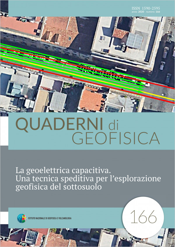
Capacitive-coupled resistivity tomography (CCR) is a geophysical prospecting technique that rapidly provides the electrical resistivity distribution of the subsoil along 2D acquisition profiles, as no galvanic contact is needed and sensors can be dragged over the surface. In this work, we present a series of results required by applying this technique in various contexts ranging from archaeological studies and geological and environmental applications also in urban contexts. We also show that recovered resistivity models are comparable with those obtained with the more laborious galvanic electrical measurements. We will explore not only the advantages of the technique in providing useful subsurface information but also the disadvantages and its main limitations.
Capacitive-coupled resistivity tomography (CCR) is a geophysical prospecting technique that rapidly provides the electrical resistivity distribution of the subsoil along 2D acquisition profiles, as no galvanic contact is needed and sensors can be dragged over the surface. In this work, we present a series of results required by applying this technique in various contexts ranging from archaeological studies and geological and environmental applications also in urban contexts. We also show that recovered resistivity models are comparable with those obtained with the more laborious galvanic electrical measurements. We will explore not only the advantages of the technique in providing useful subsurface information but also the disadvantages and its main limitations.
Bollettino Sismico Italiano 2014
Vol. 165 (2020)
This paper outlines the main characteristics of the seismicity recorded in Italy during 2014 and describes the status of the National Seismic Network (RSN). In that year 427 seismic stations contributed to the RSN, most of them owned by the National Institute of Geophysics and Volcanology (INGV) and other coming from local, regional or foreign monitoring networks.
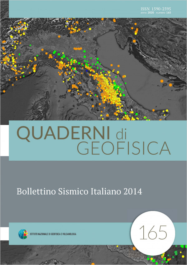
The Italian Seismic Bulletin (BSI) of 2014 contains 27433 located earthquakes, most of them belong to one of the 32 seismic sequences identified; among these the most significant are the one that began in April in Alpi Cozie (ItalyFrance border region) and another one in December in Tuscany, in the region between Firenze and Siena.
The minimum magnitude of completeness of the BSI in 2014 is MC 1.2, the same of the previous year.
We illustrate the seismicity of anthropic origin present in the BSI (about 240 events, almost 1% of the total) and we present the seismograms of a couple of collapselandslide occurred in the Dolomites near Belluno, an area where these phenomena occur very frequently.
Continuous monitoring of CO2 and H2S air concentration and soil CO2 flux survey for gas hazard assessment at Tor Caldara nature reserve (Anzio, Italy)
Vol. 164 (2020)
Tor Caldara natural reserve hosts the southernmost discharge of endogenous gas of Colli Albani volcano (mostly CO2 with a relevant H2S content up to 6.3 vol.%). Gas discharges in zones where past sulfur mining removed the impervious surficial cover (e.g. Miniera Grande and Miniera Piccola) and along tectonic fissures. A structural study of the reserve has shown the presence of two zones with different characteristics: prevailing directions NS and N30° in the northern zone; EW and N60° in the southern one. In MarchJuly 2012 a geochemical study was carried out, including a soil CO2 flux survey and continuous monitoring (from 2 to 11 days) of air concentration of CO2 and H2S in 12 sites of the reserve. Environmental parameters were also monitored. Total diffuse soil flux of endogenous CO2 was estimated to 17.48 ton*day1 from 1,259 measurements over a 0.47 km2 surface, with 6.56 ton*day1 only from Miniera Grande. This is the second highest value of soil CO2 flux at Miniera Grande, after that of 2005 (9.25 ton*day1) and is significantly higher than in 2009 (1.20 ton*day1). As both the 2005 and 2012 surveys were made shortly after earthquakes with epicentres near to Tor Caldara (max ML= 4.7 in 2005 and 3.5 in 2012), data confirm that soil CO2 flux increases during earthquakes because of seismic rock microfracturing and soil shaking. Hazardous air concentrations have been found only for H2S, up to immediately lethal values (5651,124 ppm) and with potentially lethal values (≥ 250 ppm) long persisting (up to 12h27’) in several no wind nights. Instead, the CO2 air concentration remained always well below dangerous levels (maximum recorded value = 2.1 vol.%). The most hazardous gas releasing sites were found in Miniera Grande and in a small pond NE of Miniera Piccola, where the carcasses of mammals and other small animals are frequently found. The killer gas is H2S, and the dangerous sites should be appropriately fenced to prevent access to people and animals.
La sismicità storica dell’isola senza terremoti
Vol. 163 (2020)
According to popular opinion, Sardinia is the only non-seismic region in Italy. Most researchers would probably confirm this opinion, with qualifications. Historical earthquake catalogues, up to CPTI11 [Rovida et al., 2011], report only one Mw 5.1 event on 13 November 1948: it was located in the Sardinian Sea, and had very modest effects on land. In later decades, the seismic networks did record very few earthquakes of moderate energy (Mw <5), mostly located off-shore, either south-east of Cagliari or west of Olbia or in the Sea of Sardinia. The most recent ones (occurred in 2000, 2004 and 2006) had very slight effects on the island. Given the low level of instrumental seismicity and the weak macroseismic effects of known historical earthquakes, Sardinia's seismic risk is perceived as very low.
The low seismicity of the region certainly has a geological explanation, given that the Corsica-Sardinia block is among the most stable areas of the Mediterranean basin. “Low”, however, does not mean “non-existent”: recent historical research has improved knowledge on the major known historical earthquake of Sardinia (it occurred on June 4, 1616 and was responsible for minor but widespread damage to the system of coastal watchtowers, south-west of Cagliari) and rediscovered several minor earthquakes, part of which were known to the seismological tradition but had been almost completely forgotten. This paper collects all the documentation available at present on the seismic history of Sardinia.
The low seismicity of the region certainly has a geological explanation, given that the Corsica-Sardinia block is among the most stable areas of the Mediterranean basin. “Low”, however, does not mean “non-existent”: recent historical research has improved knowledge on the major known historical earthquake of Sardinia (it occurred on June 4, 1616 and was responsible for minor but widespread damage to the system of coastal watchtowers, south-west of Cagliari) and rediscovered several minor earthquakes, part of which were known to the seismological tradition but had been almost completely forgotten. This paper collects all the documentation available at present on the seismic history of Sardinia.
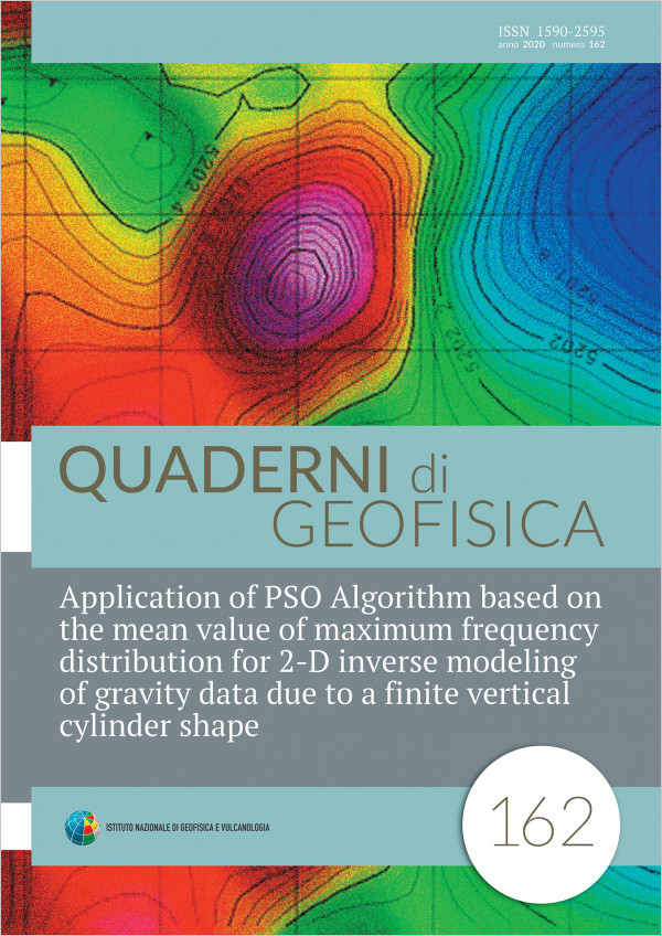
Application of PSO Algorithm based on the mean value of maximum frequency distribution for 2-D inverse modeling of gravity data due to a finite vertical cylinder shape
Vol. 162 (2020)
In this paper, Particle Swarm Optimization (PSO) algorithm is employed to invert the gravity anomaly due to a finite vertical cylinder source. The PSO inversion determines the radius (R), density contrast (ρ), depth to top (z) and bottom (h) parameters of a gravity anomaly causative body and also the location of anomaly source (origin x0) and gravity value in the origin (gx0) whose amount is maximum. During an iterative process, PSO estimates the subsurface model parameters and the gravity response according to them at each iteration. A profound weak point of Particle Swarm optimization method is getting into local minimum as the PSO algorithm can not estimates the optimal solutions. In order to overcoming this problem, the code is run frequently and the abundance distributions of the estimated values for the different parameters is drawn. Average value of each range whose frequently distributions is maximum are considered mas best solution. To evaluate the proficiency of the PSO method, a finite vertical cylinder synthetic model has been considered as the satisfactory results were achieved for the noise-free and noise-corrupted gravity data. We have also applied this approach for In this paper, Particle Swarm Optimization (PSO) algorithm is employed to invert the gravity anomaly due to a finite vertical cylinder source. The PSO inversion determines the radius (R), density contrast (ρ), depth to top (z) and bottom (h) parameters of a gravity anomaly causative body and also the location of anomaly source (origin x0) and gravity value in the origin (gx0) whose amount is maximum. During an iterative process, PSO estimates the subsurface model parameters and the gravity response according to them at each iteration. A profound weak point of Particle Swarm optimization method is getting into local minimum as the PSO algorithm can not estimates the optimal solutions. In order to overcoming this problem, the code is run frequently and the abundance distributions of the estimated values for the different parameters is drawn. Average value of each range whose frequently distributions is maximum are considered mas best solution. To evaluate the proficiency of the PSO method, a finite vertical cylinder synthetic model has been considered as the satisfactory results were achieved for the noise-free and noise-corrupted gravity data. We have also applied this approach for inverse modeling two real gravity anomaly due to a chromite deposit mass, situated east of Sabzevar, Iran and a salt dome offshore titled Louisiana from USA.

L’eruzione immaginaria. Un’indagine sulla rappresentazione del rischio vulcanico nella fantasia dei bambini
Vol. 161 (2020)
The volcanic risk has long been the focus of scientific dissemination projects, particularly in the Naples area, where the Osservatorio Vesuviano has promoted over the years numerous initiatives aimed at providing information on the hazard and volcanic risks. The training initiatives were carried out in schools developed in collaboration with the Department of Civil Protection and the dissemination activities were addressed to the population through guided visits to the historic site of the Observatory or public meetings, exhibitions, seminars, etc. organized in collaboration with the City of Science and other local authorities. Since 2005 the training activity took advantage of the EDURISK project, an initiative more specifically dedicated to seismic and volcanic risk education in schools, which has led to teacher training courses. One of the most exciting experiences developed by the EDURISK project was the realization in the school year 20172018 of a survey on the imagery of children and young people on volcanic risk. This activity aimed to identify, through a creative activity the invention of a story in a volcanic environment how they perceive the volcanic context in which they live, how they imagine an eruption could occur and what their response capacity could be. The survey was carried out in 23 primary and secondary school classes of Comprehensive Institutes in the Vesuvius area (Ercolano, Scafati, Torre del Greco) and Phlegraean (Marano di Napoli, Pozzuoli, Quarto), involving a total of about 500 children among 8 and 12 years old. Among the many themes that emerged, three are fundamental. In the Phlegraean area, the perception of living “inside” a volcano is practically absent: it is, therefore, essential to activate paths of knowledge of the territory in which one lives. The transition from the appearance of precursors and eruption is instantaneous: there is, therefore, no specific scientific knowledge, including the uncertainty about the possible evolution of the phenomena. Finally, in case of the eruption, the children think they must save themselves: in their stories, there are no institutions, an organized system of civil protection and emergency management: it is therefore essential and urgent an educational work on the recognition of community resources and reconstruction of trust between citizens and institutions.
Terremoti con effetti macrosismici in Sicilia nel periodo gennaio 2014 - dicembre 2018
Vol. 160 (2020)
The macroseismic surveys of earthquakes occurred in Sicily during the timespan 20142018, are hereinafter presented. Analysed data mainly concern significant or damaging events located in the volcanic region of Mt. Etna, together with other regional shocks in southern Sicily and Aeolian islands. Data have been collected and processed following the guidelines of the QUEST working group (QUick Earthquake Survey Team) of INGV and then parametrised according to the procedures used for compiling the CPTI catalogue and DBMI macroseismic database.
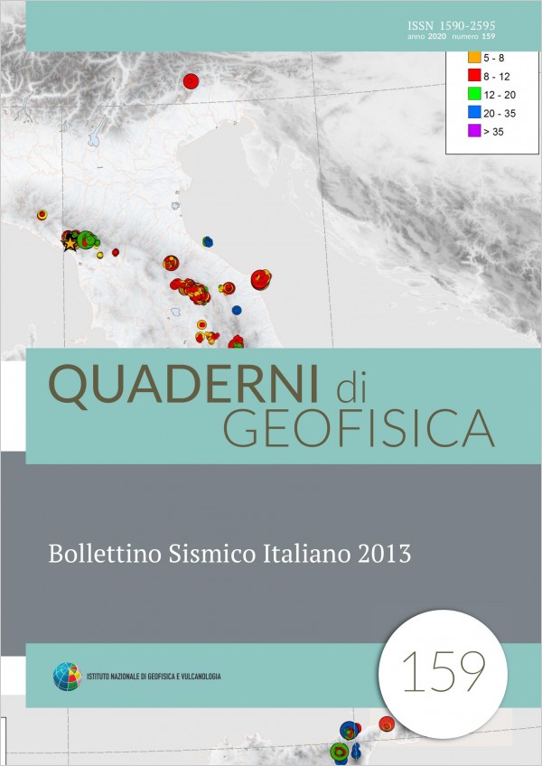
Bollettino Sismico Italiano 2013
Vol. 159 (2020)
This paper describes the status of the National Seismic Network (RSN) and outlines the main characteristics of the seismicity recorded in Italy during 2013. In this year 417 seismic stations were acquired for the RSN, most of them owned by the National Institute of Geophysics and Volcanology (INGV) while the other coming from local, regional or foreign monitoring networks. The Italian Seismic Bulletin (BSI) of 2013 contains 25180 located earthquakes, of which almost two thirds belong to the 41 seismic sequences identified; among these the most significant is the one that began in June in Lunigiana, which also recorded the strongest earthquake of 2013: ML 5.2, which occurred on June 21st. The minimum magnitude of completeness of the BSI in 2013 is MC 1.2. A chapter of the work illustrates the seismicity of anthropic origin present in the BSI (about 1%) and the seismograms of a collapse landslide occurred in the Alpine arc, an area where phenomena of this type occur very frequently.

Brevi studi di Sismologia Storica. Tre casi di Terremoti “minori” tra la Pianura Padana e le colline romagnole (sec. XVII-XIX)
Vol. 158 (2020)
This work illustrates the research on three “moderate” seismic events occurred between the seventeenth and the nineteenth century. The first one had most of its effects at the foot of the Euganean Hills, a zone of lowintensity rate. The second one was felt in a large zone, from Veneto to Marche with slight damage in some hamlets of Romagna. Both can be considered as “new entries” in the seismic Italian history. Also the last earthquake was felt in a wide area and struck particularly Romagna’s hills and Imola. This event is also reported in the CPTI15 catalogue but the new documents allowed us to improve its macroseismic scenario.
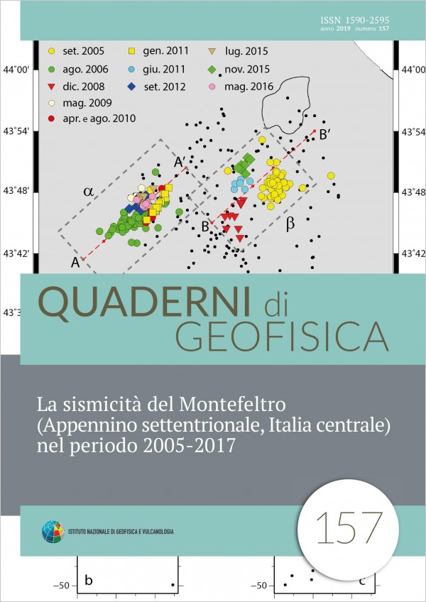
La sismicità del Montefeltro (Appennino settentrionale, Italia centrale) nel periodo 2005-2017
Vol. 157 (2019)
In this paper we examine the seismicity of Montefeltro, an historical region of northern Apennines in central Italy. The analysis focuses on the seismic activity occurred in the period 2005-2017 to exploit the substantial improvement of the National Seismic Network (RSN) in the region. We collected P and S phases from 402 earthquakes for a total of about 7000 arrival times. Earthquakes were integrated with new pickings and relocated using the Hypoellipse code. The results show a sporadic, rather diffuse background seismicity marked by three small seismic sequences strongly clustered in time and space. The most important occurred in September-October 2005 (ML=3.2) and August-September 2006 (ML=3.7), in the neighbourhood of the towns of Macerata Feltria and Casteldelci, respectively. The spatio-temporal evolution of these main episodes highlights an energy release consistent with swarm-like activity. Another major feature of the seismicity pattern is represented by the occurrence of events even in the lower crust and in the upper mantle down to at least 50 km depth.
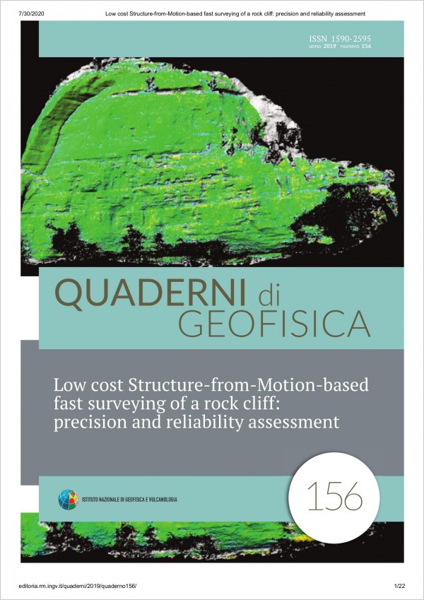
Low cost Structure-from-Motion-based fast surveying of a rock cliff: precision and reliability assessment
Vol. 156 (2019)
Structure-from-Motion (SfM) performance was studied in terms of point clouds repeatability from a fast, low cost survey of an inaccessible slope carried out by means of a prosumer camera in emergency conditions and without ground control points. A rock cliff was observed from a distance of ~340 m and the resulting point clouds were scaled with each other with the method of homologous polylines. A terrestrial laser scanning survey was carried out in order to scale the SfM data and evaluate the results. Tests of repeatability showed standard deviations (SDs) of 11 mm and 18 mm for point clouds obtained from images taken with focal lengths of 98 mm and 55 mm respectively. In order to evaluate the performance in cases where no reference models are available, data scaling was repeated by using Google Earth data, obtaining SDs ~8-9 % larger. Moreover, three times the SD turned out to be ~2.5 times the ground sample distance, leading to a suggestion for a completely independent scaling if no other sources for metric correction are available.
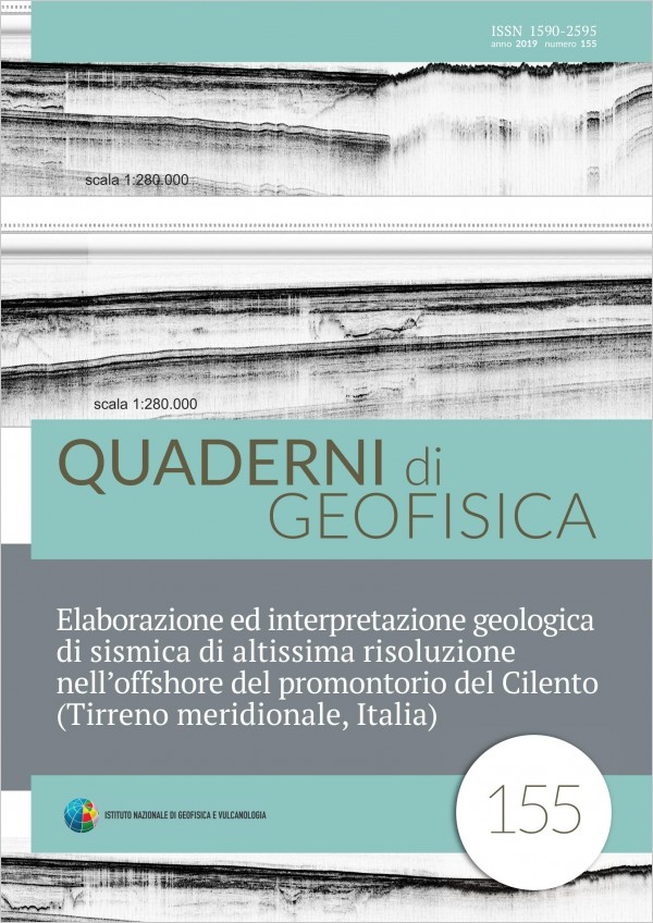
Elaborazione ed interpretazione geologica di sismica di altissima risoluzione nell’offshore del promontorio del Cilento (Tirreno meridionale, Italia)
Vol. 155 (2019)
The processing and the geologic interpretation aimed at marine geological mapping (realization of the marine map of the sheet n. 502 “Agropoli”, ISPRA, National Geological Survey of Italy) of a detailed grid of very high resolution seismic profiles (Subbottom Chirp) recorded in the Campania continental shelf between the Solofrone river mouth and the Agnone town have been carried out. The seismic profiles, recorded through the Subbottom Chirp profiler, have been processed using an opensource software for singlechannel seismic data processing, the SeisPrho, licensed by the Institute of Marine Sciences of the National Research Council of Bologna, Italy and made available. In particular, more than one hundred seismic sections, previously recorded onboard of the RV Urania (CNR) have been read and processed through the application of a vertical linear gain, allowing for a significant improvement of the seismic signal. The study area can be divided in three zones, which have been distinguished based on the trend of the seismic profiles and on the line spacing. The interpretation of the seismic profiles, carried out accordingly to the criteria of the seismic stratigraphy, has allowed to distinguish the main seismostratigraphic units occurring in the subsurface, which are separated by significant seismic reflectors,corresponding with unconformities and/or conformities. In the Cilento inner continental shelf between the Solofrone river mouth and the Licosa Cape the seismo stratigraphic analysis has shown that the recent sedimentary cover, ranging in age from the Late Pleistocene and the Holocene is organized in four main seismostratigraphic units. In its northern sector this shelf represents a depocentral area of marine deposits, mainly sands. Coarsegrained sandy belts have been identified parallel to the shoreline, suggesting the activity of alongshore currents. In its southern sector this shelf represents the seaward prolongation of the Licosa Cape structural high and is characterized by wide outcrops of rocky acoustic basement, genetically related with the Cilento Flysch Auct.
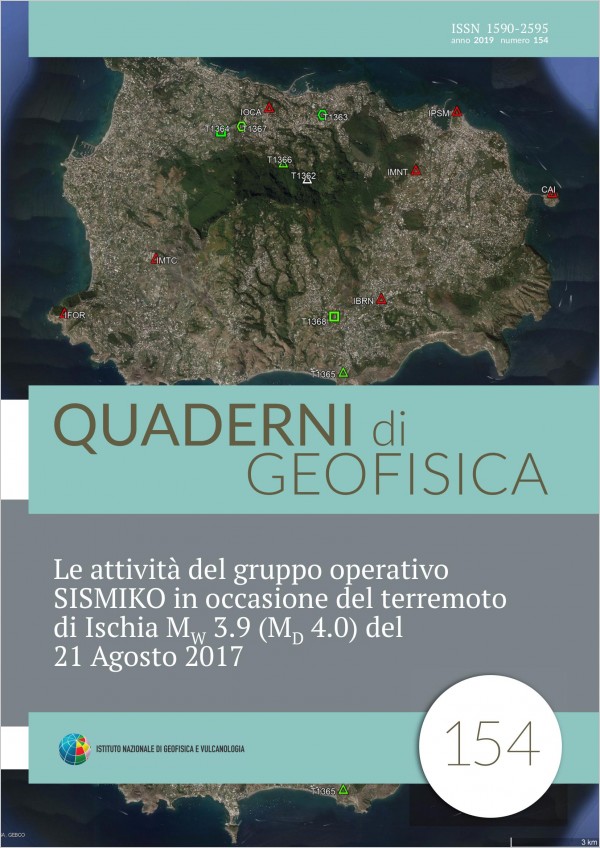
Le attività del gruppo operativo SISMIKO in occasione del terremoto di Ischia MW 3.9 (MD 4.0) del 21 Agosto 2017
Vol. 154 (2019)
After the MD 4.0 (Mw 3.9) earthquake of August 21 2017 which occurred on the Ischia island, the SISMIKO group [Moretti et al., 2016a; 2016b], which is the coordinating group of the emergency seismic networks of INGV, was activated and four seismic mobile stations were installed in the district of Casamicciola and Lacco Ameno integrated with the permanent network on the island. At the beginning, for the first three months, all the mobile stations, coded as T13 network, acquired locally and were equipped with short period sensors and one accelerometer. Starting from October 2017, the seismic signals for three of the four stations, in separate times from October 2017 to May 2018, were transmitted in real time to the INGV monitoring acquisition room for surveillance purposes. Nowadays, the mobile seismic network on the island is composed by six stations: three of them are telemetered while the others recorded signals on local disks. The seismic stations were equipped with short period sensors LE3Dlite 1Hz, LE3D 5s and FBA-EST Kinemetrics accelerometers. Although starting from September 2017, the seismicity of Ischia island was characterized by few low magnitude earthquakes, the installation of mobile stations T13 improved the performance of the seismic network either for the localization analysis or for the detection of very low magnitude earthquakes.

Sviluppo di una stazione sismica low-cost basata su tecnologia MEMS
Vol. 153 (2019)
The impact of a strong earthquake onto an urban community can be reduced taking timely actions managed by the authority in charge for the civil protection. In this view, it is of fundamental importance that the authority in charge for the seismic surveillance is provided with the appropriate monitoring tools able to give the most useful information for the best emergency management in the immediate post-event. Today this goal can be reached realizing urban-scale, real-time seismic monitoring networks (Osservatori Sismici Urbani, OSU, in Italian). The real-time OSU networks are able to promptly provide information to the emergency authority about the ground shaking at each node after an earthquake. Maps showing the spatial distribution of the ground shaking could help in the optimization of the priorities and a good management of the rescue resources in order to reduce the number of victims. Also the assessment of the damage of the buildings could be carried out according to the logic of priority given by the shakings measured by the OSU. The realisation of OSUs is the main objective of the MEMS project. This project is funded by the MIUR under the SIR program (Scientific Independence of young Researchers). The first challenge of the MEMS project was the design and the development of a devoted accelerometric stations. This work illustrates in detail the accelerometric station based on MEMS technology (Micro Electro-Mechanical Systems). The final product is a lowcost accelerometric station with high performance and great versatility.
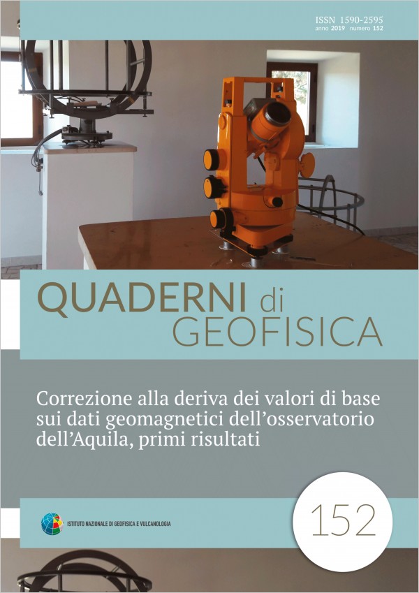
Correzione alla deriva dei valori di base sui dati geomagnetici dell’osservatorio dell’Aquila, primi risultati
Vol. 152 (2019)
Scientific research needs to rely on valid data to be successful. Magnetic instruments, in particular triaxial magnetometers, can be subject to drifting for various reasons such as temperature variations, loss of alignment, loss of leveling. All these events can have spurious effects on the recorded data. In this article, we show the characterization of one of these cases, the loss of leveling and the changes found on data, as well as the procedure used to correct the effect on the recorded numeric values.
Comparative Ozone Sensors Testing in an Anthropized Coastal Area
Vol. 151 (2019)
Air quality monitoring is traditionally performed using fixed monitoring stations in controlled environments. The instrumentation used in these stations, is often complex, bulky, very expensive, and it requires frequent maintenance works. Recently, the advancements in the field of digital technology and network communication made it possible to imagine a new paradigm of monitoring based on low-cost gas sensors. This latter is a very emerging technological area that offers considerable practical application. In this work, the performance evaluation of a low-cost O3 outdoor gas sensor was analysed by means of a comparative infield test. At this scope, we collected data in a strongly urbanized coastal zone, using both a commercial O3 monitoring station and a prototype station based on low-cost metaloxidesemiconductors (MOX) gas sensors. Finally, the performance and reliability of the low-cost prototype sensor versus the commercial one was evaluated through direct comparison between the acquired data.
Storia delle scale macrosismiche. Duecento anni di osservazione degli effetti del terremoto
Vol. 150 (2019)
The macroseismic scales used in recent years are the distillate of an evolutionary process in the field of the observation of the earthquakes’ effects which has lasted a couple of centuries. The most modern scale, the EMS-98 (European Macroseismic scale [Grünthal, 1998]) currently in use in Europe, derives from the MSK64 scale (Medvedev-Sponheuer-Karnik), which in turn, after various other proposals and variations, was an arrangement of the MCS (Mercalli-Cancani-Sieberg) of 1930 to the urban condition of central-eastern Europe. Also the MMI (Modified Mercalli) was proposed by Wood and Neumann to adapt the Mercalli scale to the specific case of California, and then extend its use to all the United States. In the world, with the exclusion of Japan that has adopted its own tradition scales (of seven degrees), in the last 130 years, the used scales derive from the De Rossi-Forel first, and then from the Mercalli one. Throughout this period, dozens of scales have been proposed, some other more meaningful than others. It is then worthwhile to snoop in the history of the macroseismic scale, a tool considered, wrongly, until a few years ago obsolete, but back in vogue in recent times. Here I tried to reconstruct its scientific and cultural journey from its origins until the advent of the scale at twelve degrees of Sieberg and the more recent scales. Obviously this note does not claim to be an exhaustive and definitive collection of all the seismic scales that have occurred over time, nor the catalog of all the possible relative sources, because it would go beyond the forces at stake. At least, it would be a guide to the history of the intensity scales, especially as regards the pioneering period of seismology, between the 19th and 20th centuries, putting together, to the extent available, useful materials, often difficult to retrieve. In particular I tried to leave the reader the possibility of a direct comparison between the largest possible number of scales that have been published over time, proposing the texts translated into Italian directly from the original.
Dati sismostratigrafici sul margine continentale della Campania tra Ischia, Capri ed il bacino del Volturno (Tirreno meridionale, Italia) in base al processing sismico ed all’interpretazione geologica di profili sismici a riflessione multicanale
Vol. 149 (2019)
Deep multichannel profiles located on the Campania continental margin have been processed and interpreted with the aim to highlight new evidence on the tectono-stratigraphic setting of this sector of Southern Italy Tyrrhenian margin. In particular, the interpreted seismic profiles have crossed the geological structures of the Ischia and Capri Islands and the Volturno offshore. The regional geological structure of the Campania continental margin is characterized by several geological structures and corresponding seismic units, both volcanic and sedimentary in nature. The interpreted seismic sections have been divided in different sectors due to their different reflectivity, respectively good next to the Sorrento Peninsula and to the Volturno river mouth and low next to the Magnaghi canyon and the Ischia structural high due to volcanic and volcaniclastic layers. The continental slope of Capri Island-Bocca Piccola is distinguished from the occurrence of a carbonate structure controlled by the related deep carbonatic seismic unit, overlain by thick sedimentary seismic units, represented by relict prograding wedges, probably Middle-Late Pleistocene in age. These units, are, in turn, overlain by a thin Holocene drape, suggesting a starvation on the continental slope off Bocca Piccola during the Late Quaternary, when this area was a structural high, characterized by Meso- Cenozoic carbonates northwestwards dipping and representing the seawards prolongation of the Capri structural high. Acoustically-transparent seismic facies have been observed in the Magnaghi canyon- Ischia offshore sector, located in correspondence to the volcanic Ischia structural high. Seismic interpretation has shown that the incision of the Magnaghi canyon, characterized by a depth of maximum cut of 450 m, has mainly involved the volcanic deposits, lacking of internal reflectivity. Another main sector is represented by the Volturno basin, where three seismic units have been identified, representing the basin filling. They have been respectively interpreted as Pleistocene coastal shales alternating with volcaniclastic deposits, as Middle Pleistocene deltaic and marine deposits and as Miocene flysch deposits, genetically related with the Frosinone Flysch. The Magnaghi basin, herein recognized and previously unknown, is a small basin located in the Ischia offshore, whose infilling is characterized by parallel and continuous seismic reflectors. A morpho-structural high (“Banco di Fuori” or “Banco di Bocca Grande”), bounding southwards the Naples Bay and high about 800 m, is characterized by the occurrence of the deep carbonate seismic unit, representing its stratigraphic bulk. While its north-western flank is characterized by the occurrence of thick relict prograding wedges, the south-eastern one is downthrown by the Acerra-Dohrn canyon normal fault, one of the most significant counter-Apenninic (NE-SW) trending regional faults controlling the structure of the Naples Bay. The high is laterally bounded by the Dohrn canyon in its southern part and by the Magnaghi canyon in its northern part. The Capri structural high is characterized by marked reflectors, parallel and continuous, interpreted as the upper relict prograding wedge (B unit), overlying the lower relict prograding wedge (A unit). Both the wedges unconformably overlie the deep carbonate unit. The passage to the Salerno Valley happens through the Capri-Sorrento regional normal fault, NNW-SSE trending, characterized by a throw of about 1 km and active during the Pleistocene. This fault separates the Salerno Bay from the Naples Bay. The Salerno Valley is filled by four seismic units. The most recent one is characterized by continuous and parallel seismic reflectors and has been put in relationships with Quaternary marine and continental deposits, overlying Pleistocene deposits, showing the same seismic characteristics and representing the second seismic unit. The third unit shows discontinuous reflectors interpreted as Miocene flysch deposits, genetically related with the Cilento Flysch, while the deepest one has been interpreted as Mesozoic carbonate deposits.

Open Science per il futuro della Ricerca europea
Vol. 148 (2018)
This paper illustrates the results of a research conducted during a Master’s degree entitled “Master in Management of Research, Innovation and Technology”, organised by the Graduate School of Business, run by the Politecnico di Milano, between February 2016 and July 2017. The research goal was to map the complex system supporting the “Open Science” paradigm and the so-called “Big Data”, with a particular focus on the Italian research environment, where INGV (Istituto Nazionale di Geofisica e Vulcanologia) operates. In addition to transferring the necessary expertise on the management of the innovation and the technology transfer, the Master’s degree offered the unique chance to encounter and exchange experiences with people operating at different levels, fields and environments, such as universities, research centres, ministries, and private companies. The three authors of this paper reflect the heterogeneous audience of the Master’s courses, with a lawyer working at the Italian Ministry of Education, Universities and Research active in the field of European Research Infrastructures, and two technologist working at INGV, one managing seismological data, and the other working as a chief engineer of the data centre in Bologna. The -very- different backgrounds of the three authors, allowed the exploration of the Open Science paradigm and the use of the Big Data in modern Science, mastering regulatory, scientific and technological aspects. To achieve a complete mapping, the authors underwent an extensive bibliographical search, and took advantage of their respective experience matured in their professional activities. The result is a comprehensive, interdisciplinary analysis, meant to give food for thought and clear suggestions to decision makers, supporting them in a more proactive, efficient, planning.
Il terremoto del 1 settembre 1951 nel maceratese: nuove fonti e revisione macrosismica
Vol. 147 (2018)
This work illustrates the process of revising the macroseismic data of the earthquake of September 1, 1951, which occurred in the province of Macerata (Central Italy), and it is quoted in the CPTI15 catalog with Mw 5.2. The historical period, close to the end of the Second World War, and the concomitance of other earthquakes in the same area, have made the research for new data, and in particular the work to discriminate the damage due to the 1951 shock from those due to war or other seismic events, very complex. Thanks to the research carried out mainly in the provincial archives of the affected areas, it was possible to deepen the level of knowledge of the event, bringing from 80 to 255 the number of localities for which macroseismic information are available. After the revision the epicentral area, with Imax 7, is restricted to the western sector of the province of Macerata, close to the Sibillini Mountains. The macroseismic magnitude, Mw 5.2, calculated with the new dataset, does not vary from the previous one.
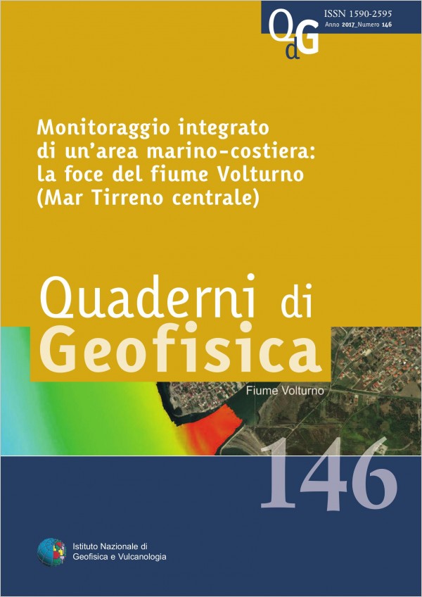
Monitoraggio integrato di un’area marino-costiera: la foce del Fiume Volturno (Mar Tirreno centrale)
Vol. 146 (2017)
This paper describes the results of the activities performed during the project PONa3_00363 I-AMICA (High Technology Infrastructure for Climate and Environment Monitoring; www.i-amica.it), as part of the activities of Development Objective 4.4 (Processes of the biosphere-hydrosphere interface and features of coastal ecosystems). Through the strengthening of scientific-technological infrastructure and equipment, I-AMICA was planned to increase the observational capacity of the monitoring of marine coastal ecosystems, particularly vulnerable in the sensitive Mediterranean area and strictly connected to the natural and anthropic continental system. For this reason research activities were mainly focused on the neritic environment adjacent to the shelf area of the Volturno River mouth (Gulf of Gaeta - central part of the Tyrrhenian Sea). Advanced knowledge on the dynamics in time of marine coastal ecosystems, in relation to the physical, chemical and biological processes that characterize their habitat, were acquired while new methods of integrated monitoring, in relation to the specific characteristics of the study area, were tested. Particular attention was given to the identification of bio-indicators in water column and sediment at sea floor. The monitoring was also integrated by studies on the shoreline changes, seismic stratigraphy of deltaic deposits and by sedimentology and morpho-bathymetry of the seabed.
Acquisizione di registrazioni di microtremore nel territorio di Camerino
Vol. 145 (2017)
In this work we present the results of a microtremor survey conducted in the area of Camerino following the 2016-2017
seismic sequence of the Cental Italy. Such sequence caused a heavy damaging level in Camerino, and especially in the
historical center. The present study aims to provide useful information to increase the knowledge on the local seismic
response of the study area, which is preparatory for future seismic microzonation of higher level.
Twenty-five ambient noise recordings have been carried out in six zones characterized by different damaging levels and type of
buildings. In general, the Horizontal to Vertical Spectral Ratio (HVSR) curves show similar trends, whit a fundamental
frequency around 1 Hz.
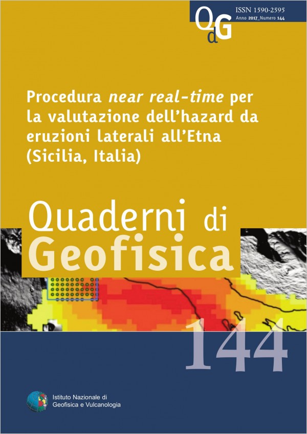
Procedura near real-time per la valutazione dell’hazard da eruzioni laterali all’Etna (Sicilia, Italia)
Vol. 144 (2017)
Mt. Etna is a composite stratovolcano located along the Ionian coast of the Sicily. The frequent flank eruptions (mostly along the NE, S and W rift zones) lead to a high volcanic hazard that is getting worse by the intense urbanization on the flanks of the volcano. In the framework of the project PON SIGMA (Integrated Cloud-Sensor System for Advanced Multirisk Management), we developed a completely automatized computer-assisted analysis that evaluate in near real-time the areas prone to the highest vent opening probability and the corresponding hazard related to effusive eruptions. The Bayesian Event Tree_Eruption Forecasting (BET_EF) algorithm is firstly used to evaluate a long-term hazard map based on the last 4.0 ka flank effusive activity. The analysis and inversion of real time monitoring data, such as seismic location and tremor sources, allowed us to evaluate the short-term Probability Density Function (PDF). A further application of the BET_EF algorithm provided a short-term scenario for lava flow simulations. The short-term scenario and the application of a specific algorithm allowed us to estimate the hazard related to the expected effusive eruption. The final intrusion of the May 2008 – July 2009 flank eruption at Mt. Etna was selected as test case. The future vent forecast highlighted the area with higher probability. It is worth noting that a good accordance is evident if the highest probability area was compared with the real vent location. A series of 200 lava flow simulations was run to assess the areas prone to the highest lava invasion hazard. Finally, the density of the simulated flows was evaluated showing that the highest values are in accordance with the area actually covered by the 2008-2009 lava field.

Materiali per un catalogo di eruzioni di Vulcano e di terremoti delle isole Eolie e della Sicilia nord-orientale (secc. XV-XIX)
Vol. 143 (2017)
This paper presents the results of a historical study carried out in the frame of Task 12 of the V3 INGV-DPC Project “Multi-disciplinary analysis of the relationships between tectonic structures and volcanic activity”. The aim of the study was to collect historical data with which to compile an integrated catalogue of the eruptions occurred on the Vulcano island and the earthquakes located in the area of the Aeolian Islands, the Gulf of Patti and the north-eastern Sicilian coast. Before the study, the amount of knowledge on Vulcano historical eruptions and Aeolian seismicity was both poor and based on very old studies (the latest was published in 1922), while the historical earthquakes of north-eastern Sicily have been studied in the last thirty years. This study collected more than 200 historical descriptions written between the 15th and 19th centuries, whose consultation leads to the identification of about 100 earthquakes (almost a third of which were unknown to previous studies, of 20 eruptions occurred on the Vulcano island (mostly known to previous studies, but in some cases either doubtful or wholly fictitious) and also a few traces of Stromboli volcanic events, though these latter had not been searched for in a systematic way. The study includes a catalogue of Volcano eruptions of the 1407-1899 period and provides for each studied event a synopsis of the effected investigation and its results, with a table of the macroseismic intensities and the transcription of the available historical information on the studied event.
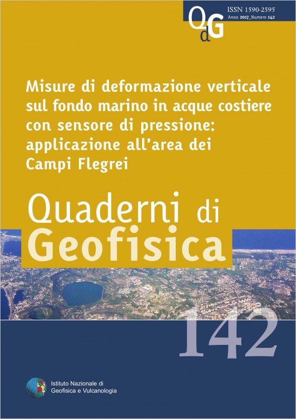
Misure di deformazione verticale sul fondo marino in acque costiere con sensore di pressione: applicazione all’area dei Campi Flegrei
Vol. 142 (2017)
The following work represents the first vertical deformation measurement of the ground in coastal waters obtained through the use of a BPR sensor (Bottom Pressure Recorder) installed in shallow water, with an accuracy comparable with that of the measures carried out by a GPS network placed on the mainland. The described measurement method allows the use of pressure sensors - based on quartz technology - as a possible and low cost integration, which allows the extension in the coastal waters of the geodetic monitoring networks located on the mainland. The area under investigation is the caldera of Campi Flegrei (Pozzuoli) in which even the bradyseism is continually monitored by the Vesuvius Observatory surveillance system in Naples. In the Gulf of Pozzuoli, which is the submerged part of the caldera, on-going studies are performing innovative methods for geophysical monitoring at sea bottom, and – in particular – vertical measures of the soil through the use of BPR sensors. Even in the shallow water condition, such as that of the Gulf of Pozzuoli, it is noted that the BPR can provide reliable estimates of vertical movements of the soil at sea bottom, through the correction of the pressure data with environmental data and it comparison with the sea level obtained from the tide gauge network. In the pages that follow, it provides guidance as to the real possibility to use BPR for the vertical movements measure of the ground, at speeds of a few centimetres per year, in the submerged part of an active volcanic area, where the sea depth does not exceed one hundred meters.