
Materiali per un catalogo dei terremoti italiani: aggiornamento di studi speditivi AMGNDT95 (1821-1905) e studio del terremoto dei Castelli Romani del 1981
Vol. 191 (2024)
The Parametric Catalogue of Italian Earthquakes (CPTI15), includes almost 5000 events; among them there are about two hundred earthquakes scarcely studied, belonging to the AMGNDT995 database, whose parametrization remains very uncertain. Five of these earthquakes are revised in this paper, with the aim of appraising their knowledge and enriching them with better information and data. In addition, we present here an event not listed in the Italian seismic catalogues that occurred in the Colli Albani volcanic district, near Rome, in 1981.

Sia dato un fango (ooze) marino…
Vol. 190 (2024)
I formulate the hypothesis that in a laminar motion regime on an inclined plane, in a marine mud rich in ammonia and water, strings of (OH)-H+NH3 are formed aligned in the direction of motion. The various groups (OH)-H+NH3 of the generic string hold tail heads by electrostatic attraction. Let there be a shear rate, with velocity that varies monotonically in the direction perpendicular to the motion and the inclined plane. The presence of lipids could facilitate laminar motion, favor the rotation of solid particulate matter of the mud around axes parallel to the inclined plane and perpendicular to the macroscopic direction of motion, and facilitate the development of “polarized” rotational kinetic energy quanta. I call such quanta: phonons-of-rotational-kinetic-energy/micro-vortices; they are polarized thanks to the shear rate. In the generic string, I speculate that such phonons induce a synchronous quantum pseudo-rotation of each group (OH)-H+NH3 around its local center H+. I observe that (OH)-and NH3 have almost the same atomic mass, in terms of the number of electrons and protons, since (OH)-has only one electron more than NH3 and if a neutron is supposed to be given by a proton plus an electron. In the generic quantum pseudo-rotation, each (OH)-is counterbalanced by the corresponding neutral group NH3, around its local center H+. I suppose that from these pseudoquantum rotations arises a magnetic field parallel to the inclined plane and perpendicular to the motion. The correspondence with stiffnites, mud flows as debated in two of my 2011 articles in Annals of Geophysics, is discussed [Pareschi, 2011a; 2011b]. Here I also propose that at the stop of motion, at pressures of 300-400 atmospheres, the string breaks and the reaction (OH)-H+NH3 → 14CH4 + OH takes place, with a nuclear transition 14N → 14C. The appearance of additional 14C and the reactive group OH are used to: i) discuss the possible backdating of certain reworked deposits of the Ionian Sea (off the Sicilian coast and South of the Calabrian coasts), currently linked to the Cretan earthquake of 365 AD and ii) explain the oxidation of the normally settled deposits underlying those reworked deposits. Since, in the literature, in the deposits mentioned above, no phenomena attributable to anomalous temperatures are reported, I deduce that the nuclear reaction 14N → 14C is cold.

Materiali per un catalogo dei terremoti italiani. Aggiornamento di studi speditivi
Vol. 189 (2023)
The latest version of the CPTI15 seismic catalogue (January 2022) includes more than two hundred earthquakes marked AMGNDT95. Their parameters are derived from expeditious studies produced as part of the GNDT/CNR ‘Hazard Project’ (1993-1995). Some of them simply parameterise data taken from bibliographic references in the PFG85 catalogue, i.e., mostly Mario Baratta’s seismological compilation “I terremoti d’Italia” [1901] or twentieth-century seismological bulletins. Others go back as far as the original sources of the references themselves.
As part of the B2 Convention between INGV and DPC (2016-2021), a review of these earthquakes was initiated, starting with the most relevant ones, for which a good margin of improvement in knowledge can be assumed. At the same time, first-level research was also begun on a dozen or so earthquakes of low energy, but still above the damage threshold, which for various reasons had never been studied so far and whose parameters in the CPTI15 are still those of the POS85 catalogue. We present here the results of the study of about thirty earthquakes belonging to both categories. The overall result is generally a strong improvement of the available information, from which it will be possible to derive epicentral parameters more up-to-date and more robust than the previous ones.
As part of the B2 Convention between INGV and DPC (2016-2021), a review of these earthquakes was initiated, starting with the most relevant ones, for which a good margin of improvement in knowledge can be assumed. At the same time, first-level research was also begun on a dozen or so earthquakes of low energy, but still above the damage threshold, which for various reasons had never been studied so far and whose parameters in the CPTI15 are still those of the POS85 catalogue. We present here the results of the study of about thirty earthquakes belonging to both categories. The overall result is generally a strong improvement of the available information, from which it will be possible to derive epicentral parameters more up-to-date and more robust than the previous ones.
Prestazioni di un sistema di allerta rapido: il caso del software PRESTo
Vol. 188 (2023)
This work was carried out within the 2015 ART-IT project (Early Earthquake Alert in ITaly). Its main purpose is to investigate the performance and the critical issues of an early warning system with particular reference to the PRESTo system (PRobabilistic and Evolutionary early warning SysTem, [Iannacone et al., 2010; Satriano et al., 2011]) whose use has been tested in the framework of the above mentioned project.
The correct operation of an early warning system can effectively guarantee a more effective management of a seismic emergency from the first seconds after the occurrence of a strong earthquake, allowing quick actions to reduce exposure and seismic risk. The work was substantially subdivided into two main steps. A first calibration phase, carried out in the first part of the project and aimed to identify the best values of the software configuration parameters in terms of event triggering and declaration. Once the values of the aforementioned parameters have been identified, the second phase of the work was focused on testing the software in real time configuration, on a test site area and the subsequent evaluation of its performance in terms of declaration and localization capacity. This work focuses mainly on the second part of the experimentation and is aimed describing and summarizing the analysis carried out to evaluate the response of the PRESTo software (and in general of an early warning system) after one year of experimentation and acquisition and highlight any problems and critical issues of the software and more generally of the rapid alert systems.
The correct operation of an early warning system can effectively guarantee a more effective management of a seismic emergency from the first seconds after the occurrence of a strong earthquake, allowing quick actions to reduce exposure and seismic risk. The work was substantially subdivided into two main steps. A first calibration phase, carried out in the first part of the project and aimed to identify the best values of the software configuration parameters in terms of event triggering and declaration. Once the values of the aforementioned parameters have been identified, the second phase of the work was focused on testing the software in real time configuration, on a test site area and the subsequent evaluation of its performance in terms of declaration and localization capacity. This work focuses mainly on the second part of the experimentation and is aimed describing and summarizing the analysis carried out to evaluate the response of the PRESTo software (and in general of an early warning system) after one year of experimentation and acquisition and highlight any problems and critical issues of the software and more generally of the rapid alert systems.
Esempi nel mondo di sismicità indotta dalla produzione geotermica: considerazioni e proposte di monitoraggio sismico
Vol. 187 (2023)
In Italy, the actual geothermal concessions for the use of the geothermal resources expire in 2024. By the forthcoming assignment of the mining rights participate ‐ beyond ENEL‐Greenpower – also players of the free market, who intend to apply new technologies, accessing, however, one and the same geothermal reservoirs of Larderello‐Travale and Mt. Amiata. The use of different methodologies (partial or complete reinjection), in adjacent areas, requires an advanced monitoring system, capable to locate microseismicity in real‐time, calculating the relevant seismic parameters and communicating the results in quasi‐real‐time to the involved concessions, the competent authorities and the population. Following the initiative of the “Regione Toscana”, the role as responsible monitoring agency (SPM) has been assigned to INGV, with the purpose to guarantee a homogeneous and centralized monitoring of all concessions operating in the Tuscan geothermal areas. Concerning power plants under national jurisdiction, the ministerial guidelines propose an experimental alert‐ and reaction‐scheme, for water reinjection, exclusively. In this perspective, it is important to stress the actual lack of specific guidelines for geothermal exploitation on regional level.
The aim of the present work is to summarize the experiences collected during the management of geothermal systems in other countries and to promote the drafting of a document that defines an appropriate communication scheme for application of the monitoring tasks by the SPM. Such a scheme may represent the basis for developing a reaction scheme and could be useful for the implementation of future regional monitoring guidelines for geothermal activities.
The aim of the present work is to summarize the experiences collected during the management of geothermal systems in other countries and to promote the drafting of a document that defines an appropriate communication scheme for application of the monitoring tasks by the SPM. Such a scheme may represent the basis for developing a reaction scheme and could be useful for the implementation of future regional monitoring guidelines for geothermal activities.

Materiali per un catalogo dei terremoti italiani. Terremoti “minori” dell’Asolano (1861-1921)
Vol. 186 (2023)
In assessing the seismic hazard of an area, and consequently, in risk estimates, a key role is played by the occurrence of strong earthquakes, in this case, the earthquake of 25 February 1695 (Mw 6.4). However, as shown by the MPS19 hazard model [Meletti et al., 2021], the significant increase in hazard values in areas of medium seismicity (e.g. Emilia Romagna), in particular the 10% estimate in 50 years, is determined by the strong improvement of the base data included in the CPTI15 catalogue [Rovida et al., 2022], represented by about a thousand earthquakes re‐evaluated with respect to the previous version, a couple of hundred of which were introduced ex novo in the catalogue.
The present work took into consideration the portion of the Treviso area close to the Venetian Prealps, in particular the area close to the town of Asolo, of which several relatively “minor” earthquakes, included in the CPTI15 catalogue [Rovida et al., 2022] based on super‐expeditious studies, were studied ex novo.
Starting from the preliminary studies available, in‐depth research was carried out going back to the original sources, redetermining the epicentral parameters of each event on the basis of a new data‐set.
As a result of this work, a substantial improvement in the information on each earthquake both in terms of the number of intensity points and the reliability of the estimates has been achieved, as well as making available the transcripts of the entire body of sources and bibliography on the earthquakes considered.
Sciame sismico nel Chianti fiorentino (2022). Le attività del Gruppo Operativo di emergenza SISMIKO
Vol. 185 (2023)
During May 2022, a short-lived seismic swarm affected a small area of the Chianti fiorentino region about 15 km south of Florence. The two strongest earthquakes of the swarm reached MW 3.7; nonetheless, they were distinctly felt up to distances of several tens of kilometers, causing residents’ concern. Moreover, the presence of a huge artistic heritage in the surrounding areas raises questions about its vulnerability to even minor ground shaking. In order to improve knowledge of the location and size of active seismogenic structures in the vicinity of Florence, the Istituto Nazionale di Geofisica e Vulcanologia (INGV) responded promptly through the SISMIKO emergency group. On the 4th of May, the day after the beginning of the sequence, five mobile seismic stations were installed at close range from the epicentral area and integrated into the INGV permanent monitoring system. This report describes the procedures related to: (i) deployment, maintenance and dismission of the mobile network; (ii) management and quality control of the acquired data. Finally, in the frame of the seismo-tectonic context of the area, we present a preliminary overview about the spatial features and temporal evolution of the swarm which had a slight resumption in August 2022, with a magnitude 2.7 event and its aftershocks.
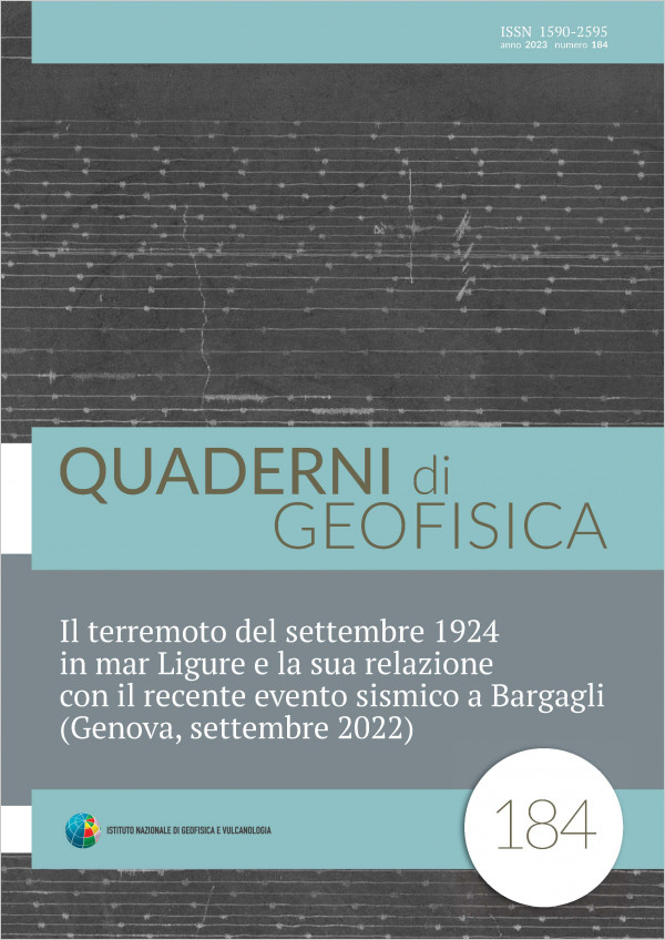
Il terremoto del settembre 1924 in mar Ligure e la sua relazione con il recente evento sismico a Bargagli (Genova, settembre 2022)
Vol. 184 (2023)
On September 22, 2022 the Bargagli area, located about 10 kilometers away from Genoa, was affected by a series of earthquakes of which the largest was that of 15.39 (local time), of magnitude Mw 4.0. The event was felt in a very large area and caused minor damage to a church and a cemetery. A few smaller magnitude tremors followed, mainly clustered in the first few days after the main event. The peculiarity of this seismic crisis is that it occurred in an area not previously affected by earthquakes of that magnitude, at least according to the information contained in the historical and instrumental catalogs currently available. This article describes a study carried out using instrumental bulletins and historical seismograms stored in the Sismos project database to study in greater detail the seismicity of the area and provide any information on other earthquakes that occurred in that sector of the Ligurian Apennines. Based on the results obtained, we propose that the earthquake of September 21, 1924, originally located offshore about two kilometers from the Ligurian coast, actually took place in the vicinity of Bargagli. Although this new position has no particular implications for the seismic hazard of the area, however, it represents an important information to be taken into account in the calculation of the return period and in the seismotectonic interpretation of the area.
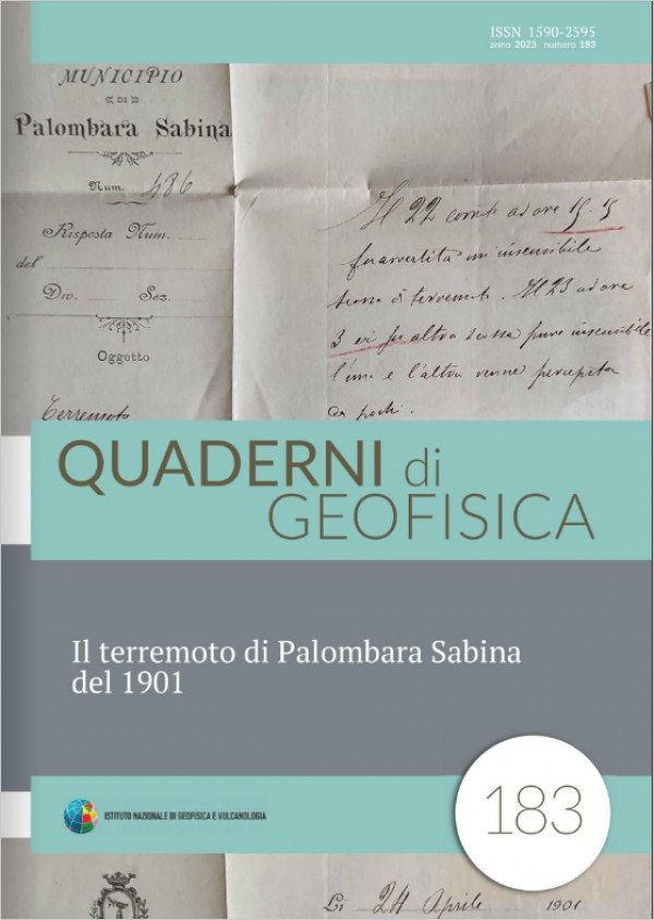
Il terremoto di Palombara Sabina del 1901
Vol. 183 (2023)
The earthquake of April 24, 1901, known as the Palombara Sabina earthquake, is the most important event (Mw 5.2, I0 8 MCS) with epicenter in the Roman province. In spite of this, the earthquake has been poorly documented to date. The aim of the present work is to update the level of knowledge through a complete reappraisal of the sources, and above all an investigation for new accounts to reconstruct the actual impact on the territory.
The results lead to a drastic resizing of the earthquake in terms of lower intensity and, consequently, lower macroseismic magnitude, but also to an improvement of the data supporting the general knowledge. Finally, some new information about the small Sabina earthquake of 1890 emerged during the work.
The results lead to a drastic resizing of the earthquake in terms of lower intensity and, consequently, lower macroseismic magnitude, but also to an improvement of the data supporting the general knowledge. Finally, some new information about the small Sabina earthquake of 1890 emerged during the work.

Comunicare ed educare al rischio, le strade possibili
Vol. 182 (2022)
We present here the results of a five-years-long earthquake educational project aiming to commemorate the hundredth anniversaries of five large Northern Apennines earthquakes occurred between 1916 and 1920 in the areas of: Rimini (1916, Mw 6.1), Valtiberina (1917, Mw 5.9), Romagna Apennines (1918, Mw 5.9), Mugello (1919, Mw 6.3) and Garfagnana (1920, Mw 6.5) earthquakes.
We saw these anniversaries as the occasion for leading the Northern Apennines people to rediscover their past, in a positive way, and to improve their awareness of the earthquake as a natural feature of the regions in which they live.
The activities that we planned for schools students encouraged them to go hunting for traces of the earthquakes of one hundred years ago in their home towns and to rediscover the memories and traditions of their communities. Together with their teachers, we also led the teenagers to find creative
ways to involve the grownups in the process of discovery and knowledge.
The Project had to cope with two emergencies: the great Central Italy earthquake of 2016-2017 and the Covid-19 epidemic. However, these stumbling blocks did not deter teachers and students from taking part in the process actively and even enthusiastically. Their families and communities were actively involved too.
This experience taught us some valuable lessons. First of all, we learned to adapt the project, as we had conceived it at the start, to a wide gamma of social and cultural contexts. Not all the involved communities were equally aware of the level of seismic risk they are exposed to. On the affluent Adriatic coast, where tourism is the main source of income, past earthquakes are something best forgotten, by citizens and administrators alike. On the contrary, in the poorer inland mountain areas (Forlivese Apennines, Mugello, Garfagnana and Lunigiana) a more down-to-earth attitude prevails: earthquakes are looked upon as something that can and does happen and people are quick to grasp how important it is to contribute to initiatives whose aim is reducing seismic risk. Thus, we had to adapt our approach to the different contexts, modifying each time the activities we proposed to the schools with the aim of obtain the best possible results from each situation.

Materiali per un catalogo dei terremoti italiani. Sismicità minore del Novecento: alcuni casi tra gli anni 1949-1971
Vol. 181 (2022)
In Italy, historical research on earthquakes has a long and glorious tradition, which in recent decades has gone through very different phases. In the first half of the 1980s and up to the mid- 90s, two very demanding research ventures were developed: the research program financed by ENEL for the qualification of sites susceptible to nuclear plants in three areas of the country (Piedmont, Lombardy, Puglia), later merged into the “Catalog of Strong Italian Earthquakes” (CFTI) of the ING/INGV, and the “Hazard project” of the GNDT/CNR, aimed at preparing all the basic data necessary for a model of hazard updated.
As part of these two ventures, for about a decade over a hundred researchers, mostly “professional” historians, have worked to update their knowledge of Italian historical earthquakes.
Researches developed by the “Hazard Project” - complementary to those of the CFTI - aimed only at rapidly re-evaluating the knowledge on about 600 intermediate energy earthquakes. Some of these studies, after a couple of decades, are now largely obsolete. For this reason, a work plan was launched aimed at deepening the knowledge on several dozens of these studies, marked in the current Parametric Catalog of Italian Earthquakes (CPTI15) by the initials AMGNDT95, providing them with an updated and, hopefully, better database.
This work presents the results of research carried out on 6 earthquakes included in the 1949– 1971 time span. Such researches have allowed a significant improvement of the epicentral parameters of these earthquakes and, at the same time, an enhancement of seismic histories of numerous localities.
Materiali per un catalogo dei terremoti italiani: revisione di alcuni terremoti presenti nei bollettini macrosismici del XX secolo
Vol. 180 (2022)
In the framework of the studies aimed at improving the knowledge of the seismicity of the Italian territory, starting from CPTI15, an analysis of the earthquakes that were scarcely documented and that needed a deeper knowledge has been undertaken. In particular, the analysis focused on those earthquakes whose only reference study was the Italian Macroseismic Bulletin (BMING/BMINGV). Of these, about forty events were identified and are the subject of this work. For each earthquake, the original macroseismic questionnaires, held in the INGV Macroseismic Archive, were retrieved and an accurate research of new accounts in the newspapers was carried out.
Data from 38 low-to-medium magnitude earthquakes occurring between 1980 and 2002, were reviewed: in total, about 2000 macroseismic questionnaires referring to more than 1400 localities have been examined. About 400 new localities have been identified for which information on 30 events was available, for a total of more than 450 new macroseismic observations.
Based on this new data set, intensities were assigned in EMS-98 and macroseismic parameters were calculated. For each earthquake a summary record was compiled with the new data and a map of the geographic distribution of the observations.
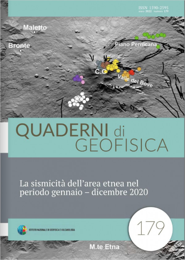
La sismicità dell’area etnea nel periodo gennaio – dicembre 2020
Vol. 179 (2022)
This work describes the main characteristics of the seismicity due to the volcano-tectonic events recorded at Mount Etna during 2020. The data are recorded by the seismic stations of the Permanent Seismic Network operated by National Institute of Geophysics and Volcanology – Etna Observatory (INGV - OE). In this year, about 100 seismic stations constitute the network. The seismic data are first transmitted in real time to the Unified Data Acquisition Centre (CUAD) and then continuously transferred and recorded in the Control Room of INGV – OE. The Analyst Working Group of the Etna Observatory (GLAOE) reviews and reprocesses the seismic data the day after they are acquired, observing standard protocols which are adopted for the compilation of the catalogues and the databases relative to the volcanic areas pertaining to the observatory. The data analyses are performed every day by the GLAOE, and are among the monitoring activities provided by the INGV in the framework of the Accordo Quadro INGV – Civil Protection Department (DPC) 2012-2021 (Allegato A).
During 2020, 3604 earthquakes were recorded in the Etna area, and of these, 2287 were localised. The focal depth is between -1.6 km a.s.l. and 35 km b.s.l., while the local magnitude (ML) is from 0.2 to 3.7. The magnitude of completeness (MC) of the 2020 resulting catalogue is equal to 1.2 (± 0.01), a value comparable to that calculated for 2017 and 2019, but 0.1 units higher than that estimated for 2018.
The seismic events with ML ≥ 3.0 are 15 and above all belonging to one of the 11 seismic sequences identified for 2020. The seismic sequence occurred on December the 31st and started at the 19:59 (UTC) is the most important one, since includes the highest number of events (21) and the most energetic earthquake of the year (ML = 3.7).

Nuovo studio della sequenza sismica del gennaio-febbraio 1703 in Italia centrale
Vol. 178 (2022)
This paper proposes a new study of the important seismic sequence that struck central Italy starting from January 1703. The sequence is currently quoted in the seismic catalogs with three main shocks that occurred between January 14th and February 2nd of that year, with magnitudes ranging between 6.0 and 6.9. Despite the already vast corpus of documentation and the extensive bibliography, due to the studies carried out between the 80s and 90s of the last century, the knowledge of this seismic sequence can be still improved. For this reason, an in‐depth study was undertaken with a twofold objective: first to re‐examine what was already known, starting from known sources, secondly to enrich the documentary resources to increase the number of intensity points, with new data. Information from approximately 390 locations was then analyzed, including more than 150 locations not included in the reference study of the sequence.
The results of this new assessment are based on a chronological reconstruction hypothesis of the shocks of the sequence that, when assigning macroseismic intensity, considers the impact of damage progression due to multiple shocks. Through this approach, the shocks already quoted in the catalogs are reassessed as faithfully as possible, with a richer framework of knowledge than in the past.
The intensity assessment (EMS‐98) has allowed building a new and richer macroseismic dataset and proposing a new interpretation of the sequence, at the same time highlighting the problems that affect the uncertainty in the intensity.
Studio di possibili effetti sistematici nelle nuvole di punti SfM da APR: confronti con TLS, distorsioni e metodi di mitigazione.
Vol. 177 (2022)
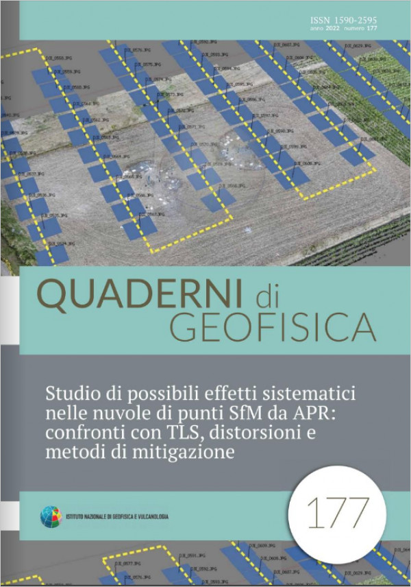
Structure from Motion (SfM) photogrammetry is based on the use of algorithms allowing the automatically identification of a large amount of homologous points (or pixels) between images overlapping areas. The coordinates of the homologous points (provided in different reference systems for each acquisition), allow the images alignment meaning the internal and external camera calibration. The number and the distribution of homologous points drives the entire procedure of photogrammetric restitution. In some cases, due to a fatal combination of acquisition strategy, digital cameras and software, anomalies could occur causing systematic effects in the point clouds representing the observed surfaces. This paper shows the results obtained from SfM surveys carried out as part of a project for the study of deformations due to the phenomenon of liquefaction by comparing multi-temporal models. This is the only case we have observed in years of SfM survey experience in which there are systematic effects preventing the direct use of the point clouds obtained using Photoscan (versions 1.1.2 and 1.7.0). Some approaches aimed at mitigating the distortions by balancing the distribution of homologous points and inhibiting the adjustment of internal camera calibration are used to improve results. A reference Terrestrial Laser Scanning (TLS) survey allowed the evaluation unexpected problems. Finally, the images data set processed by means of Metashape (1.5.0), a new improved version of Photoscan, provide good results free from systematism proving the greater efficiency of new algorithms for homologous points selection optimization. Since Photoscan is a very widespread product and also used within the INGV, it is believed that this experience can be useful to many operators involved in monitoring and studying surface deformations.
Bollettino Sismico Italiano 2015
Vol. 176 (2022)
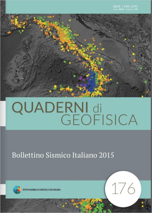
The Istituto Nazionale di Geofisica e Vulcanologia (INGV) receives signals in real time from hundreds of seismic stations located throughout the country in the Seismic Surveillance Room and Tsunami Alert Center in Rome. When an earthquake occurs on the Italian territory, an automatic alarm provides a preliminary assessment of the hypocentral parameters within a couple of minutes. Two seismologists, always present in the seismic surveillance room in Rome, check the information obtained and, for earthquakes above a certain magnitude threshold (ML ≥ 2.5), communicate the data processed to the Civil Protection Operation Room in about 12 minutes (max 30’) [Margheriti et al., 2021].
The final evaluation of the hypocentral parameters of all earthquakes, from the strongest felt in vast areas of the territory to the smallest detected only by a few instruments, is carried out later using a more accurate analysis. This activity has been assigned, for decades and still today, to the group of analysts specialized in seismic signals interpretation.
The seismological analysts of the Italian Seismic Bulletin review all the data recorded by the stations of the National Seismic Network and recognize the presence of earthquakes through a direct analysis of the signals waveforms. In this way the analyst detects the time of arrival of the seismic waves to the various sensors and evaluates the amplitude of the oscillations and the direction of the ground motion; these parameters, used in specific calculation procedures, allow to locate each earthquake8and to evaluate the associated magnitude. The information thus obtained flows into the database that the INGV manages and makes available to the community. This publication aims to make known a product of the National Institute of Geophysics and Volcanology, The Italian Seismic Bulletin, with specific focus on 2015 analysis. The main characteristics of natural seismicity and that of anthropogenic origin recorded in Italy during the examined year will be outlined.
Studio per l’individuazione di un sistema di calibrazione per sensori sismici
Vol. 175 (2022)
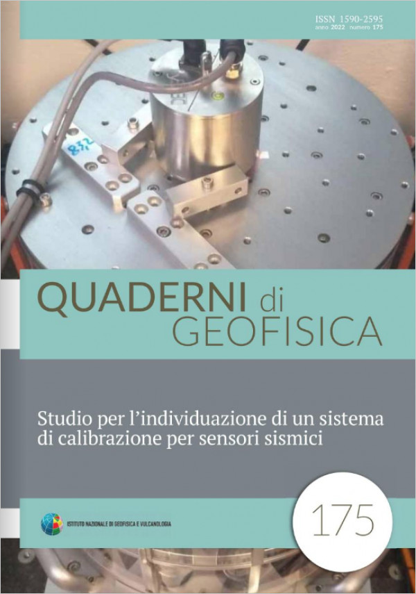
This work sets out to identify a state-of-the-art system to be used for the calibration of seismic sensors. The aim is to acquire such a system within the framework of the PON ARS01 00926 EWAS (an Early Warning System for cultural heritage) project, which seeks to develop new technologies for the protection, conservation and safety of cultural heritage and envisages creating a newly developed seismic monitoring system. This system will exploit the ETL3D/5s-H hybrid sensors, resulting from the integration of a precision accelerometer within the ETL3D/5s velocimeter [Fertitta et al., 2020]. The new calibration system, already acquired and being installed, can be used by the EWAS project partners (including the National Institute of Geophysics and Volcanology and the Kore University of Enna), to calibrate the ETL3D/5s-H sensors, and by external organisations to calibrate or gauge other seismic sensors, thus providing a useful service to the scientific community and supporting industrial activities. This paper presents the method used and the activities undertaken to define the technical specifications of the calibration system. A feasibility study of an electromechanical vibrating table and the testing of two electrodynamic calibration systems were carried out. One of the electrodynamic systems is the CS18P (Calibration System for Seismic Sensors) produced by the German firm SPEKTRA. The CS18P comprises two vibrating tables, one horizontal and one vertical, which, thanks to their fluid-dynamic suspension, eliminate the sliding and rolling friction associated with the movement of the moving part with respect to the fixed part. A hardware and software system monitors and controls the motion in real time, analyses the data and automatically processes a predefined set of measurements. In the light of the technical specifications and experimental results, the CS18P represents the ideal solution for the aims of the EWAS project and also in view of the possible future uses of the calibration system.
Il ruolo dei precursori sismici e l’importanza di un precursore elettromagnetico
Vol. 174 (2021)
This simple and qualitative discussion is an attempt to include in a comprehensive framework the problem of earthquake forecasting and univocally clarify the meaning of “precursor” and the true importance of their study. It is also the starting point to present the potential of the electromagnetic precursor in the framework of classic precursors. The fact that seismic precursors are truly existing phenomena does not represent the solution to the problem of deterministic forecasting. Currently a precursor is not a prediction aid but an investigative tool of the earthquake preparation process: aka the complex mechanism of microfracturing, growth and selforganization of fractures that is necessary to produce ruptures in the crust. Scholz’s “Theory of Dilatance” (ToD), improved and further developed for decades after 1960, remains one of the best explanations for the existence of observable precursors and still seems to highlight the only plausible common cause. ToD is presented here in an “extended” vision in the framework of geotechnical knowledge on rock fracturing in the laboratory. Dilatance is a systematic and necessary process with respect to rock breaking. It would itself be the ideal precursor to the earthquake if it did not lack the essential characteristic of being directly observable. At the moment, the only way to detect dilatance in nature is through its interaction with the surrounding environment and its ability to change the physical characteristics of the rock, that is, through secondary phenomena that it can cause. These phenomena sometimes visible on the surface are what we call precursors. We have reviewed the main “classic” precursors by examining them in the light of the ToD. The study of dilatance, which requires a comparative, systematic and extensive monitoring of precursor phenomena, could lead to a key of interpretation of the precursors themselves for the prediction of the earthquake.

Le persone dell'Istituto Nazionale di Geofisica e Vulcanologia a venti anni dalla sua istituzione
Vol. 173 (2021)
The Istituto Nazionale di Geofisica e Vulcanologia (INGV) was born from the unification of public research institutions in the field of geophysics and volcanology. In the first twenty years from the foundation law of 1999, the INGV has seen a remarkable development, alternating moments of expansion, with significant increases in funding and number of employees, with long periods of stagnation. During these years the number of people hired with fixed-term contracts has grown, also to meet the needs of seismic and volcanic monitoring of the Italian territory, carried out on the basis of agreements with the Department of Civil Protection. After twenty years, it's time to outline a picture of the present situation and the evolutionary process that determined it. With this objective, the following analysis of the evolution of INGV was carried out in the period between its establishment and 2019, with reference to aspects such as the composition of the personnel, its distribution in the Sections, age, gender, role, career, with the aim of providing a tool for evaluating the progress made and planning future developments. The presence of a large number of precarious workers, distributed unevenly in territorial offices, for many years represented the main problem of the INGV, but not the only one. The contraction of the funding and the hiring freeze also slowed the development of the careers of researchers and other employers. The poor gender balance among the personnel, in particular among researchers, and the high average age represents further critical elements. The appropriate rebalancing of heterogeneities, aimed at maximum functionality and effective growth of the institute, should be the challenge for the next years. The future of INGV will depend on the choices that will be made today and the knowledge of the evolution of the institution until today is an essential element for proper programming.
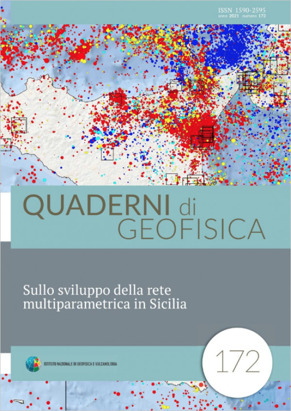
Sullo sviluppo della rete multiparametrica in Sicilia
Vol. 172 (2021)
This contribution illustrates the state of the art on the development of the multiparametric network in Sicily in the last three years. This region is wellknown for the strong earthquakes (M>6.5) which struck in historic time. However, the coverage of the seismic network developed in the last decades was not fully optimized to the need of the seismic surveillance. Since 2017, the group belonging to the National Earthquake Observatory (ONT) which operates in Sicily launched a developing plan of the preexisting seismic network in the framework of the project FISR “Sale Operative Integrate e Reti di Monitoraggio del futuro: l’INGV 2.0 (S.O.I.R.)”. Such update will end by the next years thanks to the project “GRINT Italian Research Infrastructure for Geosciences” in the framework of the “Programma Operativo Nazionale” (PON) of the Italian Ministry for the University and Research. This plan envisages both the upgrade of monitoring systems in the already existing nodes, and the integration of new nodes. The main objective is to build a multiparametric network which integrates the main seismic network, with the monitoring of other geophysical signals through the implementation of other sensors: accelerometers, geodetic GPS, radon detectors, and corner reflectors. We also illustrate the plan for the realization of a redundant network which could support the tasks of the main infrastructure in case of failure of the latter. Finally, we present some experimental urbanscale networks which in the future could support the main infrastructure.

Materiali per una storia sismica delle Isole Maltesi
Vol. 171 (2021)
We present the results of an ItalianMaltese research, carried out to collect the macroseismic data needed to update the seismic catalogue of the Maltese Islands [Galea, 2007]. In this work we adopted the most uptodate criteria developed by Italian historical seismology, obtaining results that significantly improve knowledge, particularly for the 16501923 timewindow. Several previously unknown local earthquakes have been identified and evidence has been found of earthquake damage
caused to the Maltese Islands both by earthquakes probably located in the Sicilian Channel (1658, 1780, 1861), and by some strong Greek earthquakes (1756, 1810, 1846). The European macroseismic scale 1998 (EMS98, Grünthal [1998]) was used to assign macroseismic intensities. Basic information on seismic induced natural phenomena (landslides, tsunamis) was also collected, to be used as a further constraint on the location and size of associated earthquakes, or for paleoseismological studies. As an added bonus, the study collected evidence of some Sicilian earthquakes unknown to seismological literature and data useful to improve the macroseismic database of already known Sicilian and Greek earthquakes.
caused to the Maltese Islands both by earthquakes probably located in the Sicilian Channel (1658, 1780, 1861), and by some strong Greek earthquakes (1756, 1810, 1846). The European macroseismic scale 1998 (EMS98, Grünthal [1998]) was used to assign macroseismic intensities. Basic information on seismic induced natural phenomena (landslides, tsunamis) was also collected, to be used as a further constraint on the location and size of associated earthquakes, or for paleoseismological studies. As an added bonus, the study collected evidence of some Sicilian earthquakes unknown to seismological literature and data useful to improve the macroseismic database of already known Sicilian and Greek earthquakes.
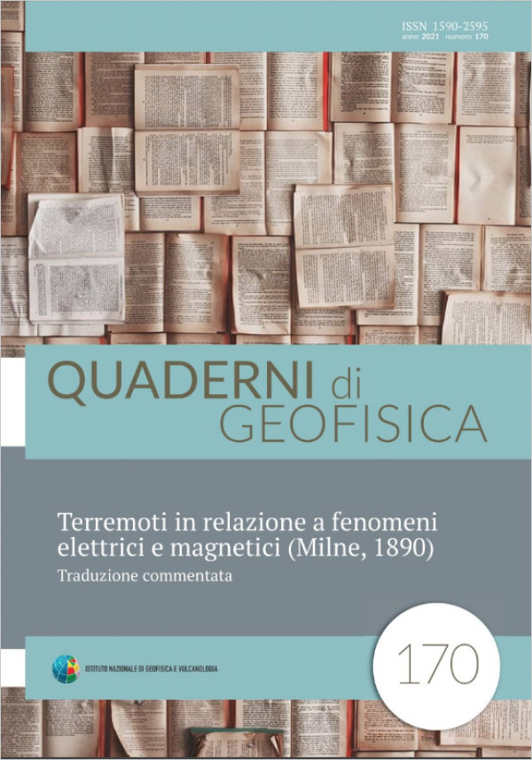
Terremoti in relazione a fenomeni elettrici e magnetici (Milne, 1890). Traduzione commentata.
Vol. 170 (2021)
This is a commented translation of the rare document cited by more than a century of bibliography as “Milne, 1890”. The text was studied to verify the veracity of some recent claims that this report (presently difficult to find) had dealt with electromagnetic precursors for the first time. An attemptwas made to investigate each episode and character, identifying the cryptic (and sometimes nonexistent) bibliographic references, tracing almost all the texts, often expanding and commenting on the relative citations. My opinion is that no one, at the time of Milne, had consciously, but maybe not even accidentally, observed a precursor of electromagnetic origin. The phenomena described are studied from either a purely electrical or magnetic point of view. Electrical signals concern too high voltages and currents. Magnetic phenomena, already at the time, were contested as products of inertial effects, but in any case it is difficult to think that the magnetic field component of an EM signal can permanently deflect the needle of a compass. However this same research has brought to light some other potentially interesting cases that should be investigated further. One of them, could actually be the first documentable case of the observation of an electromagnetic seismic precursor.
Telerilevamento di vibrazioni delle strutture tramite telesensore infrasonico
Vol. 169 (2021)
In the framework of EDISECUR project, funded by the Lazio region, a prototype of speckle tracking remote infrasonic sensor, TIS, for measuring the fundamental angular velocity, and harmonics of a surface subject to oscillations, was developed. TIS is particularly suitable for the detection and monitoring over time of buildings, bridges and other artefacts. Knowing the vibrational state of these structures can be of interest both for their dynamic characterization and for safety. This compact prototype, gives an immediate measure of angular velocity and, with simple operations, it is possible to deduce angular displacements and accelerations. From the angular quantities and the geometric dimension of the surface, it is shown how it is possible to determine other linear kinematic parameters as well. The remote sensor can be used to measure long distance surfaces of various kinds, even where it is not possible to access to perform a direct measurement. The instrument covers a frequency range up to tens of Hz, has a sensitivity and dynamics to detect vibrations induced by industrial noise, traffic, wind and more. This work is mainly aimed at TIS applications in the detection of vibrational state of structures and the methods, limits and advantages of its use are explained together with the errors of this technique. Since the TIS measures a relative movement between the same instrument and the target surface, the errors of the vibrations due to micro seismicity and other environmental causes have been evaluated. Finally, two preliminary examples of measurement on a building structure are presented.
Revisione della sismicità italiana degli anni ’30 del XX secolo. I parte. Casi particolari e una incursione negli anni precedenti
Vol. 168 (2021)
Usually seismicity is intended as a natural phenomenon; yet the recording and interpretation of data are a human undertaking, historically conditioned. This research starts from the hypothesis that the decrease in Italian seismicity observed in the historical catalog [Rovida et al., 2021] for the central years of the twentieth century is due to the social and political conditioning that hindered its registration. This work, which focuses on the 1930s, with a brief excursion into previous years, presents part of the results obtained. In particular, the article deals with three earthquakes of which the data are substantially updated (Calabria, 7.03.1928; Alpi Noriche, 14.05.1930; Valli Giudicarie, 14.04.1931); then it presents an important replica of the strong Maiella earthquake, without macroseismic data in the catalog [Rovida et al., 2021], (Maiella, 23.11.1933); finally it considers a “forgotten” fifth earthquake (Southern Italy, 13.04.1938).
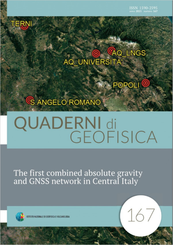
The first combined absolute gravity and GNSS network in Central Italy
Vol. 167 (2021)
A first combined absolute gravity and GNSS network of 5 stations distributed between Lazio, Umbria and Abruzzo regions, was realized in 2018 in order to lay the basics for a multidisciplinary approach to natural risk assessment in the area of Central Italy, affected by the 2009 and 2016 seismic activity. Up to now, two absolute gravity campaigns were carried out using the transportable Microg LaCoste FG5#238 and the portable A10#39 absolute gravimeters. The locations of gravimetric sites have been chosen indoor to allow optimal condition of measure; therefore, the heights of the indoor sites have been determined by joining the outdoor GNSS with classical topographic surveys. The good results obtained after the campaigns and data processing lay the foundations for a new multidisciplinary approach to study also seismogenetic areas. In this paper, we present the gravity and GNSS station monographs, together with the absolute gravity values and the coordinates resulting from the first field surveys.