
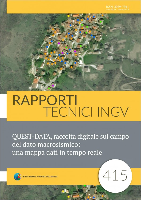
Soon after a seismic event, above the damage threshold, personnel of INGV is involved in emergency groups and is prepared, as soon as possible, to leave reaching the epicenter area. Each group has the task of collecting data, by making measurements and surveys, to study the earthquake from different points of view, and to support Civil Protection activities. In this context the field activities of the QUEST group (QUick Earthquake Survey Team) are included, with personnel that is specialized in macroseismic surveys, who has the task of reaching the areas affected by the earthquake to provide the survey on the effects on buildings, on the environment and people. The final macroseismic investigation aims to study the earthquake through direct observation and damage classification through the use of the EMS98 macroseismic scale [Grünthal, 1998]. Currently this investigation is carried out with the aid of paper questionnaire forms for collecting the data, and a series of maps, generally satellite images of the places to be investigated [Tertulliani et al., 2010]. Over time, attempts have been made to study increasingly rapid survey techniques in order to gather the actual data on the damage before the inevitable interventions of Firefighters or further damaging aftershocks that can modify the damage scenario. For this purpose, a tool for collecting macroseismic data is being developed, based on the use of tablets equipped with a graphical interface that allows the collection of information directly on maps of the locations to be investigated. In particular, the inclusion of timely information for each building, with the relative level of vulnerability and grade of damage, allows us to share information in real time between the various teams on the ground. This tool also allows the operator to work offline, and therefore to be able to gather information even in the absence or failure of the telephone signal and to send the data at a later time (as soon as it is available). In addition, the information is centralized at the operating centre that can manage and coordinate the displacement of the teams in the epicenter area. In this way new interesting scenarios are opened to the advantage of operational speed and knowledge of damage to the building, but also in terms of management of the personnel involved to optimize the survey activities.
Published: 2021-02-22