
SDQ: un tool Python-based per la valutazione della qualità dei dati sismo-accelerometrici della Rete Sismica Nazionale dell’INGV
Vol. 482 (2024)
In this paper, Seismic Data Quality (SDQ), a new application devoted to estimating the quality of the accelerometric and seismometric data recorded by the INGV National Seismic Network, is proposed. SDQ has been developed in Python with the main purpose of performing both:
• a systematic compatibility comparison between the accelerometric and velocimeter data of
sensors co‐located in correspondence with each seismo‐accelerometric recording site;
• to assign to each recorded event waveforms a quality class.
For the analyses, 230 multi‐parametric stations (i.e., equipped with both accelerometric and velocimeter channels) of the INGV National Seismic Network were considered. Data were acquired from January 2012 to March 2023 for a total of more than 15,000 event waveforms related to Italian earthquakes with local or moment magnitude (ML e/o MW) ≥ 3.5 and hypocentral distance (Ripo) ≤ 150 km. All data used in this report were downloaded from the EIDA
Italy node through the use of INGV webservices [1].
The quality of the data recorded from each single RSN station was assessed both using individual waveform metadata (Peak Ground Acceleration, PGA; Peak Ground Velocity, PGV) and the similarity of the whole time series by cross‐correlation algorithms. For each waveform, it was also possible to assign a quality class from A (excellent quality) to D (data to be rejected) by analysing both the root mean square of the signal envelope and the energy content of the Fast Fourier spectrum. The resultsallow us to highlight which RSN stations show, at present, a correct operation and which, on the contrary, need verification aimed at determining the cause of the inconsistency between the co‐ located sensors.
A New RDBMS and Structure for the IRON Database
Vol. 481 (2024)
In the last decade, radon monitoring advanced with active techniques and a regional highfrequency network. The Italian Radon mOnitoring Network (IRON) started in 2010, growing from 19 to 136 stations. To handle the increasing data, a MySQL database was implemented in 2016, followed by advanced tools in 2019. This included a refined database, SQL procedures for automatic creation (preferring PostgreSQL), and MATLAB® procedures for data standardization. In this paper, the database’ structure and the procedures are described.
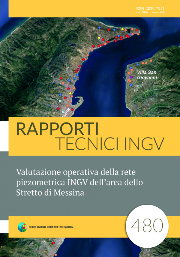
Valutazione operativa della rete piezometrica INGV dell’area dello Stretto di Messina
Vol. 480 (2024)
The Strait of Messina area represents a scientific challenge of great importance for geophysics, geochemistry and, in general, for earth sciences, due to the close coexistence of different geodynamic regimes. Here are present tectonic systems able to generate energetic earthquakes, among the strongest of the entire Italian seismic catalogue and some of the most important active volcanoes. It is mandatory to consider it a natural laboratory in which to invest in research and monitoring infrastructures [Mattia et al., 2008; 2009]. It is also for this reason that the INGV has decided to set up a site in Messina where the data of a dense network of instruments and technical and research personnel can converge. The piezometric network, in particular, is a challenge within a challenge, since there is also an obligation for INGV to enhance and make operational an infrastructure acquired in 2015 when the company Stretto di Messina S.p.A. was wound up.
This report shows methodologies and results of the revision of the network, acquired by INGV in order to assign it to the realization of a hydrogeochemical monitoring network, within the framework of WP05 “NEMESI” of the MEET project.
This report shows methodologies and results of the revision of the network, acquired by INGV in order to assign it to the realization of a hydrogeochemical monitoring network, within the framework of WP05 “NEMESI” of the MEET project.
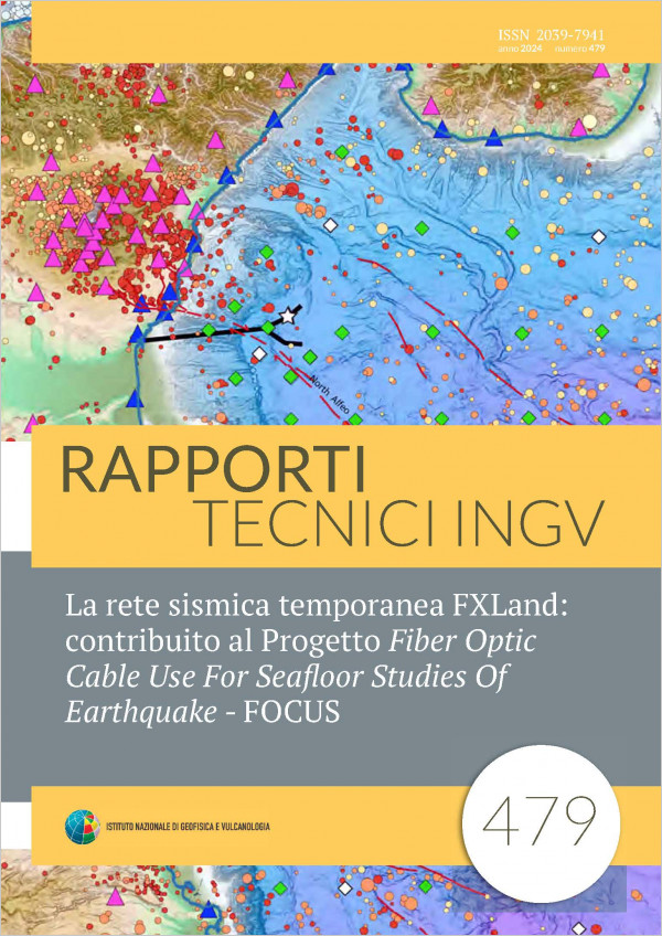
La rete sismica temporanea FXLand: contribuito al Progetto Fiber Optic Cable Use For Seafloor Studies Of Earthquake - FOCUS
Vol. 479 (2024)
In 2018 the project FOCUS - Fiber Optic Cable Use For Seafloor Studies Of Earthquake - started coordinated by Marc-André Gutscher from the Laboratoire Géosciences Océan at the University of Brest, France. This project investigates the seismicity and the crustal structure of the Ionian Sea through the analysis and interpretation of data collected by underwater instrumentation and by monitoring networks either available or specifically deployed near the coast.
In this context, the Osservatorio Nazionale Terremoti (ONT) and the Osservatorio Etneo (OE) of the Istituto Nazionale di Geofisica e Vulcanologia (INGV) and the Laboratorio di Sismologia of the University of Calabria (UniCal), contributed to the installation of a temporary seismic network to integrate the permanent networks present in the Strait of Messina region and along the Sicilian-Calabrian Ionian coast. The new network, consisting of 13 stations, acquired data from December 2021 to June 2023.
In January 2022, the international partners of FOCUS project installed a temporary network of OBS seismometers and seabed pressure sensors. The integration of all these data is aimed to obtain the recording and localization of earthquakes in the Ionian Sea, with a detail never achieved in terms of small magnitudes and accuracy of the locations. The institutions involved in the project collaborate on data acquisition and processing, the imaging of the Earth’s interior with advanced techniques, data interpretation, and modeling. The large amount of data collected will improve seismic monitoring and knowledge relating to the Earth's structure of the investigated area with particular attention to seismogenic structures.
This work describes the design, installation and management of the temporary network "FXland" and provides information related to its functioning and the characteristics of the acquired dataset.
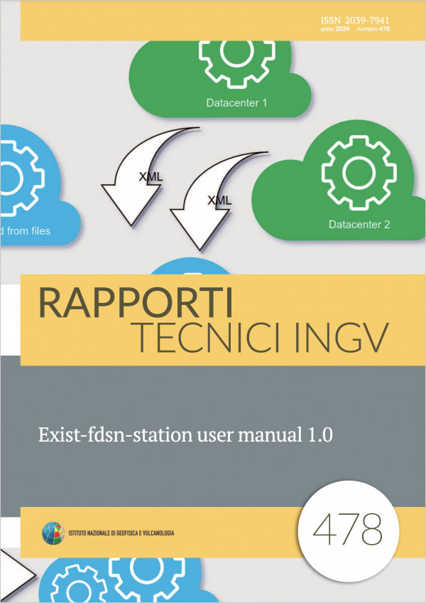
Exist-fdsn-station user manual 1.0
Vol. 478 (2024)
Existfdsnstation is an open source software that implements the standard fdsnws/station web service, integrating the application into a native XML database containing seismic stations metadata in the StationXML file format. Through its HTTP Application Programming Interface, extended with the PUT method for writing, this software can be used as a RESTful microservice. The software is publicly available and licensed under a General Public License. This manual describes all the operational phases, from installation to distribution in a production environment, for using existfdsnstation to store a set of StationXML files and exposing them efficiently with a standard fdsnws/station webservice.
ESM processing tool users’ manual
Vol. 477 (2024)
The behaviour of the ground surface and of structures subjected to earthquakes can be estimated analysing the accelerograms of seismic records. The ground motion is strongly dependent on several factors and the ability to record, characterize and extract the main features of waveforms is essential to better understand these dependencies. One of the most difficult steps of this analysis is the waveforms’ processing. Its purpose is the estimation and the removal of noise in the records, to evaluate reliable ground motion.
In this framework a processing tool fully integrated within the Engineering Strong Motion (ESM) database was designed [Paolucci et al., 2011; Luzi et al., 2016].
In the last decade the number of waveforms is sharply increased and so is the time it takes to process them. To solve this issue a possible solution is to broaden the number of qualified people involved in the processing. The main aim of this tutorial is to teach the largest number of people how to use the ESM processing tool and to provide some important guidelines for the thresholds of the parameters to set. In the text a stepbystep processing routine is depicted with a description of the purpose for each parameter. In addition, a suite of explanatory examples with peculiar situations is given.
OEDataRep: the new version of the Osservatorio Etneo Open Data Repository
Vol. 476 (2023)
The use of a generalist, non fieldspecific Open Data based Repository, started at the INGV Osservatorio Etneo of Catania (INGVOE) following the introduction of a first prototype, called DataRep in late 2021. During this experimental period, DataRep was used as the institutional data repository of the INGVOE, testing its functionalities, usage procedures and the interaction with the national INGV metadata catalog (“Data Registry”) through its associated Metadata Editor software. Due to the heterogeneous nature of data types managed at INGVOE, mainly structured as temporal data (also known as timeseries) or catalogs of events (e.g. earthquakes, eruptions), there has been an increasing interest in making the data repository interact with another key software developed and distributed by the INGVOE: the TSDSystem (TimeSeries Database System) framework. Among other features, the TSDSystem facilitates the collection of timeseries from several sources, supporting their standardization within a unique and coherent database structure, and allowing the retrieval of data in a convenient way by easily providing joint requests of multiple timeseries at once that may be displayed on the same time axis. From the interoperability of the three software involved the Metadata Editor, the data repository and the TSDSystem users may uniquely interact with the web graphical user interface of the Metadata Editor in order to describe the metadata associated with a future publication and upload them together with the related files to the data repository. The latter will then act as a client of the services exposed by the TSDSystem. Following this workflow, datasets that include timeseries data published to the repository, will also be put atomically into the TSDSystem database.
Likewise, the same timeseries data will be retrieved from the TSDSystem and displayed by the repository web interface. The integration of the three software platforms is at the core of a new version of the DataRep repository that is now being phased out in favor of a new implementation called OEDataRep, the acronym of Osservatorio Etneo Open Data Repository. This new version involved a complete overhaul of the data repository software that has considerably improved both the underlying infrastructure and the graphical user experience.
Likewise, the same timeseries data will be retrieved from the TSDSystem and displayed by the repository web interface. The integration of the three software platforms is at the core of a new version of the DataRep repository that is now being phased out in favor of a new implementation called OEDataRep, the acronym of Osservatorio Etneo Open Data Repository. This new version involved a complete overhaul of the data repository software that has considerably improved both the underlying infrastructure and the graphical user experience.
‘Fragile Home’, uno strumento educational per visualizzare una casa “prima” e “dopo” un terremoto
Vol. 475 (2023)
The Italian territory is particularly exposed to seismic risk. In 2021, in fact, the National Seismic Network recorded 16,095, an average of 44 earthquakes per day. Earthquakes, therefore, represent a very important risk both for homes that - due to their architectural history and construction techniques - are fragile and for the social communities and local economies that are overwhelmed by the consequences.
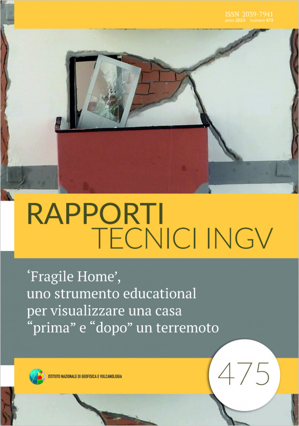
‘Fragile Home’ represents a house, on several levels, exposed to the shaking of a seismic tremor. It represents the typical rooms of a traditional house as they appear ‘before’ an earthquake and ‘after’ the damage caused by the seismic event. The walls, architectural structures and furnishings of the ‘after’ part are damaged under the effects of the collapse typical of a house built without earthquakeproof techniques.
This work, designed to be presented to an audience of school-age children, is intended as a stimulus to build the awareness of the new generations on the fragility of the structures we live in, even though they conceptually represent our safety, our ‘safe roof’.
Technical documentation of SEISMOFAULTS.EU: the IT infrastructure employed by the European Databases of Seismogenic Faults (EDSF) installation
Vol. 474 (2023)
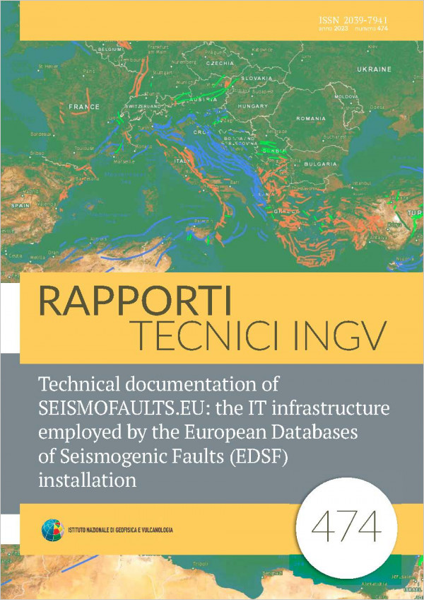
SEISMOFAULTS.EU is the IT infrastructure designed and implemented to publish datasets that are part of the European Databases of Seismogenic Faults (EDSF) installation hosted by the Istituto Nazionale di Geofisica e Vulcanologia.
It consists of carefully selected and configured hardware and software in order to ensure a reliable, and secure service. The implemented backup solutions and continuous monitoring of the entire platform at various levels safeguard the system from disruptions due to various types of possible malfunctions.
The main functionalities of SEISMOFAULTS.EU include the publication of datasets of seismogenic sources of the European and Mediterranean area through the standard web services developed by the Open Geospatial Consortium. Websites related to the same datasets as well as web services related to sibling projects, are also published through the infrastructure.
Following government recommendations for public administration, most of the software used in the platform has an opensource license. The main software applications
involved in web services publishing are PostgreSQL/PostGIS and GeoServer.
SEISMOFAULTS.EU was designed under the auspices of EPOS, Thematic Core Service Seismology, and actively contributed to it by integrating datasets on seismogenic faults in the EuroMediterranean area into the EPOS Integrated Core Service Central hub platform.
The combination of efforts between EPOS and SEISMOFAULTS.EU strengthens the scientific geoscience community in coordinating efforts aimed at advancing knowledge in the field of seismology and the study of seismogenic sources and earthquake hazard analyses.
A procedure to use the RAD7 detector for measuring 222Rn in soil gases exceeding instrumental limits: an application to chemically aggressive fumaroles of the Campi Flegrei area
Vol. 473 (2023)
This report proposes a properdesigned method for the RAD7 detector to measure 222Rn in gases discharged from sulfurous fumaroles, tested at temperatures between 94°C and 162°C.
RAD7 is one of the most widely used commercial instruments for 222Rn measurements, either dissolved in water or fluxing from soils, offering a reliable comparison of data acquired in different laboratories being already calibrated by the manufacturer. However, RAD7 cannot be used for measurements in hot and acidic gas soils.
The properdesigned method involves sampling of the gas insitu in Tedlar® bags, transferring the gas into glass tubes and, finally, measuring the gas via a closed loop using the RAD7 after the removal of H2S by proper traps.
This new method has been tested for measuring radon in the hostile environments of Solfatara and Pisciarelli in the Campi Flegrei volcano (Italy), providing the instrumental base for creating timely Rn content datasets.
Installazione di una rete temporanea per il monitoraggio della sismicità nei dintorni dell'invaso idrico artificiale di Monte Cotugno (Basilicata, Italia)
Vol. 472 (2023)
This technical report describes the details of the installation of a temporary network around the Monte Cotugno dam (Basilicata) and shows the results of the first analyses carried out on the acquired signals.
This experiment, which took place between June 2021 and June 2022, has been performed by installing 6 temporary stations which have been integrated with local permanent stations from the national network. It is part of the activities aimed at researching new cases of seismicity in Italy with a possible anthropogenic cause (such as, for example, seismicity stimulated by reservoirs, exploitation of geothermal resources, extraction or injection of fluids into the crust, etc.). The objective is to record micro-seismicity around sites with human activity that may have the potential to stimulate such events, and to compare the recorded data with possible anthropogenic causes. In this way, in cases where it is possible to detect some indication of a possible correlation between seismicity and human activity, it will be possible to propose new episodes of potentially induced seismicity to be integrated into the EPISODES platform of the TCS AH of the EPOS (European Plate Observing System) research infrastructure. We selected the artificial basin of Monte Cotugno for three reasons: 1) it is the reservoir associated with the largest clay dam in Europe and presents large seasonal and multi-year variations in level of water, 2) in this area the national seismic network has a very limited coverage, therefore it was necessary to increase it in order to record low-magnitude events possibly induced by the reservoir, 3) the area presents a moderate seismic hazard.
This experiment, which took place between June 2021 and June 2022, has been performed by installing 6 temporary stations which have been integrated with local permanent stations from the national network. It is part of the activities aimed at researching new cases of seismicity in Italy with a possible anthropogenic cause (such as, for example, seismicity stimulated by reservoirs, exploitation of geothermal resources, extraction or injection of fluids into the crust, etc.). The objective is to record micro-seismicity around sites with human activity that may have the potential to stimulate such events, and to compare the recorded data with possible anthropogenic causes. In this way, in cases where it is possible to detect some indication of a possible correlation between seismicity and human activity, it will be possible to propose new episodes of potentially induced seismicity to be integrated into the EPISODES platform of the TCS AH of the EPOS (European Plate Observing System) research infrastructure. We selected the artificial basin of Monte Cotugno for three reasons: 1) it is the reservoir associated with the largest clay dam in Europe and presents large seasonal and multi-year variations in level of water, 2) in this area the national seismic network has a very limited coverage, therefore it was necessary to increase it in order to record low-magnitude events possibly induced by the reservoir, 3) the area presents a moderate seismic hazard.
Sistema di sincronizzazione dei dati multiparametrici acquisiti dagli osservatori sottomarini cablati nella facility di EMSO Western Ionian Sea
Vol. 471 (2023)
The PON‐EMSO InSea (Initiatives in Supporting the consolidation and enhancement of the EMSO infrastructure and related Activities) project aims to upgrade the seafloor infrastructure located offshore Catania and called Western Ionian Sea, the facility managed by INGV (Istituto Nazionale di Geofisica e Vulcanologia) and part of the European Consortium EMSO (European Multidisciplinary Seafloor and water column Observatory). The objective of the project is the permanent installation of several multiparametric seabed observatories, at a depth of about 2000 meters, powered by a submarine electro‐optical cable connected to a shore station located in the port of Catania and managed in collaboration with INFN (Istituto Nazionale di Fisica Nucleare). Through the electro‐optical cable, the submarine instrumentation is connected to the onshore laboratory; all the instruments are nodes of an ethernet network whose purpose is to save the data produced by the observatories, monitor and control the parameters of the submarine infrastructure and manage the timing of all the instruments. This technical report describes the constructional and functional characteristics of the Syncboard v1.0 synchronization board developed by INGV to distribute the timing supplied by a GPS antenna, installed at the shore station, to all the instruments installed on the submarine observatories
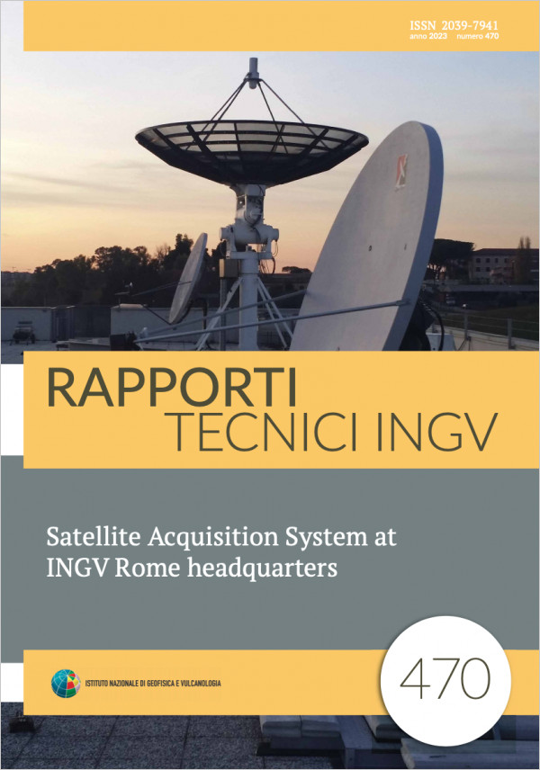
Satellite Acquisition System at INGV Rome headquarters
Vol. 470 (2023)
This technical report describes the MAST satellite acquisition system (Multimission Acquisition SysTem) operating at the INGV headquarters in Rome since 2019 and part of the main instrumentation of the ADEO laboratory (Earth Observation Data Acquisition) established in May 2021 by the Remote Sensing Functional Unit of the ONT section.
The system acquires meteorological and environmental satellite data transmitted by the EUMETSAT Consortium through the EUMETCast distribution system. EUMETCast’s Basic, High volume 1, High Volume 2, and Terrestrial services are currently distributing realtime or near realtime more than 120 data and products acquired by Earth Observation (EO) instruments aboard satellites in geostationary and polar orbit managed by major international space agencies. The MAST system was designed to reliably receive this increasingly large amount of data distributed through the EUMETCast service. Therefore, it responds to the need to supply INGV with an EO satellite data acquisition system capable of providing the most accurate and timely information possible on the expected scenario in the case of major events of volcanic, environmental, and seismic activity. It also provides the necessary infrastructure to develop and deploy new monitoring and research products generated from EO space data.
This report describes both the hardware and the software structure related to the acquisition and organization of the satellite data distributed by the EUMETCast service that are the basis of the generated products. MAST was also designed with particular attention to the overall reliability of the system, achieved with the redundancy of its hardware and software components. Furthermore, easily replaceable commercial and modular hardware components and Pythonbased opensource acquisition software in Linux were used. These choices allow easier MAST system management without additional maintenance and licensing costs, fully controlled by INGV personnel.
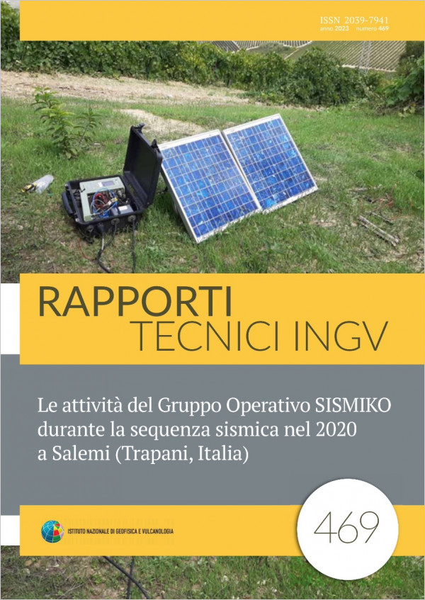
Le attività del Gruppo Operativo SISMIKO durante la sequenza sismica nel 2020 a Salemi (Trapani, Italia)
Vol. 469 (2023)
On 19 September 2020, the Coordination Committee of SISMIKO, one of the Emergency Operational Groups (GO) of the National Institute of Geophysics and Volcanology (In italian: Istituto Nazionale di Geofisica e Vulcanologia, INGV), met to evaluate an intervention by the mobile seismic network in Eastern Sicily. In the previous days some seismic events, located near the municipalities of Salemi, Vita and Gibellina in the province of Trapani, were troubling the localadministrations. The Head of Civil Protection of the Sicily Region therefore asked the president of the INGV for an assessment of the intensification of the seismic monitoring of the area. At the time of the convocation of the Coordination Commitee there were about 10 events of magnitude M, between 1.3 and 3.5 M; four of these earthquakes had been felt by the population. After the meeting, the decision has been taken to activate SISMIKO and to install a temporary network made up of 4 seismic stations.
The data of the stations, transmitted in real time to the INGV acquisition centers of Catania (Osservatorio Etneo, OE) and Rome (Osservatorio Nazionale Terremoti, ONT), were integrated into the system to contribute to the national seismic surveillance services that are carried out at the ONT Operations Room. This work describes the main activities carried out by SISMIKO, starting from the convening of the Coordination Committee to the uninstallation of the infrastructure.
The data of the stations, transmitted in real time to the INGV acquisition centers of Catania (Osservatorio Etneo, OE) and Rome (Osservatorio Nazionale Terremoti, ONT), were integrated into the system to contribute to the national seismic surveillance services that are carried out at the ONT Operations Room. This work describes the main activities carried out by SISMIKO, starting from the convening of the Coordination Committee to the uninstallation of the infrastructure.
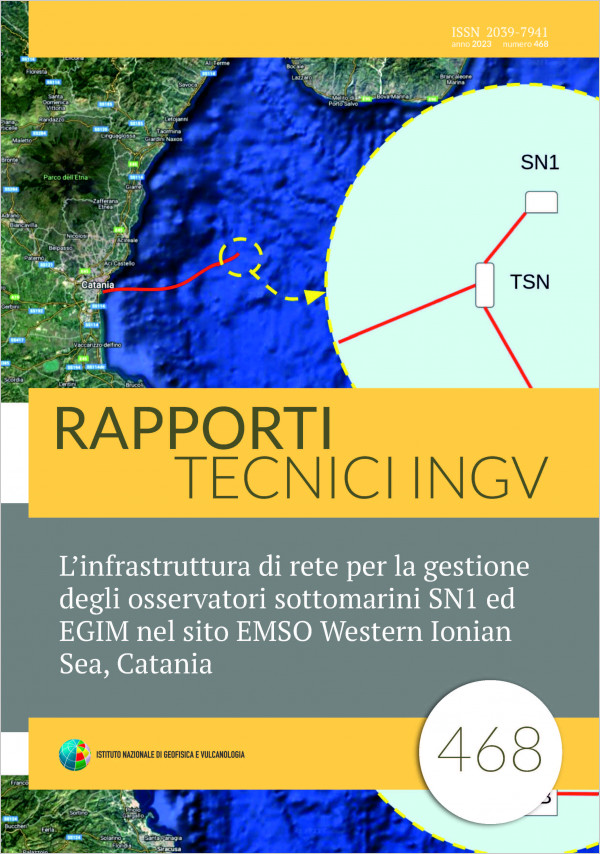
L’infrastruttura di rete per la gestione degli osservatori sottomarini SN1 ed EGIM nel sito EMSO Western Ionian Sea, Catania
Vol. 468 (2023)
Starting from 2001 INGV, in cooperation with INFN, performed several experiments with multidisciplinary submarine observatories installed at deep sea off the coast of Catania at the Western Ionian Sea site, the INGV Regional Facility that today contributes to the EMSO ERIC (European Multidisciplinary Seafloor and water column Observatory - European Research Infrastructure Consortium). Submarine equipment can provide real-time data to shore acquisition systems and are remotely accessible. For the management of several submarine platforms, a computer network was developed to support the systems for data management, acquisition and distribution. This technical report describes the network implementation for the simultaneous management of two submarine observatories and a Junction Box.
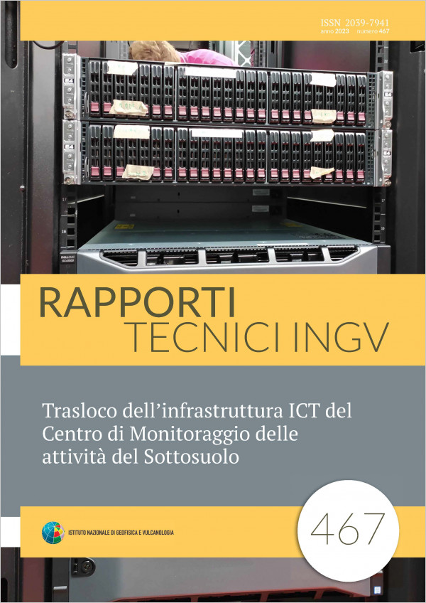
Trasloco dell’infrastruttura ICT del Centro di Monitoraggio delle attività del Sottosuolo
Vol. 467 (2023)
This article shares the experience gained during the move of the Information and Communication Technology infrastructure of the Centro di Monitoraggio delle attività di Sottosuolo of Istituto Nazionale di Geofisica e Vulcanologia from the datacenter the headquarters of the Bologna Section in via D. Creti 12 to the Tier-1 datacenter of Istituto Nazionale di Fisica Nucleare, on via Berti Pichat 6.
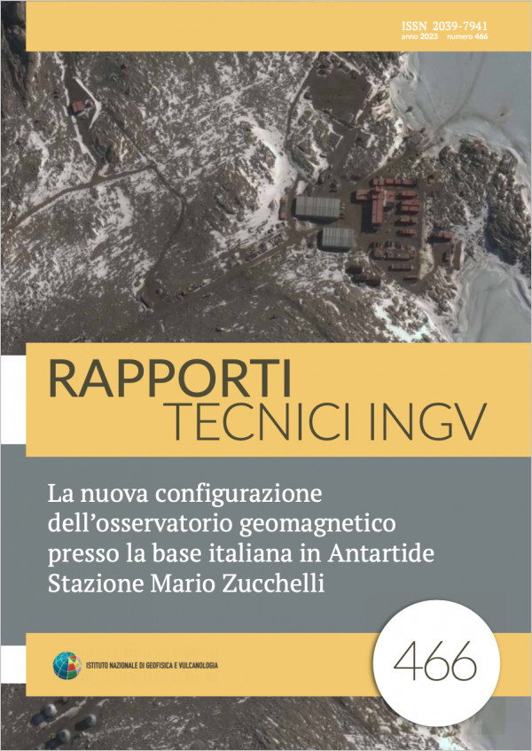
La nuova configurazione dell’osservatorio geomagnetico presso la base italiana in Antartide Stazione Mario Zucchelli
Vol. 466 (2023)
This technical report describes the instrumentation installed in the Antarctic geomagnetic observatory at the Italian base “Mario Zucchelli” and managed by INGV staff. The observatory continuously acquires measurements the Earth’s magnetic field in Antarctica since 1986. The measurements of the field components and its variations in Antarctica are very important for geomagnetic studies as it is close to the geomagnetic north pole and site of important magnetic phenomena such as the polar lights (Aurora), and interactions between the Earth’s magnetic field and the solar wind. Periodic absolute measurements are carried out by an operator to ensure the high quality standards of the observatory data. The geomagnetic instrumentation installed at the observatory is checked annually and periodically updated. The updates made during the latest research campaigns are detailed in this technical report.
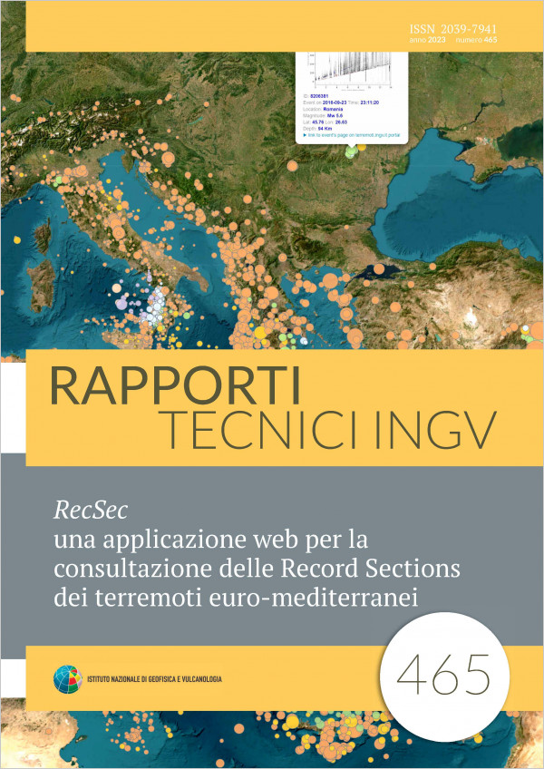
RecSec una applicazione web per la consultazione delle Record Sections dei terremoti euro-mediterranei
Vol. 465 (2023)
In this short note, we introduce a web application where the Record Sections, automatically created after a revised earthquake location, can be accessed. The Record Sections are graphical representations of the waveforms of seismic events in Distance-Time diagrams. They are created for each event occurring in the Euro-Mediterranean area with a magnitude greater than 2.8 and for which a definitive location is computed by the INGV surveillance service. The analysed stations belong to many European seismic networks whose waveforms are distributed through EIDA [European Integrated Data Archive, http://www.orfeus-eu.org/data/eida/]. The IT tool we have realized, described in this note, is a useful multipurpose instrument: it can be fruitfully employed both for research purposes, for a rapid quality control of seismic stations and also for education.
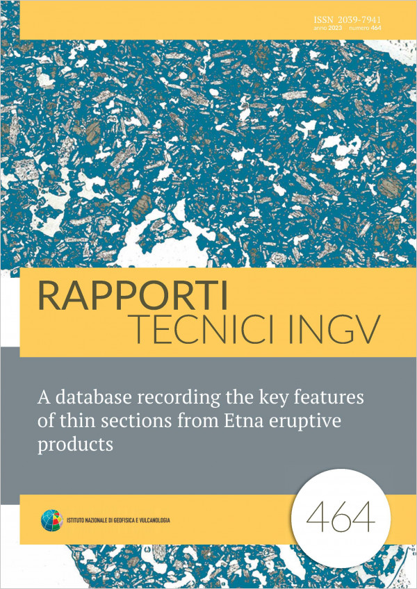
A database recording the key features of thin sections from Etna eruptive products
Vol. 464 (2023)
The Istituto Nazionale di Geofisica e Vulcanologia Osservatorio Etneo (INGV OE) hosts a collection of thin sections – thin slices of rock made for petrographic observation and chemical characterization under the microscope. Thin sections are from eruptive products of Etna, collected over the last 30 years for monitoring purposes. This collection is a resource that can be utilized by the INGV staff to support volcano monitoring as well as by researchers for investigating petrological processes and contributing to the understanding of the genesis of recent Etna magmas.
To facilitate and encourage these activities we created a database, in the form of a Microsoft Excel™ spreadsheet with defined fields, designed to describe the key petrographic properties of samples cut into thin sections, in a consistent way. The freely available database, which includes linked images of the thin sections, allows researchers interested in studying Etna volcanism to gain an overview of the main petrographic features of the rocks, which can help them to select the most appropriate samples for their research project(s). The information included in the database can also be utilized for monitoring purposes via comparison with samples from ongoing eruptive events. The database currently contains the description of 33 thin sections from the 20072008 eruptions of Etna, with the remaining thin sections in the INGV OE collection to be added in future. This work has been designed to be incorporated, in the future, into the TSDSystem (Time Series Database), a resource developed over many years by the INGV OE Information Technology (IT) staff, the purpose of which is to archive, update and distribute data from INGV OE monitoring activities. It is hoped that this resource, once available for the scientific community, will both inspire and facilitate research projects involving Etna eruption products, making full use of this extensive but otherwise scarcely studied sample collection, with the ultimate aim of improving understanding of volcanic activity at Etna.
To facilitate and encourage these activities we created a database, in the form of a Microsoft Excel™ spreadsheet with defined fields, designed to describe the key petrographic properties of samples cut into thin sections, in a consistent way. The freely available database, which includes linked images of the thin sections, allows researchers interested in studying Etna volcanism to gain an overview of the main petrographic features of the rocks, which can help them to select the most appropriate samples for their research project(s). The information included in the database can also be utilized for monitoring purposes via comparison with samples from ongoing eruptive events. The database currently contains the description of 33 thin sections from the 20072008 eruptions of Etna, with the remaining thin sections in the INGV OE collection to be added in future. This work has been designed to be incorporated, in the future, into the TSDSystem (Time Series Database), a resource developed over many years by the INGV OE Information Technology (IT) staff, the purpose of which is to archive, update and distribute data from INGV OE monitoring activities. It is hoped that this resource, once available for the scientific community, will both inspire and facilitate research projects involving Etna eruption products, making full use of this extensive but otherwise scarcely studied sample collection, with the ultimate aim of improving understanding of volcanic activity at Etna.
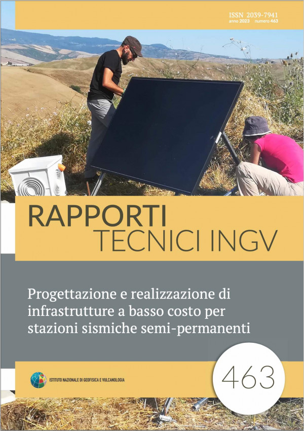
Progettazione e realizzazione di infrastrutture a basso costo per stazioni sismiche semi-permanenti
Vol. 463 (2023)
This report describes the state of the art of the installation techniques for seismic stations developed by the Seismology Group and the Seismology Laboratory at the INGV branch in Pisa, with examples of applications taken from long‐duration field experiments carried out in different areas of Tuscany, such as Monte Amiata and the Mugello basin.
Our goal was to develop a low‐cost infrastructure, portable and easily adaptable to different terrains, suitable for hosting a variety of real‐time seismic stations.
In addition to improving the structural resistance of the deployment, we also developed applications for the remote monitoring of the state of health of the seismic stations, which allowed a more efficient maintenance of the instrumentation.
The proposed type of installation has proved to be sufficiently robust and suitable for installations with a temporal duration of a few years, and in agreement with the expected targets, as proved by the analyses carried out during and at the end of the experiments in which they were used.
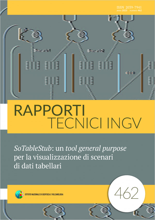
SoTableStub: un tool general purpose per la visualizzazione di scenari di dati tabellari
Vol. 462 (2023)
In the routine activities of research and monitoring within the Istituto Nazionale di Geofisica e Vulcanologia (INGV-OE) different actors manifest, over time and for several purposes, the need to analyse particular subsets of data contained in various databases. Often, in fact, before using sophisticated analysis tools, a mere cross-visualization of the data offers a first and concrete help in the analysis of the same. For example, new queries are constantly being designed to aggregate and provide informations relating to groups of instruments of the monitoring networks or relating to particular time series of interest or even to list services belonging to control room systems. Once created, the aggregation queries are then integrated into existing tools (web pages, client/server applications), or sometimes new tools are designed and implemented from scratch to explore the requested data (which may vary over time). These activities, which are certainly difficult (or even prohibitive) to carry out for a “layman”, impact the normal activity of the IT staff who is called to design queries and create new data visualization tools or continuously integrate the existing ones.
The SoTableStub application was created to meet this need, allowing even less experienced users to independently create display panels (called “scenarios”) that can be customized both in terms of content and style, in order to show data coming from different sources and available in tabular format. One of its strengths is that it was designed for the web and then users need only a web browser to run the application and visualize data.
The SoTableStub application was created to meet this need, allowing even less experienced users to independently create display panels (called “scenarios”) that can be customized both in terms of content and style, in order to show data coming from different sources and available in tabular format. One of its strengths is that it was designed for the web and then users need only a web browser to run the application and visualize data.
Analisi della pericolosità di frana dei versanti interni del Lago Albano
Vol. 461 (2023)
Lake Albano has a volcanic origin. It is located in the Quaternary volcanic district of the Colli Albani (Albani Hills) at approximately 20 Km from the metropolitan center of Rome. The volcanic edifice hosting the lake is characterized by gently inclined outer flanks and steep slopes in correspondence with the internal walls of the crater. Here is where much evidence is found of slope failures producing landslides.
The presence of numerous dwellings and of recreational activities along the internal slopes of the crater, and in particular along the edge and the lake coastline, make the area of potentially high risk, not only because of the inner intense slope instability, but also because of possible secondary effects due to tsunamis waves that might be generated by the impact of sliding subaerial masses on the lake surface or by sub‐aqueous landslides.
Aim of this work is evaluating landslide hazards in the study area of Lake Albano by means of techniques based on Ordinary Least Squares, OLS, and of the Empirical Likelihood Ratio, ELR, used as a modeling function.
The model proposed made it possible to analyze the spatial relationships between landslides and the themes supporting the analysis, measuring and evaluating the relationship between each specific type of landslide and each supporting digital map. The model could also benefit from the addition of new information to support the analysis such as new information levels and more detailed data that should certainly improve the results obtained.
Misura della potenza elettrica assorbita da diverse stazioni sismiche
Vol. 460 (2023)
The use of seismic recorders in a monitoring network requires a knowledge of certain characterizing parameters that indicate the performance and consequent reliability of the value measurements provided for various fields of experimental seismology. These parameters are normally indicated in the datasheets drafted by the manufacturers, which are used for reference when choosing a recorder to meet the requirements of each specific application, from both the technical and financial perspectives. Among the parameters of most interest to seismic stations is electrical power absorption. Knowledge of this parameter facilitates appropriate sizing of the photovoltaic panel-based power system in order to ensure continuous operation of remote seismic stations regardless of weather conditions.
The present work involved measuring the electrical power absorption under different recorder operating conditions to verify both the accuracy of the values reported in the datasheets, and to compare the different devices being used at our Institute. Correlation of the results with the experimental setups under which the seismic data loggers operated also made it possible to optimize the software settings for a prototype recorder under development by our team, in order to regulate certain functional blocks with the aim of minimizing power consumption.
The present work involved measuring the electrical power absorption under different recorder operating conditions to verify both the accuracy of the values reported in the datasheets, and to compare the different devices being used at our Institute. Correlation of the results with the experimental setups under which the seismic data loggers operated also made it possible to optimize the software settings for a prototype recorder under development by our team, in order to regulate certain functional blocks with the aim of minimizing power consumption.
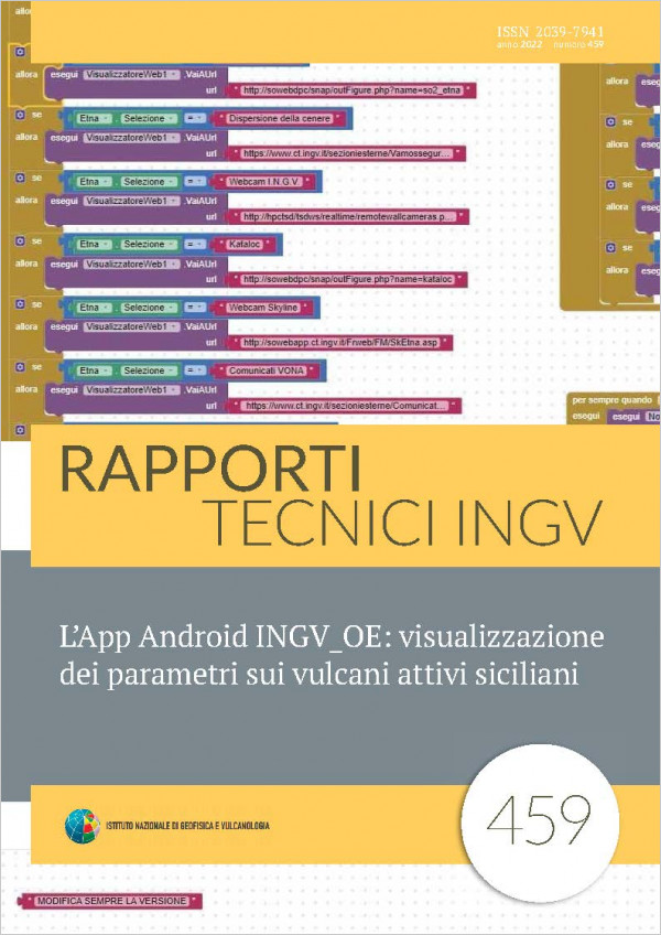
L’App Android INGVOE: visualizzazione dei parametri sui vulcani attivi siciliani
Vol. 459 (2022)
For the needs of a response in a short time on the conditions of the Sicilian volcanoes in terms of Civil Protection and being the subject of a specific activity of the INGV of Catania - Osservatorio Etneo (INGV-OE), the need was felt to develop an application for Android.
It allows you to quickly and conveniently view the main volcanological parameters available on the various pages of the INGV-OE website, the Osservatorio Nazionale Terremoti (INGV-ONT) and other sites.
In this way, as much useful information as possible is available with a simple click, both for an initial assessment of the state of a Sicilian volcano being studied and monitored by the INGV-OE and for possible evolution of the volcano itself.
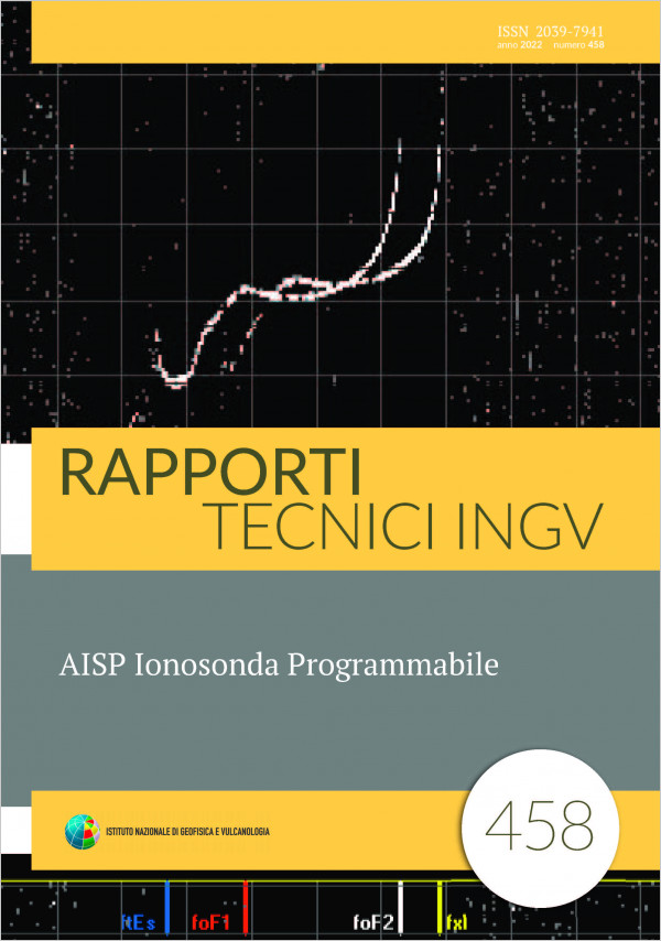
AISP Ionosonda Programmabile
Vol. 458 (2022)
The project is aimed to develop a prototype of pulse compression ionosonde for vertical surveys (coded pulse radar) that, based on SDR (Software Defined Radio) devices, makes it possible to realize a programmable instrument that is therefore versatile and innovative compared to classical ionosondes. The programmable ionosonde (AISP) is an evolution of the AIS (Advanced Ionospheric Sounder) ionosonde completely designed and built at INGV and still functioning at the ionospheric observatory in Rome. The AISP ionosonde is an ionosonde for vertical soundings consisting of an SDR device that acts as a transmitter and receiver of the Radio Frequency (RF) signals and generator of all the control signals of the devices necessary for the operation of the ionosonde as the radio frequency (RF) power amplifier and the antenna. The SDR device transmits and receives the RF signals generated numerically by a Personal Computer (PC) connected through the Ethernet port to the SDR device, allowing a wide choice of configurations and a great versatility to this ionosonde. Vertical surveys to map the ionosphere in a specific region for the verification of theoretical models of the global ionosphere and to study the possibility of using the local variations of the Total Electronic Content (TEC) as possible precursors of earthquakes.