
Rilievi geofisici nel Lago di Scanno
Vol. 116 (2014)
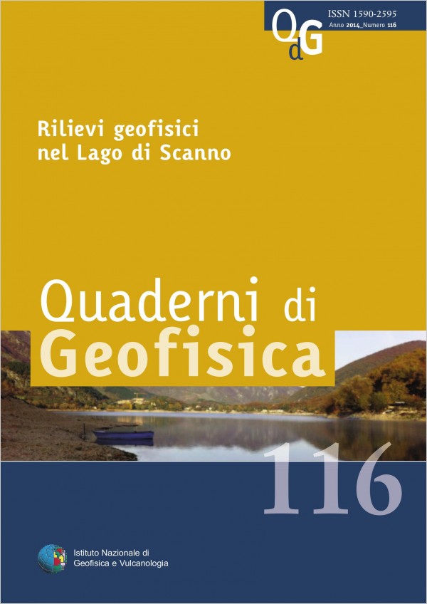
Nel corso dell’autunno del 2012 il personale della Sezione di Geomagnetismo, Aeronomia e Geofisica Ambientale dell’Istituto Nazionale di Geofisica e Vulcanologia (INGV) ha effettuato un rilievo geofisico multiparametrico nel Lago di Scanno, un piccolo bacino idrico di sbarramento nei comuni di Villalago e Scanno, in Abruzzo. Il lago di Scanno è stato oggetto infatti di notevole interesse da parte dei media locali e nazionali (Il Messaggero, Il Tempo, Il Centro, TG1 RAI, RAINews24, Virgilio.it, rete5.tv, ecc.) a causa del diffondersi di notizie in merito ad alcuni ‘strani fenomeni’ osservati da frequentatori del luogo. In particolare, sono state riportate notevoli ed inspiegabili variazioni del livello d’acqua del lago con conseguente moria di pesci, anomalie nel comportamento di bussole magnetiche indossate da subacquei durante le loro immersioni in alcuni punti del lago e, ancora, insolite e strane presenze di oggetti non ben identificati accompagnate da misteriosi bagliori di luce.
A causa del perdurare di queste affermazioni, le autorità del luogo hanno chiesto una collaborazione all’INGV per verificare la presenza o meno di fenomeni scientifici degni di considerazione e meritevoli di attenzione. Per rispondere a tale richiesta, l’Unità ‘Geofisica e Tecnologie Marine’ della sede distaccata di Porto Venere (SP) ed il Laboratorio di Geofisica Ambientale di Roma hanno organizzato una campagna di indagini geofisiche mirata alla completa caratterizzazione ambientale del lago. Sono stati eseguiti pertanto una serie di rilievi geofisici impiegando l’imbarcazione dell’INGV denominata ‘BigOne’. In particolare è stato eseguito un rilievo batimetrico con multibeam, un rilievo sismico con sub bottom profiler, un rilievo morfologico con side scan sonar e un rilievo magnetico con un magnetogradiometro marino. A causa della grande estensione dello specchio lacustre, il survey geofisico è stato pianificato e condotto nella porzione Nord del lago, concentrando quindi il lavoro nella zona interessata dalle segnalazioni della presenza di anomalie del campo magnetico, manifestatesi, secondo i racconti, come variazioni improvvise del comportamento di bussole da immersione.
A causa del perdurare di queste affermazioni, le autorità del luogo hanno chiesto una collaborazione all’INGV per verificare la presenza o meno di fenomeni scientifici degni di considerazione e meritevoli di attenzione. Per rispondere a tale richiesta, l’Unità ‘Geofisica e Tecnologie Marine’ della sede distaccata di Porto Venere (SP) ed il Laboratorio di Geofisica Ambientale di Roma hanno organizzato una campagna di indagini geofisiche mirata alla completa caratterizzazione ambientale del lago. Sono stati eseguiti pertanto una serie di rilievi geofisici impiegando l’imbarcazione dell’INGV denominata ‘BigOne’. In particolare è stato eseguito un rilievo batimetrico con multibeam, un rilievo sismico con sub bottom profiler, un rilievo morfologico con side scan sonar e un rilievo magnetico con un magnetogradiometro marino. A causa della grande estensione dello specchio lacustre, il survey geofisico è stato pianificato e condotto nella porzione Nord del lago, concentrando quindi il lavoro nella zona interessata dalle segnalazioni della presenza di anomalie del campo magnetico, manifestatesi, secondo i racconti, come variazioni improvvise del comportamento di bussole da immersione.

Bollettino Sismico Italiano 2010
Vol. 115 (2013)
Il Bollettino Sismico Italiano (BSI) dell’Istituto Nazionale di Geofisica e Vulcanologia (INGV) è il risultato dell’analisi sistematica dei segnali sismici eseguita dagli analisti sismologi del Centro Nazionale Terremoti (CNT). Le localizzazioni del BSI vengono pubblicate in due distinti siti web: il primo, con indirizzo http://bollettinosismico.rm.ingv.it/ mette a disposizione degli utenti i dati (dal 1-1-2002 al 30-4-2012) in forma di file ASCII contenenti la lista delle localizzazioni con i parametri ipocentrali e i dati di fase in formato GSE 2.0. Le stesse localizzazioni sono contemporaneamente pubblicate

La valorizzazione delle collezioni storiche di interesse scientifico: l’esempio delle medaglie di lava dell’Osservatorio Vesuviano
Vol. 114 (2013)
In this paper the Osservatorio Vesuviano collection of lava medals is presented and described as a whole, along with the information regarding each component item, making available this cultural heritage also to a non-specialists public. Moreover, the recent history of Vesuvius has been analyzed in order to find any possible element of correlation between the eruptive activity of the volcano and the production of lava medals. The collection, kept in the oldest volcano observatory in the world, is part of a much wider and very rich cultural estate of great scientific, artistic and historical interest. The collection, which has never been exposed due to lack of information on the component items, represents an important account of the life around the volcano and an invaluable record of a three-centuries long history of Vesuvius activity. It is also an almost unique collection, as the only other similar one is presently exposed at the Mineralogical Museum of the Federico II University of Naples. The uniqueness of this collection was already understood by early collectors, which mainly grouped the samples that celebrated historical, cultural and artistic events of that time. However the production of medals has been always strongly conditioned by the availability of fluid flows of lava, which can be easily sampled and moulded but not continuously produced by the volcano. A new systematic organization and classification of the medals is presented in this paper allowing the description of many aspects of the history of Vesuvius and its volcanological observatory, and the timing of many events that characterized the life of the Parthenopaean interland.
Le ceneri distali dell’eruzione del Vesuvio del marzo 1944 raccolte a Devoli (Albania)
Vol. 113 (2013)
Bout 70 years since the last eruption of Vesuvius in March 1944, the authors received a sample of volcanic ash collected on the night between 22 and 23 March 1944 at Devoli (Albania), by Prof. Antonio Lazzari engaged in oil prospecting at the Shipyard AIPA. This ash sample, "jealously" guarded by Prof. Ludovico Brancaccio, has delivered to the authors for further studies on the event, during the collection of witness on the Vesuvius 1944 eruption, published in a book edited by the Vesuvius Observatory -INGV in 2010 by Elena Cubellis and Aldo Marturano. The volcanic ash, collected in Albania, has been attributed to the most violent phase of the eruption (the eruption began on March 18 and was declared ended April 7), defined by the then Director of the Vesuvius Observatory Giuseppe Imbò, explosionsmixed phase, which began at about 12 on March 22 and continue for approximately 24 hours. Due to the scarcity of proximal deposits, the description of Imbò remains the main track for the study of this phase of the eruption. Therefore, the sample of volcanic ash analyzed in this study, is of particular importance being the distal facies examined. The ash was subjected to laboratory analysis and geochemical and textural results, when compared with the available data on other phases of the eruption, have allowed us to formulate a hypothesis about the mechanisms causing a sudden increase in the degree of explosiveness. In particular, the obtained data showed a rapid increase in the height of the eruption column, which reached, probably, an altitude higher (~ 10 km) than that reported by contemporary sources. These results have important implications for volcanic hazard; in fact, if such a scenario would to occur in the future, the effects on the territory which today is highly urbanized, could be critical.
Scientific review on the Complex Eikonal, and research perspectives for the Ionospheric Ray-tracing and Absorption
Vol. 112 (2013)
Scientific review on the Complex Eikonal, and research perspectives for the Ionospheric Ray-tracing and Absorption he present paper conducts a scientific review on the complex eikonal, extrapolating the research perspectives on the ionospheric ray-tracing and absorption. As regards the scientific review, the eikonal equation is expressed, and some complex-valued solutions are defined corresponding to complex rays and caustics. Moreover, the geometrical optics is compared to the beam tracing method, introducing the limit of the quasi-isotropic and paraxial complex optics approximations. Finally, the quasi-optical beam tracing is defined as the complex eikonal method applied to ray-tracing, discussing the beam propagation in a cold magnetized plasma. As regards the research perspectives, this paper proposes to address the following scientific problem: in absence of electromagnetic (e.m.) sources, consider a material medium which is time invariant, linear, optically isotropic, generally dispersive in frequency and inhomogeneous in space, with the additional condition that the refractive index is assumed varying even strongly in space. The paper continues the topics discussed by Bianchi et al. [2009], proposing a novelty with respect to the other referenced bibliography: indeed, the Joule’s effect is assumed non negligible, so the medium is dissipative, and its electrical conductivity is not identically zero. In mathematical terms, the refractive index belongs to the field of complex numbers. The dissipation plays a significant role, and even the eikonal function belongs to the complex numbers field. Under these conditions, for the first time to the best of our knowledge, suitable generalized complex eikonal and transport equations are derived, never discussed in literature. Moreover, in order to solve the ionospheric ray-tracing and absorption problems, we hint a perspective viewpoint. The complex eikonal equations are derived assuming the medium as optically isotropic. However, in agreement with the quasi isotropic approximation of geometrical optics, these equations can be referred to the Appleton-Hartree’s refractive index for an ionospheric magneto-plasma, which becomes only weakly anisotropic in the presence of Earth’s magnetic induction field. Finally, a simple formula is deduced for a simplified problem. Consider a flat layering ionospheric medium, so without any horizontal gradient. The paper proposes a new formula, useful to calculate the amplitude absorption due to the ionospheric D-layer, which can be approximately modelled by a linearized complex refractive index, because covering a short range of heights, between h1= 50 km and h2= 80 km about.
Uesto articolo presenta una rassegna scientifica sull’iconale complessa, estrapolando prospettive di ricerca sul ray-tracing e
l’assorbimento in ionosfera. Per quanto riguarda la rassegna scientifica, viene presentata l’equazione dell’iconale e vengono proposte alcune soluzioni a valori complessi corrispondenti ai raggi complessi ed alle caustiche complesse. Inoltre, la geometria ottica viene
confrontata con il metodo del beam-tracing, introducendo il limte delle approssimazioni di ottica quasi-isotropica e parassiale complessa. Infine, viene definito il beam tracing quasi-ottico come il metodo dell’iconale complessa applicato al ray-tracing, discutendo la propagazione di un fascio in un plasma freddo magnetizzato. Per quanto riguarda le prospettive di ricerca, questo articolo si propone di affrontare il seguente problema scientifico: in assenza di sorgenti elettromagnetiche (e.m.), si consideri un mezzo materiale che sia invariante nel tempo, lineare, otticamente isotropo, generalmente dispersivo in frequenza e disomogeneo nello spazio, con la condizione aggiuntiva che l’indice di rifrazione vari anche fortemente nello spazio. L’articolo prosegue gli argomenti discussi da Bianchi et al. [2009], proponendo una novità rispetto al resto della bibliografia citata: infatti, si assume che l’effetto Joule non sia trascurabile, cosicchè il mezzo sia dissipativo, e la sua conducibilità elettrica non sia nulla. In termini matematici, l’indice di rifrazione appartiene al campo dei numeri complessi. La dissipazione gioca un ruolo importante, ed anche la funzione dell’iconale appartiene al campo dei numeri complessi. Sotto queste condizioni, per la prima volta secondo nostra conoscenza, vengono derivate opportune equazioni generalizzate per l’iconale complessa e di trasporto, mai discusse in letteratura. Inoltre, al fine di risolvere I problemi del ray-tracing e dell’assorbimento in ionosfera, suggeriamo un punto di vista prospettico per cui, anche se le equazioni dell’iconale complessa vengono derivate assumendo il mezzo come otticamente isotropo, comunque, secondo l’approsimazione quasi-isotropica dell’ottica geometrica, queste equazioni possono essere riferite all’indice di rifrazione di Appleton-Hartree per un magneto-plasma ionosferico, qualora divenga solo debolmente anisotropo in presenza del campo di induzione magnetico della Terra. Infine, viene dedotta una formula semplice per un problema semplificato. Si consideri un mezzo ionosferico a stratificazione piana, quindi senza gradienti orizzontali. L’articolo propone una nuova formula, utile per calcolare l’assorbimento in ampiezza dovuto allo strato D ionosferico che può essere approssimativamente modellato con un indice di
rifrazione complesso linearizzato, in quanto copre un breve intervallo di altezze, tra h1= 50 km e h2= 80 km circa.
Noise measurements at seismic array in the drilling site of Bagnolifutura, Campi Flegrei
Vol. 111 (2013)
Noise measurements at seismic array in the drilling site of Bagnolifutura, Campi Flegrei n 2012 two seismic surveys were carried out in the area of Bagnolifutura (Campi Flegrei, Naples), with the aim of characterizing the properties of the seismic noise during the drilling activity performed in the framework of the Campi Flegrei Deep Drilling Project (CFDDP; https://sites.google.com/site/cfddpproject/). During the first survey, which was conducted from 2 to 4 April, before the drilling, seven broadband threecomponent seismometers were installed in two different array configurations. The second survey started on November 26, in concomitance with the drilling operations and fluid injection, and ended on December 5, four days after the end of the drilling, when the maximum depth of 502 m was reached. During this period seven broadband and one short-period three-component sensors were installed. A preliminary spectral analysis was performed on samples of seismic noise; moreover the root mean square of the amplitude of the signals and the polarization parameters were calculated. The preliminary results show similar spectral and polarization features for the data of the two surveys, whereas the amplitude of the seismic noise collected during the second survey is greatly influenced by the bad meteorological conditions. As future development experimental site transfer functions from Nakamura’s technique and surface wave dispersion from array techniques will be calculated to obtain the shallow crustal structure. The results corresponding to the different phases of the drilling activity will be compared, with the aim of establishing if significant variations of the medium properties have occurred during the experiment. Moreover the recorded signals will be deeply investigated in order to detect the eventual occurrence of microseismicity induced by fluid injection and to define its features.
El corso del 2012 sono state realizzate due campagne di acquisizione dati nell’area di Bagnolifutura (Campi Flegrei, Napoli), con lo scopo di caratterizzare le proprietà del rumore sismico durante l’attività di perforazione avvenuta nell’ambito del progetto Campi Flegrei Deep Drilling Project (CFDDP; https://sites.google.com/site/cfddpproject/). Durante la prima campagna, condotta dal 2 al 4 aprile, prima della perforazione, sono stati installati sette sismometri a larga banda a tre componenti, in due diverse configurazioni di array. La seconda campagna è iniziata il 26 novembre, in concomitanza con le operazioni di perforazione e l’iniezione di fluidi, e si è conclusa il 5 dicembre, quattro giorni dopo la fine della perforazione che ha raggiunto la massima profondità di 502 m. In questo periodo sono stati installati sette sensori a larga banda ed uno a corto periodo, tutti a tre componenti. È stata effettuata un’analisi spettrale preliminare sui campioni di rumore sismico; inoltre sono stati calcolati lo scarto quadratico medio dell’ampiezza del segnale e I parametri di polarizzazione. I risultati preliminari mostrano, per I dati registrati durante le due campagne, caratteristiche spettrali e di polarizzazione simili, mentre l’ampiezza del rumore sismico registrato durante la seconda campagna appare fortemente influenzata dalle cattive condizioni meteorologiche. Come sviluppo futuro, saranno calcolate le funzioni di trasferimento del sito mediante il metodo di Nakamura, e la dispersione delle onde superficiali attraverso le tecniche di array, con lo scopo di ottenere la struttura crostale superficiale. I risultati corrispondenti alle diverse fasi dell’attività di perforazione saranno confrontati con lo scopo di verificare se sono avvenute variazioni significative delle proprietà del mezzo nel corso dell’esperimento. Inoltre I segnali registrati saranno attentamente esaminati per rilevare l’eventuale presenza di microsismicità indotta dall’iniezione di fluidi, e per definirne le caratteristiche.
El corso del 2012 sono state realizzate due campagne di acquisizione dati nell’area di Bagnolifutura (Campi Flegrei, Napoli), con lo scopo di caratterizzare le proprietà del rumore sismico durante l’attività di perforazione avvenuta nell’ambito del progetto Campi Flegrei Deep Drilling Project (CFDDP; https://sites.google.com/site/cfddpproject/). Durante la prima campagna, condotta dal 2 al 4 aprile, prima della perforazione, sono stati installati sette sismometri a larga banda a tre componenti, in due diverse configurazioni di array. La seconda campagna è iniziata il 26 novembre, in concomitanza con le operazioni di perforazione e l’iniezione di fluidi, e si è conclusa il 5 dicembre, quattro giorni dopo la fine della perforazione che ha raggiunto la massima profondità di 502 m. In questo periodo sono stati installati sette sensori a larga banda ed uno a corto periodo, tutti a tre componenti. È stata effettuata un’analisi spettrale preliminare sui campioni di rumore sismico; inoltre sono stati calcolati lo scarto quadratico medio dell’ampiezza del segnale e I parametri di polarizzazione. I risultati preliminari mostrano, per I dati registrati durante le due campagne, caratteristiche spettrali e di polarizzazione simili, mentre l’ampiezza del rumore sismico registrato durante la seconda campagna appare fortemente influenzata dalle cattive condizioni meteorologiche. Come sviluppo futuro, saranno calcolate le funzioni di trasferimento del sito mediante il metodo di Nakamura, e la dispersione delle onde superficiali attraverso le tecniche di array, con lo scopo di ottenere la struttura crostale superficiale. I risultati corrispondenti alle diverse fasi dell’attività di perforazione saranno confrontati con lo scopo di verificare se sono avvenute variazioni significative delle proprietà del mezzo nel corso dell’esperimento. Inoltre I segnali registrati saranno attentamente esaminati per rilevare l’eventuale presenza di microsismicità indotta dall’iniezione di fluidi, e per definirne le caratteristiche.

Terremoto in Emilia Romagna: le attività del Pronto Intervento Sismico durante il primo mese di emergenza. Modalità e tempistica
Vol. 110 (2013)
On May 20th 2012 (Sunday) an earthquake (ML 5.9) hit Northern Italy at 02:03 UTC,. The National Seismic Network [Amato and Mele, 2008; Delladio, 2011] of the Istituto Nazionale di Geofisica e Vulcanologia (INGV) located the hypocenter below the Po Valley in the Emilia region (44.89° N, 11.23° E, 6.3 km depth). Just after the mainshock, the INGV structure of rapid response for seismic emergency has been activated in order to install a temporary seismic network as a complementary of existing permanent network in the epicentral area. The INGV installed 44 temporary stations, ten of these transmitting in real time to seismic monitoring room in Rome. Further 38 temporary seismic stations (16 provided by National Civil Protection Department - DPC, 8 provided by the National Institute of Oceanography and Experimental Geophysics - OGS and 14 provided by French colleagues) have been installed in the epicentral area. The final configuration was obtained by coordination among INGV and other agencies. The Centro Operativo Emergenza Sismica (COES) [Moretti et al., 2010a] was activated relatively late, on June 8th 2012, because the INGV branch in Bologna located close to the epicentral area, was in the early days fulfilling the COES tasks. The COES ensured continuous and direct communication with the DPC officers present in the epicentral area. At the same time, the structure has been proposed as logistic support to all the INGV colleagues engaged in activities in the epicentral area (mobile seismic networks, EMERSITO, GPS, EMERGEO, QUEST) and to the service dedicated to the education and information promoted in favor of affected populations, civil defense operators as well as rescue volunteers. In this paper we will describe the activities carried out during the first month of emergency, the method and timing of the intervention, and finally the structures involved.
Caratterizzazione del rumore magnetico di fondo nel nuovo osservatorio di Varese Ligure
Vol. 109 (2013)
The accuracy of geomagnetic field measurement at a given point on the Earth's surface is limited by the ambient magnetic noise level which is usually determined by the superposition of signals generated from different sources. The noise that dominates in all physical systems, particularly in spectral regions at lowest frequencies is the flicker noise [Vladimirov and Kleimenova 1962]. The analysis of the background noise that exists on the site is essential to design a new magnetic Observatory. Noise measurements allow then to evaluate the magnetic pollution status of the area and constitute a basic cognitive tool for the building of a new magnetic Observatory. Only by comparing signals of natural origin and the noise is possible to characterize the site. The purpose of this note is the separation of local and regional magnetic noise from signals of external origin. In the near field zone gradients are very high, the contribution of these sources depends much on the source-observer distance. The noise level at a given point is determined not only by the intensity and the distance from sources but also on the electromagnetic characteristics of the site where the measurement is performed, i.e. on the electrical conductivity structure of the subsoil, which determines the electromagnetic Earth-source coupling. From a single measurement point it is difficult to separate the signal from the noise even in the near field zone. However since the two signals have some peculiar properties which affect the field boundary conditions on the Earth's surface you can take advantage of these features to separate them. In the near field, magnetic natural signals coming from magnetosphere and ionosphere are always curl-free and divergence-free while artificial signals are almost always divergent and curled. In the far field instead both signals are curl-free and divergence-free. Another aspect concerns the spectral properties of signal and noise that both have a trend Cf -α where C is a constant of proportionality, f is the frequency and the coefficient is different for the two types of signals [Vladimirov and Kleimenova, 1962]. In geomagnetism there are three frequency bands of interest useful to evaluate the noise: the first is the spectral range that extends from nHz to μHz, the second is that from μHz to mHz and the third band is the one that coincides with the range of magnetic pulsations [Jacobs, 1970], [Troitskaya, 1964] originated from magnetospheric and ionospheric sources (1mHz-1Hz). In this note an analysis of stationary noise component only in the third band of frequencies has been made.
Pianificazione e preparazione dell’emergenza. L’esercitazione a Santa Sofia (FC) del 26/30 settembre 2011: un esempio di gestione di una crisi sismica
Vol. 108 (2013)
At the end of September 2011 a simulation test of rapid-response to a seismic emergency was conducted in the frame of the current agreement between the Istituto Nazionale di Geofisica e Vulcanologia (INGV) and the Civil Protection Agency of the Emilia Romagna, with the objective of evaluating the level of preparedness reached in the emergency procedures established by INGV and the regional Civil protection Agency for a major earthquake. The simulation involved more than 50 researchers and technicians working in the offices and in the field in the pretended epicentral area. The INGV staff involved belongs to different INGV offices (Ancona, Arezzo, Bologna, Irpinia, Milan, Pisa and Rome). The preparation of the test event was based on the past experiences of real emergencies, primarily the long emergency in L’Aquila territory in 2009 [Margheriti et al., 2010; 2011; Moretti et al., 2011c], with a look to the new instances from INGV researchers and from outside (for example, instances of the Civil Protection). Despite the unexpected and the inevitable mistakes and the challenging efforts of putting together many different competences, with the need of satisfying the commitments made with the Civil Protection Agency of the Region of Emilia Romagna, it was immediately clear that the experience would improve our skills both from a professional and a human point of view. It was an important opportunity to interact and engage activities with colleagues to learn new things. This experience was then of paramount importance in the management of the seismic emergency in May 2012 in the Po Valley [Moretti et al., 2012].
Monitoraggio del Vesuvio con antenne sismiche: primi risultati dell’array VAS
Vol. 107 (2013)
A seismic array named VAS (Vesuvius Array South) has been installed at the beginning of 2012 on the south flank of Mt. Vesuvius to improve the seismic monitoring of the volcano. It is composed of 10 short period seismometers connected by cable to the acquisition system. One three-component and nine vertical components are acquired by two six-channel data loggers. Data acquisition is continuous, on local memory, 100 samples per second, with 24 bit dynamic range.
Data are periodically collected, converted and analyzed by applying four different array methods in several frequency bands in the range 1 Hz – 5 Hz. Array methods furnish propagation direction and apparent velocity of coherent signals, giving an important contribution to the identification of seismic events that could be related to the volcanic activity. Preliminary results of array analysis show that the array VAS has an optimal resolution in the 2 Hz – 5 Hz frequency range. Higher frequency signals may have a poor coherence due to the short wavelength, while at frequency lower than 2 Hz, the coherence of seismic noise may be comparable to the signal of interest, thus preventing the identification of natural events potentially related to changes in the dynamic of the volcano.
Data are periodically collected, converted and analyzed by applying four different array methods in several frequency bands in the range 1 Hz – 5 Hz. Array methods furnish propagation direction and apparent velocity of coherent signals, giving an important contribution to the identification of seismic events that could be related to the volcanic activity. Preliminary results of array analysis show that the array VAS has an optimal resolution in the 2 Hz – 5 Hz frequency range. Higher frequency signals may have a poor coherence due to the short wavelength, while at frequency lower than 2 Hz, the coherence of seismic noise may be comparable to the signal of interest, thus preventing the identification of natural events potentially related to changes in the dynamic of the volcano.

Esperienze di monitoraggio integrato: il caso della Rete Sismometrica dell’Italia centro orientale e dei suoi servizi
Vol. 106 (2013)
This paper describes the results of a joint venture undertaken by the Istituto Nazionale di Geofisica e Vulcanologia (INGV) and the regional government of the Marches for the improvement of earthquake monitoring in the regional territory. Besides adding many new monitoring stations to the original network, strong motion stations have been installed resorting – in order to keep down the costs of the operation - to selecting cheap but effective devices and using the existing regional wireless radio infrastructure. The data recorded by the apparatus operating within the region and in its immediate vicinity, together with a regular practice of data swapping that has been established between the Ancona branch of INGV and the INGV headquarters in Rome, allowed to achieve a dual aim: improving knowledge on the regional seismicity and supplying the Marches regional Department of Civil Protection with an efficient information service especially tailored to its particular requirements.
The March 11th, 2011, M 9.0 earthquake offshore Honshu island (Japan): a synthesis of the Tohoku-Oki INGV Team research activities
Vol. 105 (2013)
On March 11th, 2011 (at 05:46:23 UTC) a megaearthquake (M 9.0) occurred near the NE coast of Honshu island (Japan), originated near the subduction plate boundary between the Pacific and the North America plates. The epicenter has been located at about 130 km East of Sendai city, at a depth of about 32 km. This seismic event has been followed by a devastating tsunami. The location, the geometric parameters, the focal mechanism, are in agreement with the occurrence of the earthquake along the subduction plate boundary. The initial seismological analysis indicated that a surface of about 300 km x 150 km over the fault moved upwards of 30-40 m. The Tohoku-Oki INGV Team has made available a wide and multisciplinary expertise to investigate the different scientific issues concerning the earthquake. Indeed from Seismology to Geomorphology, from Remote Sensing to GPS, from Tsunami to Source Modeling the INGV Team has completed a wide range of analysis, obtaining relevant outcomes that are summarized in this work.
Studio di fattibilità per il monitoraggio delle deformazioni del fondo marino tramite GPS su una meda elastica (Golfo di Pozzuoli – Campi Flegrei)
Vol. 104 (2012)
The continuous measurement of ground deformations is an important contribution to the monitoring of volcanic areas. When the volcano is totally or partially submerged, the traditional geodetic methods cannot be applied and the measures of seafloor deformation are extremely difficult and expensive. This paper describes the installation of a continuous GPS station on an elastic beacon. The measurements were conducted in the Campi Flegrei Caldera (Gulf of Pozzuoli, Naples), whose vertical displacements are related to the bradyseismic phenomenon. Experimental observations show that it’s possible to monitor vertical displacement of seafloor with a resolution of a few centimeters, also taking into account for measurement errors (due to weather and sea conditions acting on the elastic beacon). This non expensive technique is relevant at Campi Flegrei area, because it extends the ground deformation monitoring at sea, contributing to a better modeling of the deformation field.
La variazione recente del campo di deformazione dell'area dei Campi Flegrei (Napoli) osservata con dati di Interferometria SAR
Vol. 103 (2012)
Geodetic monitoring of Campi Flegrei caldera, west of Naples, has been historically carried out through ground-based networks and integrated at the end of the nineties with space-borne InSAR techniques, exploiting the SAR sensors onboard the ERS1-2 and ENVISAT satellites from the European Space Agency (ESA).
Recently, besides the ESA satellites operating in the C-band, InSAR monitoring of Campi Flegrei area has been complemented also by high resolution SAR sensors, i.e. TerraSAR-X from the German Aerospace Center (DLR) operating in the X-band, in order to measure also small ground deformations, otherwise not detectable by C-band sensors.
Starting from April 2011, Campi Flegrei area underwent an uplift phase of more than 4 cm till now, strong enough to be detected also through ASAR-ENVISAT observations, in spite of the limitations due to the satellite orbital switch at the end of 2010.
In this paper the results of ASAR-ENVISAT data processing are presented for the period from January 2011 to February 2012, showing a ground deformation value comparable with the outcomes of other geodetic techniques.
La sequenza sismica del 2010 nelle province di Macerata e Fermo e la sperimentazione della trasmissione dei dati in tempo reale via UMTS
Vol. 102 (2012)
Following the three ML = 4.0 seismic events that struck the Fermano-Maceratese area (Central Italy) between January 10, 2010 and January 12, two real time temporary seismic stations of the INGV rapid response seismic network were deployed to improve detection and hypocentral locations.
This area has a peculiar seismicity confined in a fragile seismogenetic layer at a depth between 15 and 25 km that is worth studying.
The stations were connected to the INGV national network data acquisition center using UMTS routers. This solution has proved to be extremely fast and cost effective. Only one of the stations suffered from UMTS signal weakness, yet data gathered contributed to improve the real time hypocentral locations during the sequence.
The joint dataset composed by data from national, temporary and regional stations has been reprocessed producing higher quality data for the seismic studies in the area.

Ricercatori in aula: esperienze di divulgazione delle Scienze della Terra
Vol. 101 (2012)
Spreading Earth Science knowledge, specifically concerning earthquakes and volcanoes, is a way to trigger fundamental changes in attitude towards our Planet and Natural Hazards. The Milano-Pavia division of Istituto Nazionale di Geofisica e Vulcanologia (INGV) is working towards this end within the frame of Conosciamo la Terra, an International Year of Planet Earth (IYPE) project intended to address school kids and fill the gap between science and school worlds. The work was done in low hazard areas, where earthquakes and volcanoes do not belong to daily life and the topics
could be addressed chiefly involving the cognitive component of learning. Lectures were given directly in school so that students were easily lead by scientists in a journey towards knowledge.
We tested the procedure in 16 different schools, spanning the whole range of school education, and involved 42 classes for more than a thousand students; we highlighted that the interest towards Earth Science might not be directly linked to the level of hazard approached students live in. Low hazard areas also need, want and deserve efficient outreach. Thanks to the work done
here we could challenge communication skills of science towards society and promote a positive role of scientist in society as well as that of institution, like INGV, supporting a new public image of science and researchers.
Analisi qualitativa dei dati Intermagnet 2010 di L’Aquila
Vol. 100 (2012)
The purpose of an observatory is not only to provide data but also to ensure their validity and continuity in order that they could be used for scientific researches. In recent years there has been a growing interest towards geomagnetic data, especially for seismic precursors research. The continuity of data is necessary to be able to study physical phenomena on many time scales and their reliability is needed to be able to have an accurate representation of the phenomenon under investigation. Data affected by noise could mislead the researcher, showing anomalies that do not exist or hiding real effects. In this paper we want to show a simple qualitative analysis of data acquired at L’Aquila Observatory during 2010, highlighting criticalities observed in the acquisition system and describing the procedure used to identify and correct their cause . We believe that this approach will be useful not only for people involved in the elaboration of data from magnetic observatories, but also for the data final users.
Bollettino Sismico Italiano 2009
Vol. 99 (2012)
This paper describes the status of the Italian National Seismic Network and the Italian seismicity in year 2009. We outline the main seismic sequences that occurred during the year, with particular emphasis on the L’Aquila-Rieti seismic period. The INGV National Seismic Network recorded about 26000 earthquakes in Italy and neighboring areas during 2009, which were analyzed and localized by the seismology group of analysts involved in the publication of the Italian Seismic Bulletin (BSI). The minimum magnitude of completeness Mc of the BSI 2009 is ML 1.6 (ML 2.1 in the BSI 2008).
The number of active seismic stations during 2009 was 305 (279 in 2008).
We provide an estimate of the number and magnitude of anthropic events (quarry-blasts) included in the BSI 2009.
The number of active seismic stations during 2009 was 305 (279 in 2008).
We provide an estimate of the number and magnitude of anthropic events (quarry-blasts) included in the BSI 2009.

11 maggio 2011: il terremoto previsto e l’Open Day all’INGV
Vol. 98 (2012)
In 2010, Internet rumors started to circulate about a devastating earthquake allegedly forecast in Rome, on May 11, 2011, by Raffaele Bendandi, an Italian self-taught natural scientist (Faenza, 1893-1979). As the date approached, Roman residents, tourists and commuters started pelting INGV with anxious inquiries.
As May approached, the attention of the public and the media grew. INGV decided to organize at its headquarters in Rome an Open Day devoted to the public who wanted to have information and learn more about the Italian seismicity, the earthquake as natural phenomenon, and seismic hazard. The Open Day was preceded by a press conference, with the purpose to present the
initiative and open a scientific discussion with the journalists about earthquakes prediction and Italian seismic risk assessment.
About 30 journalists from newspapers, local and national TV’s, press agencies and web news attended the press conference and hundreds of articles appeared in the following days, advertising the May 11 Open Day.
The INGV opened to the public all day long with the following program: meetings with researchers to answer scientific questions; visiting the seismic monitoring room, staffed by seismologists 24h/7 all year; guided tours through interactive exhibitions on earthquakes and Earth’s magnetic field; conferences on different topics, from the social impact of rumors to seismic risk
reduction. During the day, 13 new videos have also been posted our YouTube/INGVterremoti channel to explain the earthquake process and hazard, and to provide periodic updates on seismicity in Italy from seismic monitoring room.
On May 11 the INGV headquarters was peacefully invaded by over 3,000 visitors from 10 am to 9 pm: families, students with and without teachers, civil protection groups and many journalists.
The initiative, built up in few weeks, had a very large feedback, and was an important opportunity to make extensive information on seismic risk.
Lo studio dei vulcani attivi e delle strutture crostali con reti sismiche temporanee: storia, evoluzione e prospettive della Rete Sismica Mobile dell’Osservatorio Vesuviano (INGV)
Vol. 97 (2012)
I n this paper the history of the Mobile Seismic Network of the Osservatorio Vesuviano (at present Department of Napoli of the Istituto Nazionale di Geofisica e Vulcanologia – INGV) is described. The instrumental development and the main research and monitoring activities since the early 1980’ are reported. Starting from the analog stations with magnetic tape recording to the first digital stations with trigger recording, until the modern multichannel 24bit devices, the technological development of the last 30 years has given a strong contribution to increase the knowledge in the seismology and seismotectonics fields.
The Mobile Seismic Network has been engaged in active and passive seismic studies both on volcanic and tectonic areas.
Particularly, the contribution of the Mobile Seismic Network for the monitoring of Neapolitan active volcanoes has been very important to improve the Permanent Network. During seismic crises high quality data have been gathered allowing detailed analyses of the seismic activity.
Moreover, the time synchronization by means of GPS time code allowed the deployment of the Mobile Network abroad and the collaboration with the main international research institutes.
At present, the Mobile Seismic Network of the Osservatorio Vesuviano is developing on multichannel acquisition systems, also in array configuration, to gathered simultaneously seismic signals with a large frequency band.