
Prototipo di un portale per la distribuzione dei dati dell’Osservatorio Etneo basato sulla piattaforma Zenodo
Vol. 457 (2022)
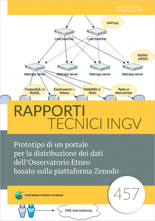
The Open Data model requires that scientific publications results, produced by research organizations or institutes must be freely accessible and usable by anyone, with the only constraint of citing the source. This approach has driven research institutions to publish their scientific products through an operation called “deposit”, on self-managed and self-maintained web portals that represent institutional databases according to the Open Access directives. Among the key operations carried out by the INGV Osservatorio Etneo (OE), there is the gathering and collection of data from the data- acquisition instruments scattered throughout its competence area; these data cataloged in sets, called datasets, on the basis of discrete values such as: examined phenomenon, its time interval and its geolocation. Following the Open Access directives for the publication of these datasets, the OE adopts an implementation of the aforementioned databases, also known as data repositories or digital archives. The implementation described in this document, called DataRep, is based on the Zenodo portal: an open-source software for the implementation of a multidisciplinary repository maintained by CERN. This document describes the result of the collaboration between the OE and the INGV Ufficio Gestione Dati, specifically the interaction between the DataRep software - implemented by the OE by customizing and adapting the Zenodo software - and the Metadata Editor, the official tool for publishing scientific products adopted by INGV. DataRep allows to automatically obtain a landing page associated to each dataset, resolvable through the public DOI published through the Metadata Editor.
The INGV Mediterranean GNSS Archive (MGA)
Vol. 456 (2022)
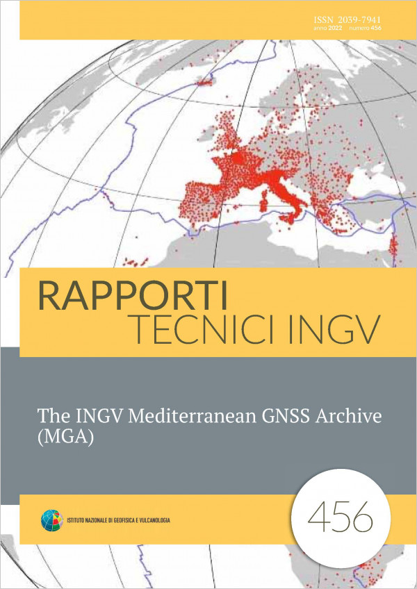
The Global Navigation Satellite System (GNSS) represents a primary data source in Solid Earth Sciences. In order to investigate the Earth’s crustal deformation, time series of the estimated daily positions of the stations are routinely analyzed at the Istituto Nazionale di Geofisica e Vulcanologia (INGV) to investigate the deformation of the Earth’s surface caused by tectonic and nontectonic processes. The GNSS observations of the stations are processed using the three main scientific software: GAMIT/GLOBK, BERNESE, and GIPSY OASIS II. The accuracy and the strength of geodetic solutions often depend on the geometry and spatial density of the network, and the availability and quality of GNSS data. In many circumstances, GNSS networks are deployed for topographic purposes by private or public institutions, and a significant number of GNSS stations in large regions acquire continuous observations. It may happen that such networks do not collect and distribute data according to IGS standards, so it could be difficult to analyze this data using automated dataprocessing tools. For that reason, this data is often ignored or partially used by the scientific community, despite their potential usefulness in geodynamic studies. We have attempted troubleshooting this problem by establishing a centralized storage facility in order to collect all available GNSS data and standardize both formats and metadata information. Here we describe the processes and functions that manage this unified repository, called MGA (Mediterranean GNSS Archive), which regularly collects GNSS RINEX files from a large number of CORS (Continuously Operating Reference Station) located across a wide region of mainly the European and African plates. RINEX observation data and metadata information are provided to the analysts through an FTP server and dedicated webservices. The complete data set is stored in a PostgreSQL database in order to easily retrieve pieces of information and efficiently manage the archive content. The system implements many highlevel services that include scripts to download files from remote archives and to detect new available data, web applications such as API (Application Program Interface) to interact with the system, and background services that interact with the database. During the development of this product, particular attention was paid to what has already been achieved by the EPOS Thematic Core Service WP10 (https://www.eposeu.org/tcs/gnssdata andproducts), whose objective was: “... to develop an open source platform with programmatic and web interfaces to store and disseminate raw data and metadata from GNSS stations operating in Europe”. Many ideas and tools presented here were inspired by that project.
Configurazione del sistema PRESTo per l’allerta rapida di eventi sismici (early warning sismico)
Vol. 455 (2022)
The present work is part of the 2015 ART-IT project (Early Earthquake Alert in Italy). Its main purpose
is the estimation of the PRESTo system [PRobabilistic and Evolutionary early warning SysTem,
Iannaccone et al., 2010; Satriano et al., 2011] performance through an ad hoc calibration of the
software configuration parameters using only the accelerometric networks installed in an area of
Central Italy, selected as test site. The correct operation of an early warning system could be used for
a more correct and effective management of a seismic emergency from the first seconds after the
occurrence of a strong earthquake, allowing to adopt sudden actions to reduce the exposure and,
consequently, the seismic risk. To evaluate the performance of the software, it is necessary to carry out an a priori calibration phase
of the configuration parameters in order to guarantee the best performance in terms of seismic event
detection and reliability in the estimation of hypocentral parameters. The tests were carried out by
means of a series of recorded waveforms simulations considering a selected catalogue of earthquakes
with a magnitude range between 3.9 and 5.4, occurred in the Amatrice-Norcia area, with
a magnitude range between 3.9 and 5.4, occurred in the Amatrice-Norcia area, with particular
focus on the seismic sequence of January 2017.
Controllo remoto di un sistema per l’acquisizione di dati sismici in Alta Affidabilità
Vol. 454 (2022)
In the context of the permanent seismic surveillance network managed by the Vesuvius Observatory, a remote control system associated with High-Availability (HA) microclusters has been implemented. It satisfies the operational need to reduce the downtime of data acquisition systems in case of malfunctioning of the HA cluster, drastically reducing the need to have an on field operator for resolution.
The present work, therefore, aims at providing a technical description of the High-Availability (HA) system in use at the seismic station of Forio Punta Imperatore in the island of Ischia (identification code: IFOR) and of the related remote control system that has been implemented, named Remote Communication and Start/Stop System (RC3S).
The present work, therefore, aims at providing a technical description of the High-Availability (HA) system in use at the seismic station of Forio Punta Imperatore in the island of Ischia (identification code: IFOR) and of the related remote control system that has been implemented, named Remote Communication and Start/Stop System (RC3S).
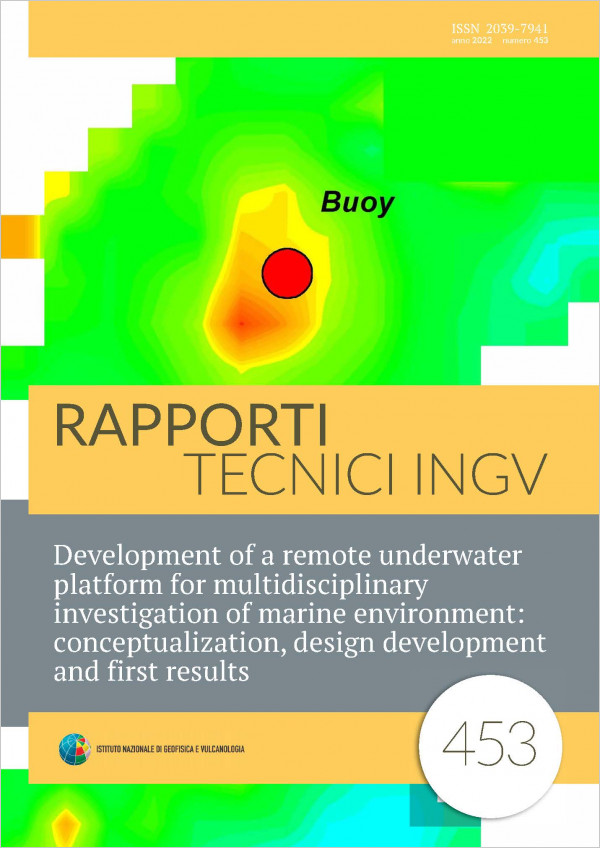
Development of a remote underwater platform for multidisciplinary investigation of marine environment: conceptualization, design development and first results
Vol. 453 (2022)
The study and evaluation of the health state of oceans and major seas requires an integrated approach able to discern all the information about quality of the marine environment where seabed, water column and marine circulation should be considered as a unique ecosystem. Marine litters have a very important impact on the global pollution of the coast and offshore area because they are present both on the water column, as micro/nano litters, and on the seabed as macro items. Within the large family of marine litters, we also recognize all those objects related to the military activity of the last World Wars, which are largely widespread along the coast of our seas. Most of these anthropic objects are nowadays partially or completely buried below the seafloor. Investigation of the seabed for detection of any possible anthropic objects represents thus a very important task. Here we present the conceptualization of a remotecontrolled underwater platform integrating magnetic sensor, multiparametric probe, direct camera visualization and an acoustic beacon for underwater positioning. This newly developed system aspires to become a versatile investigative tool for a multidisciplinary study of the marine environment especially for the coastal areas and very shallow regions having anthropic influence. We report the results of the first test where we describe capability of the platform and possible future development.
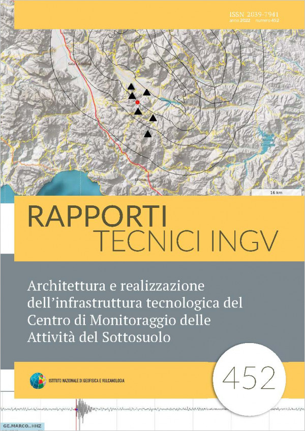
Architettura e realizzazione dell’infrastruttura tecnologica del Centro di Monitoraggio delle Attività del Sottosuolo
Vol. 452 (2022)
This article describes the IT infrastructure implemented by the Centre for the Monitoring of Subsoil activities to monitor the areas of competence of which, according to the provisions of the Addresses and Guidelines and following the appointment by the Ministry for Economic Development, the INGV is the Structure in charge of seismic and geodetic Monitoring. Particular attention is paid to the hardware and software infrastructure, the data formats used and their installation is described.

Rilievo fotogrammetrico SfM very close range per applicazioni in ambito archeometrico: test e considerazioni
Vol. 451 (2022)
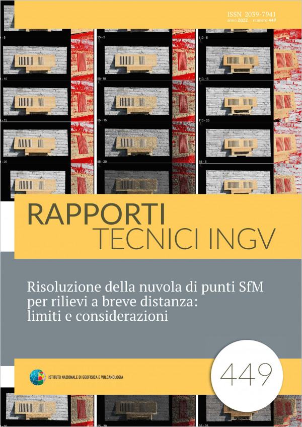
SfM (Structure from Motion) photogrammetry offers great versatility in survey and restitution operations. The most important feature that allows this technique to be applied to a wide range of observation distances is the resolution of the images intended both as the quantity and quality of the pixels that compose them. With the same digital camera, equipped with a good sensor (CMOS) and operating in good light conditions, it is possible to acquire images over large or short distances with focal lengths that can vary between the extremes of wide angle and telephoto. Photogrammetry can thus be applied to elements of various sizes: from large structures such as slopes, land and buildings, to artifacts and even very small archaeological finds. It is therefore a question of using a versatile tool such as a digital camera to be able to work on specific scales and accuracies depending on the area of work. In the scale of the relief of a rock wall (a few hundred meters) derived digital models with centimeter accuracies are obtained, in the scale of applications from very short distances to small objects, much higher accuracies are achieved, up to a few hundredths of a millimeter. This technical report shows some SFM relief tests carried out on the archaeological finds preserved at the Delta Antico Museum in Comacchio (FE) to observe the type of precision and accuracy obtainable and to evaluate the usefulness of the working method used for future applications to the entire collection.
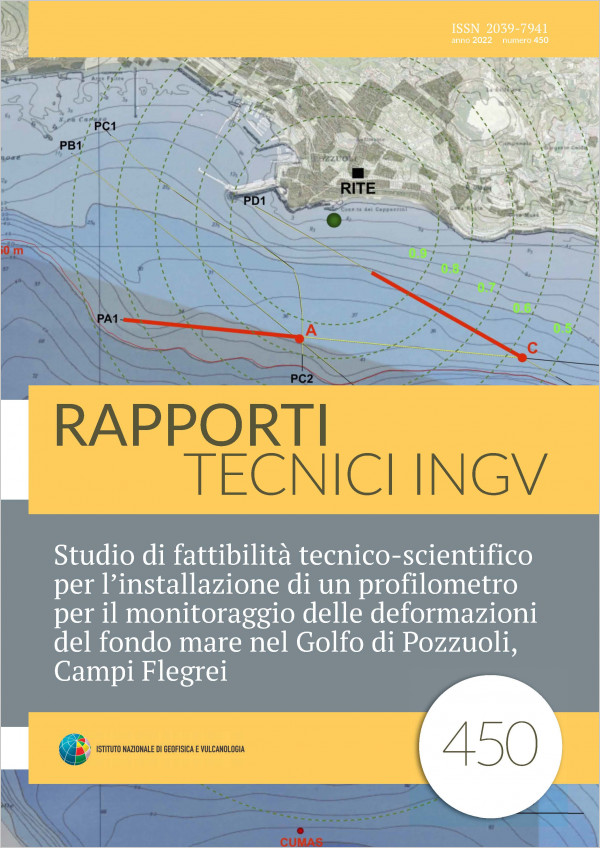
Studio di fattibilità tecnico-scientifico per l’installazione di un profilometro per il monitoraggio delle deformazioni del fondo mare nel Golfo di Pozzuoli, Campi Flegrei
Vol. 450 (2022)
This report presents a feasibility study aimed to use an innovative instrumentation for the measurement and real-time monitoring of the vertical deformations of the sea floor, which will be integrated in the MEDUSA permanent marine infrastructure installed in the Gulf of Pozzuoli, the submerged part of the Campi Flegrei caldera. The instrumentation consists of a Digital Profile Gauge, which is currently owned by ENI S.p.A. (Italy) in the framework of the agreement between these and INGV. The digital profile gauge consists of a flexible hydraulic circuit containing several pressure sensors, which measure the difference in pressure between one of these and another one used as reference point. This difference is proportional to their relative vertical displacement. The characteristics of the fluid filling the circuit and the quality of the pressure sensors, allows measurements with a sub-centimetric accuracy. The digital profile gauge consists of 15 segments, 200 m long each, which can be arranged in one or more alignments for a total length of 3 km, with sensor spacing every 100 m. In the report a description of the instrumentation and the environmental and technical installation requirements are presented and some installation configurations are proposed. The criteria for choosing these configurations are described; they take into account the technical requirements of the instrumentation, including the constraints for the integration with the MEDUSA infrastructure, the scientific validity of the installation and its contribution to strengthening the surveillance and monitoring system of the study area, managed by the INGV, Sezione di Napoli - Osservatorio Vesuviano. An assessment of the vertical deformations that can be measured from the digital profile gauge was calculated using a simple descriptive model of the deformation field that is well suited to the data collected both from the monitoring networks present on land and by MEDUSA marine infrastructure.
Risoluzione della nuvola di punti SfM per rilievi a breve distanza: limiti e considerazioni
Vol. 449 (2022)
A reasonable estimate of the resolution of a point cloud obtained by Structure-from-Motion (SfM) photogrammetry is mandatory in order to perform a correct analysis of the detected object. The knowledge of the expected resolution and of its limits allows one to establish, right from the measurement design stage, realistic hypothesis on the achievable degree of detail. This paper shows a case study designed for applications in the architectural field, where the distances involved generally range from few meters to a few tens of meters. Therefore, an artificial 3D target composed of both flat and three-dimensional elements was devised and measured in order to evaluate the degree of perturbation in a 3D case with respect to ideal 2D visibility conditions. The results confirmed and extended what already evidenced in previous publications, showing that resolution gets worst of about 20-25% when compared with the 2D case.
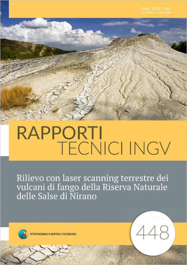
Rilievo con laser scanning terrestre dei vulcani di fango della Riserva Naturale delle Salse di Nirano
Vol. 448 (2022)
Mud volcanoes are mud emissions generated by the rising gas from deep hydrocarbon deposits. The extruded material is mainly composed of methane, fossil salt water and clays, and results deposited on the ground forming cones and pools. The Salse di Nirano reserve is one of the oldest and ancient example of geological protected area, in Italy and in Europe.
In this technical report it is widely described the terrestrial laser scanning (TLS) measurement campaign performed on February 2020 together with results and considerations/opportunities for planning an exhaustive monitoring of the area. The research aims at providing a reliable contribute in searching for possible correlations between areas movements and mud extrusions. In summary, this paper shows the first TLS observation carried out to start the monitoring of the studied phenomena.
In this technical report it is widely described the terrestrial laser scanning (TLS) measurement campaign performed on February 2020 together with results and considerations/opportunities for planning an exhaustive monitoring of the area. The research aims at providing a reliable contribute in searching for possible correlations between areas movements and mud extrusions. In summary, this paper shows the first TLS observation carried out to start the monitoring of the studied phenomena.
REfAsE - Rest Engine for Asynchronous job Execution: un motore software modulare RESTful per il dispatch e processing asincrono di job eterogenei
Vol. 447 (2022)
The REfAsE - Rest Engine for Asynchronous job Execution - system is positioned within the operations and functionalities related to the management of a seismic event and related activities. The software, designed and implemented entirely within the Functional Unit “Monitoring Room and IT”, has taken on the role of “middleware” and “broker” for that part of the processing load necessary to the production of reports of above threshold events, graphs and maps used for the creation of periodic seismic bulletins and automatic reports. The primary intent was to “isolate” WESSEL (WEb Service for Seismic Event Location, the system that allows the management and analysis of all phases of localization of seismic events of neapolitan volcanoes) detaching these features from the main processing flow and implementing the additional ones with granular and atomic approach.
Thanks to its RESTful interface and a simple protocol allowing to completely manage the resources through HTTP (HyperText Transfer Protocol) commands, it is possible to submit jobs and obtain the related results in an asynchronous way, without the computational cost burdening the main system. The idea that guided the design of REfAsE was therefore to create a software engine capable of taking charge of all those requests that it is possible to satisfy even in non-real time, i.e. accepting jobs (tasks to be completed) that require resources and computation time that should not be“subtracted” from WESSEL, intended both as a software system and as a computing hardware infrastructure that keeps it in production.
REfAsE, designed to be modular, scalable and integrable, currently implements several operational scenarios:
production of releases for the Civil Protection Department (DPC);
creation of periodic seismic bulletins;
creation of maps and graphs for the automatic reports.
At the moment there are other protocols and implementations under development that will allow REfAsE to act as a provider for different seismic location softwares as Hypo71, Localmag, NonLinLoc, etc.
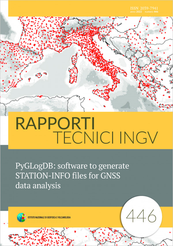
PyGLogDB: software to generate STATION-INFO files for GNSS data analysis
Vol. 446 (2022)
Massive analysis of GNSS data (Global Navigation Satellite System) requires the development of specific tools to automate the different steps of processing: from data download to ground displacements estimates. In this technical report we describe the tools and algorithms we have developed to handle the metadata associated with GNSS observations from continuous networks operating in the EuroMediterranean and African area, which are routinely processed by the three main INGV data analysis centers. Obtaining accurate metadata, which records information on how a GNSS station is equipped (receiver, antenna, monument, etc..), is mandatory in order to obtain accurate GNSS stations daily position and their evolution through time. Here we will describe the processing chain, the software developed using opensource programming language, describing the major issues found in treating incomplete, inconsistent or wrong information, and the methods adopted to minimize or resolve these problems. The software developed is going to be implemented in the centralized GNSS data and metadata archive that we are realizing at INGV, and that will serve both institutional activities and research projects. The goal of this tool is to minimize errors and reduce/avoid the human intervention in handling a large set of information, facilitating the automatic analysis of data from thousands of GNSS stations on a daily basis. The software acronym is pyGLogDB, which stands for: “python GNSS Logfile elaboration with the support of DataBase”.
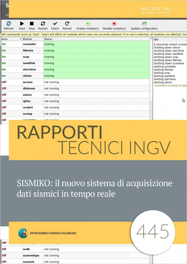
SISMIKO: il nuovo sistema di acquisizione dati sismici in tempo reale
Vol. 445 (2022)
SISMIKO is one of the emergency operating groups (GO) of Istituto Nazionale di Geofisica e Vulcanologia (INGV) whose principal task is the prompt installation a temporary seismic network, with real time data transmission, to integrate the permanent seismic stations in an area where a strong earthquake or a seismic sequence is occurring [Moretti et al., 2012; 2016].
SISMIKO was formally established in 2015 by the union of some mobile seismic networks managed by different groups of INGV headquarters. Each of these networks was conceived according to different criteria, determined by its geographical locations and its relationships with the Italian Rete Sismica Nazionale (RSN) [Michelini et al., 2016; Margheriti et al., 2020]. These heterogeneities includes also in the data acquisition systems of the stations managed by the GO. Thanks to a careful planning and configuration, today SISMIKO has the capability and the expertise to deploy, in a few hours, seismic stations and integrate their real time data into the acquisition system of the main operating room in Roma. In this way SISMIKO significantly contributes to monitoring and surveillance service carried out by INGV in case of seismic emergencies [Margheriti et al., 2020].
During 2020, following a renewal and homogenization of the GO instrumental inventory started in 2019 (cofinanced in the framework of the ongoing Agreement between INGV and Italian Civil Protection Department), the task of developing a unified real time acquisition system for all the SISMIKO seismic stations was pursued, independently from the geographic location of the single INGV branches. This new approach has several advantages, primarily allowing the full interchange of the operators, among the various INGV branches, in the management of the data acquisition system, which is a critical issue in managing a seismic emergency.

Un sistema modulare hardware/software a basso costo per il monitoraggio della sala CED
Vol. 444 (2022)
In this paper, the design and development of a low-cost monitoring system is reported, in order to control the critical operating parameters of a data center, such as temperatures in the most representative spots of the server room, the cooling system efficiency, power supply related physical measurables useful to evaluate its quality and efficiency level. This solution, specifically customized for the new data center of the Italian National Data Center (IT-NDC) located at the Roma 2 branch office, is actually designed with a modular structure, where hardware and software components can be easily added, even to detect parameters not explicitly planned in this specific work.
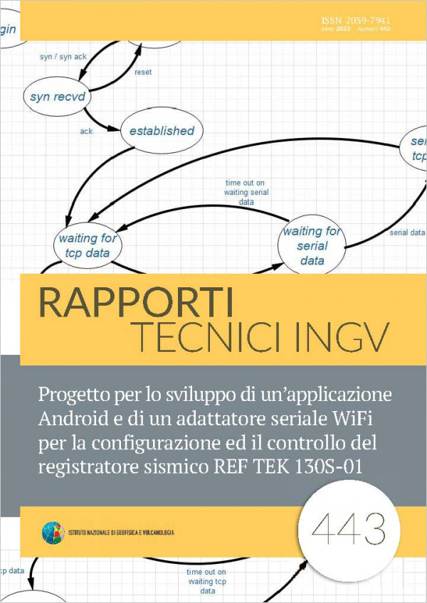
Progetto per lo sviluppo di un’applicazione Android e di un adattatore seriale WiFi per la configurazione ed il controllo del registratore sismico REF TEK 130S-01
Vol. 443 (2022)
Seismic instrumentation is fundamental for seismological science. It is thanks to a network of instruments positioned on a specific area and the collection of frequency and amplitude parameters, related to the seismic event, that it is possible to trace the epicenter of the earthquake. Over the years there have been various evolutions both by the seismic sensor used to transform the movement of the earth into a variable parameter (e.g. mechanical movement, electrical voltage) and by the seismic recorder responsible for storing and making the detected information usable.
Further progress has been achieved through the digital processing of seismic data allowing the creation of seismic stations that can record on hard disk and remotely transmit a considerable amount of information for post-processing. A seismic station that contains the characteristics described above is the REF TEK 130S-01 (hereinafter referred to as 130S-01).
The 130S-01 has six input / output connectors: two connectors for seismic channels input, a terminal connector for configuration and control, a network connector that combines Ethernet and serial PPP for network access, an external power connector and a connector for the GPS receiver. An LCD display allows the user to monitor the status of various subsystems within the 130S-01 without a terminal device connected. Configuration, control and status monitoring are performed with an iPod touch or iPhone using a WiFi serial adapter with the Field Setup Controller (iFSC) software available as a free download from the Apple store. By analyzing the communication protocol between the iFSC app and the WiFI-serial converter, an application for the Android environment was developed (hereinafter referred to as the RTManager app). At the same time, this analysis allowed the hardware / software development of a low-cost WiFi-serial converter created through the use of an embedded Linux system based on an ARM processor.
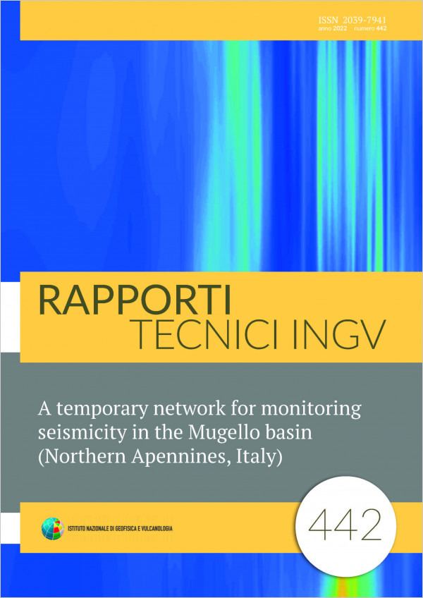
A temporary network for monitoring seismicity in the Mugello basin (Northern Apennines, Italy)
Vol. 442 (2022)
Within the geodynamic context of the Northern Apennines (Italy), one of the most relevant seismogenic areas is the Mugello basin (NorthEastern Tuscany). The area has a welldocumented record of seismicity; the two major historical earthquakes occurred in 1542 (Mw=6.0) and in 1919 (Mw=6.4). The proximity of the Mugello Basin to densely urbanized areas and the potential impact of strong earthquakes on the cultural heritage in the nearby (~30km) city of Florence makes a better knowledge of the seismicity in that area an important target. Following this argument, by mid2019 we deployed 9 temporary stations within and around the Mugello basin, complementing the permanent monitoring networks currently operating in the area. This report describes the details of the temporary network deployment and shows sample recordings and locations from a Mw=4.5 earthquake which struck the NW margin of the basin on Dec. 9, 2019.

Strong scaling analysis of the code GALES on 3D fluid, solid, and FSI problems
Vol. 441 (2022)
GALES is a generalpurpose multiphysics finite element software developed at INGV Pisa, and it consists of various solvers for computational fluid dynamics (CFD), computational solid dynamics (CSD) and fluidsolid interaction (FSI). The software has been verified and validated on several benchmarks. The software is intended to be used for highperformance computing (HPC) on cluster machines and has been in regular use to study 2D volcanology problems such as magma transport and rock deformation. Recently, the numerical code has been extended to 3D. In this report, we present the implementation of GALES for a parallel environment and perform a strong scaling study on various solvers of GALES for 3D problems.
“Hai sentito il terremoto?” Notifiche HSIT veloci e sicure via Telegram, il sistema di messaggistica istantanea
Vol. 440 (2022)
“Hai sentito il terremoto?” [Tosi et al., 2007; De Rubeis et al., 2019] web portal offers a seismic event notification service, called “Servizio Info-Terremoti”, to which users can register by entering their e-mail address and the municipality for which the intend to receive information on earthquakes.
The service sends to its subscribers, who are inside a distance radius depending on earthquake magnitude and depth, a notification via e-mail with the seismic event epicenter data and a request to fill the online macroseismic questionnaire. In this way, even the low degrees of intensity can be correctly estimated, since an answer is also received from those who did not feel the earthquake.
The natural evolution of an e-mail based notification system can be found in the current instant messaging systems that allow you to reach more users in less time, using massive groups or channels, depends on platform.
Hai sentito il terremoto? choose the instant messaging system Telegram because offers channels with unlimited number of subscribers and an automatic system to interact with user, called bot.
Database Sismogrammi Storici Vesuviani: reingegnerizzazione del portale web con RWD (Responsive Web Design)
Vol. 439 (2022)
As part of the internship carried out in collaboration with the University of Salerno, Department of Information and Electrical Engineering and Applied Mathematics, the old portal “Vesuvian Historical Seismograms Database” was reengineered in order to make accessible and disseminate without any limit, the historical but also scientific heritage of the Vesuvian Historical Seismograms.
This portal, once at the forefront, is now characterized by outdated technologies / methodologies and it is not accessible by new mobile devices. At present 9 out of 10 Italians use smartphones to surf the internet, it was considered necessary as well as a duty to the scientific and non-scientific community, to proceed with the re-engineering of the portal through a Web Design Responsive approach. The application of this approach made it possible to optimize the portal presentation on all access device (desktop, tablet, smartphone).
In addition, a functionality has been implemented, it allow a more agile and targeted search for the desired seismogram among the approximately 300 existing seismograms: previously, only a sequential search could be performed.
The new portal was implemented using the open source development framework “Bootstrap”. Thanks to the components that it offers to the developer, it made possible to create the new Mobile-First Responsive portal in a faster and more optimized way.
This portal is available at the following web address: http://portale2.ov.ingv.it/carte/
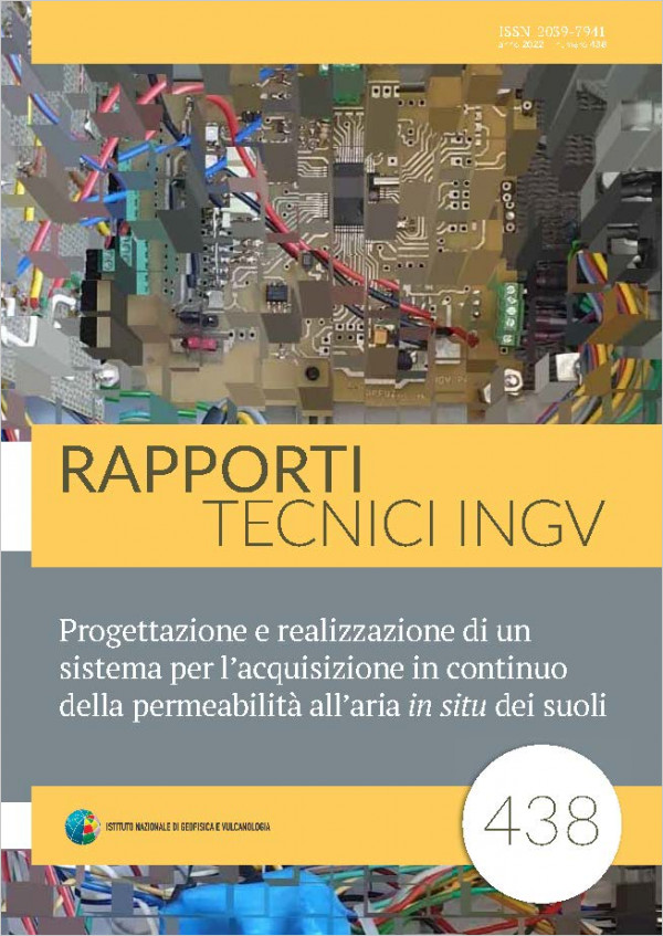
Progettazione e realizzazione di un sistema per l’acquisizione in continuo della permeabilità all’aria in situ dei suoli
Vol. 438 (2022)
A new indirect method of estimating in situ soil air permeability is presented in this technical report. The new method is simply based on the measurement of air pressure (probe pressure) generated by pumping a constant air flux inside a special designed probe inserted into the soil. To calibrate the method, some measurements of the probe pressure were performed in some soils of the island of Vulcano, characterized by different values of the air permeability. Furthermore, technical aspects of a new device for performing continuous acquisition of the air permeability based on the new indirect method, were also described
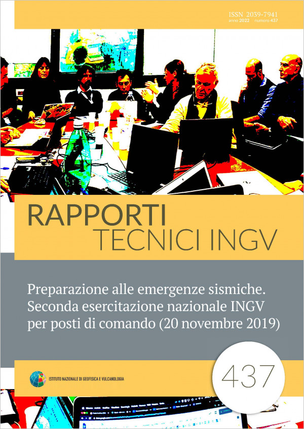
Preparazione alle emergenze sismiche. Seconda esercitazione nazionale INGV per posti di comando (20 novembre 2019)
Vol. 437 (2022)
On November 20, 2019, an exercise was held at the National Institute of Geophysics and Volcanology (INGV) as part of the activities planned for preparing for seismic emergencies. The training was "table-top" with the simulation of an earthquake with a magnitude greater than the threshold required for the activation of the intervention procedures, described in the "Protocol of the Authority for the management of seismic and tsunami emergencies and Establishment of the Crisis Unit”, the flow of actions that follow was verified. The exercise involved the entire INGV even if the Rome headquarters was the most involved, and it was the second of this type after that carried out in 2015 [Pondrelli et al., 2016]. Main motivation of this training was the analysis of the efficiency of the Organization Protocol, a document that for the first time at INGV codifies the actions of the Crisis Unit and of the Institute in general on the occurrence of seismic events and / or seismic sequences and / or tsunamis. The Protocol has been formalized on the basis of the numerous experiences that the Institute has supported over many years, to honour its vocation in the monitoring and seismic surveillance of the national territory [Margheriti et al., 2021].
Calcolo del fattore di scala nelle analisi di dati SfM: considerazioni
Vol. 436 (2021)
The point clouds obtained from Structure from Motion (SfM) photogrammetry need a scale factor correction if are used for quantitative evaluations as well as surface variations, volume estimates, and so on. The scale factor is required also for multitemporal models comparison. It can be achieved using homologous points, that is, points from artificial or natural elements detectable in the point clouds and just measured with independent and external measurements. In this work two different and independent approaches for the recognition, measurement and comparison of homologous points aimed at calculating the corresponding scale factors are shown. The
first approach is based on the measurement of positions of artificial targets by means of realtime kinematic satellite navigation (RTK GNSS); the second one is based on the extraction of homologous points from TLSbased morphological maps. The results, influenced by the errors of the performed measurements, show a 0.04% discrepancy between the scale factors. Although this study concerns a specific case and therefore is not representative or exportable to general situations, it highlights the need to carefully evaluate the corrections applied to the scale factor in order to avoid errors of interpretation and, therefore, allow meaningful comparisons between multitemporal models aimed at extracting information on surface variations.
first approach is based on the measurement of positions of artificial targets by means of realtime kinematic satellite navigation (RTK GNSS); the second one is based on the extraction of homologous points from TLSbased morphological maps. The results, influenced by the errors of the performed measurements, show a 0.04% discrepancy between the scale factors. Although this study concerns a specific case and therefore is not representative or exportable to general situations, it highlights the need to carefully evaluate the corrections applied to the scale factor in order to avoid errors of interpretation and, therefore, allow meaningful comparisons between multitemporal models aimed at extracting information on surface variations.
Impiego dei router cellulari nella rete sismica permanente, rete sismica mobile e nella rete di telecamere di sorveglianza dell’INGV-OE
Vol. 435 (2021)
Transmission systems play a crucial role in the data acquisition chain of instrumental networks in many areas, such as civil, military or scientific research. The usability of the data is even more important when these are closely linked to phenomenologies that have immediate repercussions on the safety of the population, or when these are generated for civil protection purposes. In this work we will describe how and why we arrived at the use of cellular modems / routers for the transmission and acquisition of video and geophysical (seismic and GPS) signals in the monitoring and surveillance networks of the INGV Osservatorio Etneo, from the experimentation, started in 2016, up to their greater diffusion today, and how this has allowed the realization of installations in areas often difficult to access or characterized by absence of radio visibility, often reducing their power consumption and providing them with more than sufficient bandwidth to implement interactivity with the installed devices and the transmission of various types of geophysical signals. In order to have a complete picture, the operations carried out as well as the software specifically designed to automate some operations through the potential offered by the routers and to allow an effective and efficient transfer of the produced data will be described, to then show some checks on the continuity of operation of the first implementations in the permanent seismic network in order to finally decide on the efficiency and stability of the systems used. The uses in the field of video streaming and their impact on the expansion of the volcanic areas observed will also be described.
Il contributo dei dati di “Hai Sentito il Terremoto?” al monitoraggio sismico
Vol. 434 (2021)
After a seismic event, the web portal Hai sentito il terremoto? receives reports from citizens about their earthquake experience, through the compilation of the online macroseismic form, published on the project site. The reports are received both from citizens, who spontaneously fill in the macroseismic questionnaire, before the official publication of the location of the earthquake, and on request, via email, from subscribers to our InfoEarthquakes service, following publication. The developed web application purpose is to be a useful support to the INGV Seismic Monitoring Service, showing aggregated information, adequately proposed, which may be useful to the seismologist to improve the earthquake localization.

Elettronica ed elementi hardware impiegati nel sistema intelligente multi-sensore per la rilevazione e il monitoraggio della cenere vulcanica attraverso il processamento delle immagini
Vol. 433 (2021)
Within the framework of Ash-RESILIENCE, we are performing an innovative and extremely low cost, low energy consumption and small size wireless electronic multi sensor system for the detection and monitoring of volcanic ash in sensitive areas, in order to manage information and alerts caused by ash fallout in real time. We want to implement a Wireless Systems Network in order to record, process and share data acquired to monitor areas affected by ash fallout. Collected data will be available through remote access connecting the systems directly to the acquisition center at INGV-OE. To obtain an embedded device with appropriate computational power without influencing system costs and dimensions, we employed a “Single Board Computer”, such as Raspberry Pi. The main challenges are:
• decreasing the overall complexity of the system using fewer sensors and mechanics to maximize reliability; • promoting innovative software solutions, using powerful open source image processing tools. We developed an algorithm for ash detection to receive alerts and monitoring data when the ash amount in the ground exceeds a pre-specified value of interest. From this point of view, to detect volcanic ash we used an image processing approach, which represents the central aspect of the system. To distinguish images pixels into two classes data, background (white collecting surface) and foreground (dark ash particles), we determine an automatic adaptive image threshold to carry out the binarization of images to get dependable information for the measure of the ash quantity starting with the ash particles pictures acquired by a visible, small size, low cost Full HD camera. The next goal will be integrating into the algorithm the innovative method “Pixel Digital Weight” we conceived, to accurately measure the ash weight, which does not require sophisticated scales and sensors, but only by means of the image processing.
• decreasing the overall complexity of the system using fewer sensors and mechanics to maximize reliability; • promoting innovative software solutions, using powerful open source image processing tools. We developed an algorithm for ash detection to receive alerts and monitoring data when the ash amount in the ground exceeds a pre-specified value of interest. From this point of view, to detect volcanic ash we used an image processing approach, which represents the central aspect of the system. To distinguish images pixels into two classes data, background (white collecting surface) and foreground (dark ash particles), we determine an automatic adaptive image threshold to carry out the binarization of images to get dependable information for the measure of the ash quantity starting with the ash particles pictures acquired by a visible, small size, low cost Full HD camera. The next goal will be integrating into the algorithm the innovative method “Pixel Digital Weight” we conceived, to accurately measure the ash weight, which does not require sophisticated scales and sensors, but only by means of the image processing.