
Procedure Operative per i Comunicati alla protezione civile e ad altre istituzioni in uso presso la Sala di Monitoraggio dell'INGV - Osservatorio Vesuviano
Vol. 432 (2021)
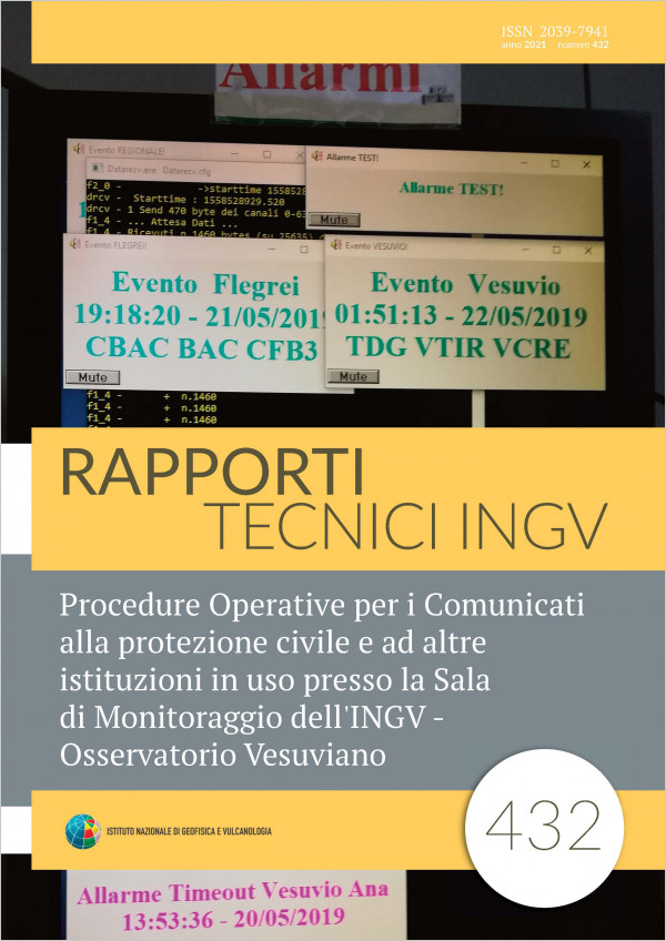
This Manual has the purpose to support the Vesuvian Observatory shift worker in carrying out the activities set out in Annex 2: Operating Procedures for Bulletin, drawn from the document Guidelines for shiftworkers and available staff.
In particular, it provides different levels of description of the activities / operations that the shift worker has to carry out during his surveillance shift, specifically in case of “Seismic event above threshold” or “Seismic swarm”.
At the beginning, through a Flow Diagram it is possible to examine the sequence of all the operations that have to be carried out and their specific conditions, all contained in a single page. This diagram is then detailed through a sequence of Operations (call below “Macro Operations”) which describe, in a few lines, the steps to be performed.
Lastly, each Operation (in section “Operazioni Dettagliate”) is described in all its features and details (identification of the Monitors / Stations, programs to be used, basic commands, etc.), in order to provide the shift worker (also neophyte) with all the necessary information that allow him to operate independently and in accordance with the procedures.
Since some operations can be carried out in several ways, in these cases, there will also be a further section called the “Alternative Mode” that has the aim to describe, in detail, the sequence of the steps to be taken. It is important to underline that it is recommended to use the first operating mode. In fact, only the suggested methods will be shown in the Macro Operations and not the alternative ones.
Ionosonda SDR per sondaggi obliqui
Vol. 431 (2021)
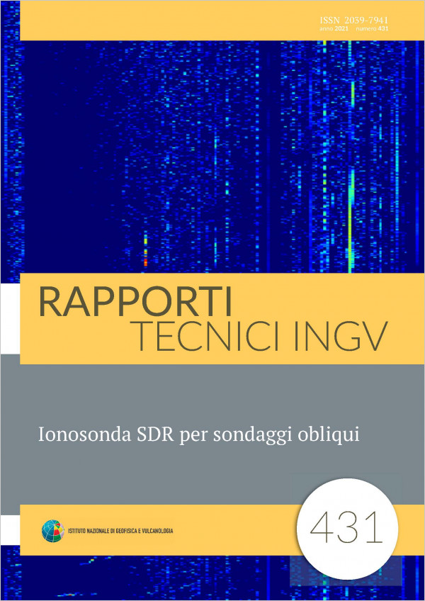
The aim of the project is to carry out a prototype of an ionosonde for oblique sounding, based on the frequency modulated continuous wave principle and implemented by means of innovative programmable devices that allow creating smaller and more transportable instruments with respect to the classic ionosondes. The SDR ionosonde is a bistatic radar composed by a transmitter, which can simultaneously serve several receivers placed in different locations, and by one or more receivers that can tune in to different transmitters, sounding at different times. The surveys allow to map the ionosphere in various parts of the territory for the verification of the theoretical models of the ionosphere and to study the local variations of the Total Electronic content (TEC) as earthquake precursors.
User’s guide for paleointensity experiments: an update of the Guidebook “Guida all’uso del forno ASC TD-48SCper la stima della paleointensità assoluta con il metodo Thellier-Thellier modificato”
Vol. 430 (2021)
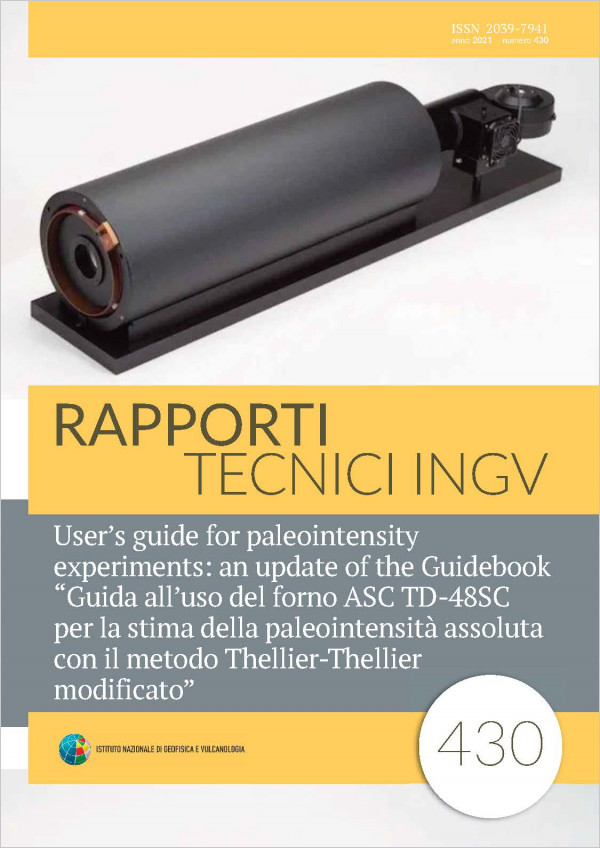
The understanding of the ancient Earth’s Magnetic Field strength, or paleointensity, is fundamental for several disciplines of Earth Sciences. Following the growing interest in this field in the last decades, the number of paleointensity studies has been increasing and the Paleomagnetic Laboratory of the Istituto Nazionale di Geofisica e Vulcanologia (INGV) in Rome, Italy, expanded the instrument park with a new ASC TD48SC oven for paleomagnetic and paleointensity measurements. This manual represents an updated version of the original manual “Guida all’uso del forno ASC TD48SC per la stima della paleointensità assoluta con il metodo
ThellierThellier modificato” [Di Chiara, 2014]. The aim is to provide a practical guide for paleointensity measurements, using the IZZIThellier experiment and the software Thellier_GUI for the processing of the geomagnetic field strength or paleointensity data.
ThellierThellier modificato” [Di Chiara, 2014]. The aim is to provide a practical guide for paleointensity measurements, using the IZZIThellier experiment and the software Thellier_GUI for the processing of the geomagnetic field strength or paleointensity data.
The new ITalian ACcelerometric Archive ITACA: database, web-services, and tools to access and analyze earthquakes waveforms
Vol. 429 (2021)
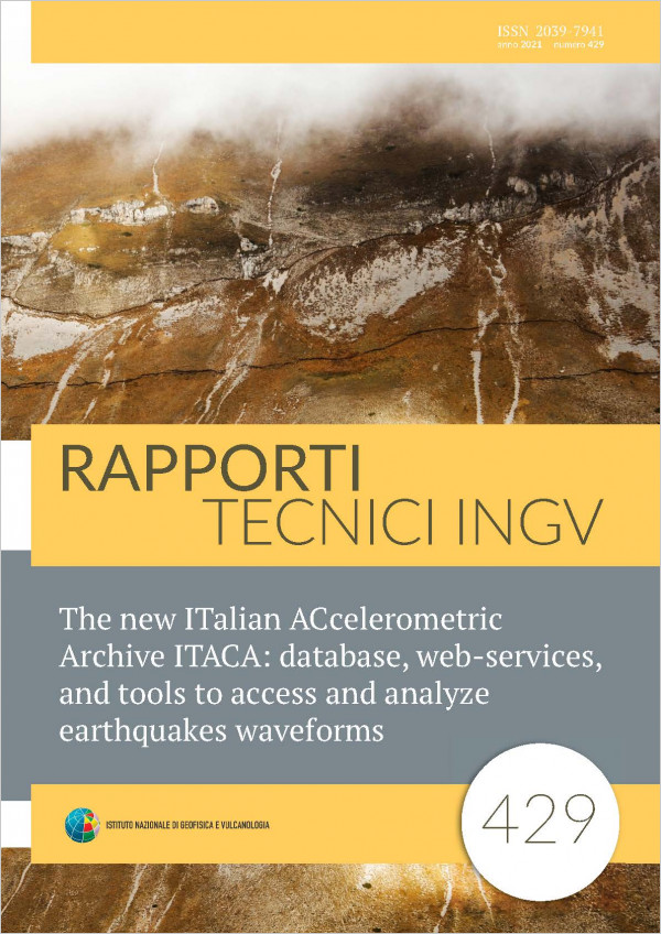
The growing interest in the open access of groundmotion data, webservices, and tools motivate every year a new release of the ITalian ACcelerometric Archive (ITACA), which represents the most complete collection of accelerometric waveforms recorded in Italy. In the last years, ITACA has undergone an important renewal process resulting in a new layout of the website (http://itaca.mi.ingv.it) and substantial changes in the database content and services. In this work we present the main feature of the last release of ITACA v3.1 (last accessed on July 2020), providing Users with information to browse the website and to access and analyze data.
Il nuovo sistema di acquisizione e visualizzazione dei dati di Campo Magnetico Terrestre
Vol. 428 (2021)
For many years, INGV has been recording, sharing and analyzing data relating to the Earth’s magnetic field (CMT) from geomagnetic stations and observatories, placed on national territory and southern polar area. Besides, the Institute is a member of Intermagnet (http://www.intermagnet.org/), an international consortium of institutes that records and delivers each own magnetic field values collected at ground observatories. Data sent to Intermagnet can be freely visualized and downloaded from the scientific community interested in the topic. The observatories and monitoring stations managed by INGV are located 6 in Italy and 2 in Antarctica. Each station/observatory is composed of 2 similar and parallel acquisition systems to ensure continuity of the recording of the components and intensity of the magnetic field vector, as recommended by the IAGA (International Association of Geomagnetism and Aeronomy).
Given the variety of models and types of instruments available at INGV, the unification of the acquisition system in a single software able of managing and saving data from all types of different instruments was created. Moreover, given the number of systems, a central single database at the incoming and outgoing flow knot of data with a unique communication protocol was implemented.
This work illustrates the acquisition and analysis procedures on the dataset for geomagnetic observatories managed by INGV for the benefit of users who make use of the databank at the URL: http://geomag.rm.ingv.it.
HSIT over cloud. Migrazione dell'infrastruttura HSIT su cloud Microsoft Azure
Vol. 427 (2021)
Current Hai sentito il terremoto?, below HSIT1, informatic infrastructure is stable and optimized over the years to be able to withstand an increasing load of users but is based on obsolete devices and is very hard to update, due to bureaucratic reasons, because the buy procedure takes a long time, and due to technical reason, because there is a lack of dedicated technical specialist, in addition to the initial installation and configuration, that can constantly monitor the entire system. Furthermore, if more resources are needed onthefly, there are no IT devices capable of dynamically adapting to the needs of the moment. So we decide to migrate the entire informatic infrastructure over cloud platform, because the service is costanlty updated and manteined, permit to scale2, manually or automatically, the device numbers based on realtime need, and the last but not the least during software issue (opeating system update failed, bug in web application, etc.) is always possible rollback to a previous working status, simply restoring a previuos snapshot3. This document describes the IT architecture built on the Microsoft Azure cloud platform and the procedure for replicating the entire system.
Telemetria a basso costo per liquidi criogenici (tappo attivo per dewars)
Vol. 426 (2020)
Those scientific and industrial equipment that require a very low temperature cooling system to operate often require continuous maintenance and constant control of the cryogenic liquid level. For this reason, some plants are equipped with remote surveillance systems based on “ad hoc” developed technologies for very low temperatures. We present a patented technical solution to be able to use, in cryogenic conditions, a common ultrasound sensor that costs 4 euros. This cap for dewar tanks, due to its particular shape, allows to obtain this result. Consequently, it also offers the possibility of being able to use other lowcost technologies, such as the microcontrollers of the Arduino series. This
allows an unlimited range of developments ranging from remote monitoring to the total automation of the ordinary maintenance of the cooling system. With this idea an “active cap” for Dewar was created at very low cost. It monitors the level of liquid nitrogen and provides online measurements updated in real time, the forecast of intervention for topping up and any alarm messages. A simple upgrade can allow automatic refilling of the liquid in the dewar. This solution, for inexpensiveness, can also represent an alternative to closedcircuit cooling and recycling systems.
allows an unlimited range of developments ranging from remote monitoring to the total automation of the ordinary maintenance of the cooling system. With this idea an “active cap” for Dewar was created at very low cost. It monitors the level of liquid nitrogen and provides online measurements updated in real time, the forecast of intervention for topping up and any alarm messages. A simple upgrade can allow automatic refilling of the liquid in the dewar. This solution, for inexpensiveness, can also represent an alternative to closedcircuit cooling and recycling systems.
Studio e rivalutazione del terremoto di Sulmona del 25 agosto 1905
Vol. 425 (2020)
This work focuses on the process of revision of the macroseismic data of the 25 August 1905 earthquake, which hit Sulmona and more generally the Peligna Valley. The earthquake is currently quoted in the Parametric Catalog of Italian Earthquakes [CPTI15, Rovida et al., 2019] with a moment magnitude Mw 4.8 and epicentral intensity Io equal to 6. The reference study mentioned in the CPTI15 is a preliminary study of the GNDT Macroseismic Archive [Monachesi and Castelli, 1995] and as such can be subject to an improvement, as it is dated and inevitably lacking in information. Starting from the state of the art and the review of the known sources, the results inferred from the new research will be exposed. The product obtained is a significant increase of the knowledge of the 1905 Sulmona earthquake, which is clearly highlighted in the new intensity map of the event which is now consisting of 67 locations (against 29 in the previous one) 41 of which, with an assignment of a degree of intensity (against the previous 22).
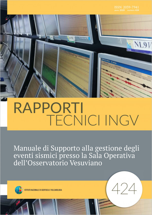
Manuale di Supporto alla gestione degli eventi sismici presso la Sala Operativa dell’Osservatorio Vesuviano
Vol. 424 (2020)
This manual has the objective to provide the shift workers of the Osservatorio Vesuviano Monitoring Room with an useful support to carry out their activities. Specifically, it focuses on the guidelines for the use of information systems related to the analysis and management of seismic events. Shift workers, among their duties, have the task to perform the preliminary location of the occuring seismic events that has to be done by means of two specific systems: WinPick and WESSEL. The first program (WinPick), developed by Flora Giudicepietro [Open File Report n.6, Osservatorio Vesuviano, December 2000] provides the functionalities to analyze in detail the traces of an event in order to perform its location that has later to be saved on two files: one with arrival times and one with location data. The second system (WESSEL), developed by Rosario Peluso in the framework of the FISR SOIR “Sale Operative Integrate e Reti di monitoraggio del futuro” project, provides the features to automatically acquire the files generated by WinPick, therefore all the event data, and to insert them in the SERENADE database and in Sismolab. This is the database developed as part of the Speed project (Scenari di Pericolosità e Danno dei vulcani della Campania) to allow realtime sharing of the monitoring data of the OV with the DPC, later the Speed/Sismolab system it was extended to allow access to data also to the public. It is used to simultaneously show the definitive, revised and automatic locations of a seismic event (obviously on the basis of those available). The shift worker in the monitoring room has the task of populating the database with the localized events: this operation, previously carried out through the system interface, is now carried out directly via WESSEL. In addition, WESSEL also sends automatic e manual localization of events, to the unified seismological database developed by the ONT as part of the FISR SOIR project (Integrated Operating Rooms and Future Monitoring Networks), to create a unified database for the seismic locations of the three INGV monitoring rooms.
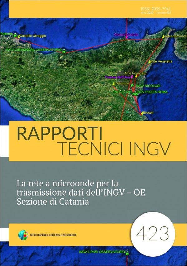
La rete a microonde per la trasmissione dati dell’INGV – OE Sezione di Catania
Vol. 423 (2020)
The Etneo Observatory, the Catania headquarters of the National Institute of Geophysics and Volcanology, has among its primary tasks the seismic and volcanic surveillance of Sicilian volcanoes and seismic areas of eastern Sicily. In order to meet these obligations, it needs to transfer in a safe manner a variegated multitude of data ranging from images coming from thermal cameras to data from GNSS stations. Some types of data, such as those from permanent seismic network, also need to be transferred very quickly in order to implement rapid alert systems (e.g., “seismic early warning”). For this reason, as part of the “Vulcamed” infrastructure project, a microwave data transmission network was designed and built that ranges from southeastern Sicily to the Aeolian islands and Palermo involve five Sicilians provinces (CT, ME SR, EN, PA). This network uses professional radio systems operating in licensed band that guarantee high operating standards and advanced management functions.
Evoluzione del sistema di compressione ACE e applicazione ai dati magnetici
Vol. 422 (2020)
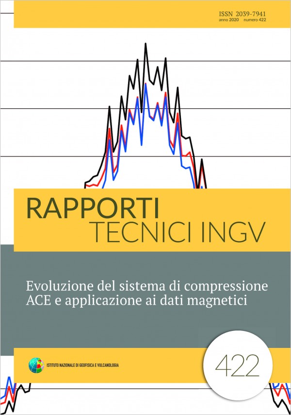
The signal acquisition, especially in geophysics, produces a huge amount of data. This obviously depends by the instrument used, the sampling rate employed and the precision required. Communication infrastructures play an important role in realtime use of the signal acquired, but they are not always able to meet the needs in terms of transmission speed and energy consumption, so they make impossible using telemetry. In such cases, data compression can help us and, especially if it is made ad hoc, can solve the problem. The algorithm below described uses the relationship between low and high frequency signal components to reduce the amount of data, highlighting the useful information.
Progetto per la misura, raccolta e trasmissione di dati di emissione radon per stazioni sismiche multiparametriche
Vol. 421 (2020)
The seismic monitoring of the national territory and of the EuroMediterranean area makes use of the velocimetric, accelerometric and GPS (geodetic) data acquired by the stations of the National Seismic Network, by the RING Network and by the MedNet Network. As part of the FISR 2017 project “Integrated operating rooms and monitoring networks for the future: INGV 2.0” (2017), sensors capable of detecting both geophysical and geochemical parameters at the same time are being integrated. This technical report describes the integration of a Rn222 sensor (radon hereafter). Over the past few decades radon has found a variety of Earth Science applications, ranging from its use as a potential earthquake precursor and tectonic stress indicator to its specific role in volcanic environments, where significant changes in concentration previous or concomitant to eruptive crises are also induced by volcanic gases, CO2 for example, which act as carriers accelerating the migration of radon through the earth’s crust and therefore its detection. In order to explore the possibility of a link between seismogenic processes and temporal variability of radon emissions, a permanent national network has been created, IRON (Italian Radon mOnitoring Network), which uses both commercial radon instruments, equipped with a proprietary system for data storage, transmission and consultation, and INGV sensors that need an interface to acquire and make data available remotely. A hardware and software interface has therefore been designed, built and tested capable of i) counting and storing the pulses in TTL format generated by the instrument which measures the radon concentration in air, ii) being connected to a router for sending the acquired data to a server. A service (syncproc) was also created in PHP to query remote stations at regular intervals and collect the acquired data intended to populate a database created with MariaDB. An expressly created website allows to extract the stored data from the database and configure each installed sensor. The various software elements have been designed using open source resources.
Servizio DynDNS@INGV per le stazioni sismiche
Vol. 420 (2020)
This paper describe the implementation of a Dynamic DNS Service, realized inside INGV, used by seismic stations using an internet connection with variable IP address, to definitively solve the problem of using a private provider, not fully compliant to INGV working needed or too expensive, in their business solution. The realized system solves different issues verified, primarily about unavailability of request domain name, limits on account management and the service’s purchase, offering an easy control system for end users.
Il Backup dei dati. L’esempio dell’INGV - Osservatorio Vesuviano
Vol. 419 (2020)
One of the main goals of an organization is to prevent data loss as a result of catastrophic events. The measure to be adopted is called “data backup”. It’s a simple concept: make backup copies to prevent data from becoming an unpleasant memory due to hardware, software, fire, electrical problems or other events. If concept is simple, the strategy for saving data is much more complex. Periodic data backup must be part of an efficient “disaster recovery” strategy. Different strategies and technologies are available to implement a correct backup plan. We will briefly analyze the strengths and weaknesses of the main systems available, in order to plan and apply a backup and recovery policy, taking advantage of the data and have it available in the shortest possible latency time. Optimal configuration, costs, backup mediums, reliability and availability are some of the aspects to be carefully evaluated to minimize the risk of data loss. Carrying out a detailed analysis of all aspects is not a simple task. Far from being exhaustive, the aim of this work is to provide a brief overview of backup process main aspects and provide magnitude of costs in economic and technical resources necessary for the data backup plan implementation. Hardware configuration, reliability and availability of the systems, software, types and size of backup will be taken into consideration.
L'emergenza sismica in Molise (Agosto 2018). Implementazione della rete sismica di emergenza SISMIKO e condivisione dei dati
Vol. 418 (2020)
On 16 August 2018 at 18:19:04 UTC an earthquake with magnitude ML 5.2 (MW 5.1) occurred in the Molise region. The earthquake was felt in a large area including many regions of Central and Southern Italy. The seismologists on duty in the 24H seismic monitoring room of the National Institute of Geophysics and Volcanology (INGV) located the event in the province of Campobasso, 4 km southeast of Montecilfone and at a preliminary depth of 9 km. The same area was affected two days before by a MW 4.6 event (August 14 at 23.48 Italian time1). Following the MW 5.1 event and the associated aftershock sequence, the SISMIKO Operational Group was activated [Moretti et al., 2012; 2016a; 2016b; Pondrelli et al., 2016] for the installation of temporary seismic stations to integrate the permanent stations of the National Seismic Network (RSN [Michelini et al., 2016; INGV Seismological Data Centre]) deployed in the region.
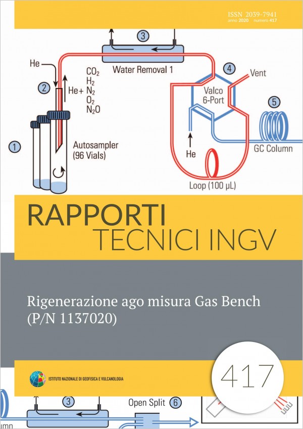
Rigenerazione ago misura Gas Bench (P/N 1137020)
Vol. 417 (2020)
In the following work we propose a method for the regeneration of the sampling needle used in the Thermo Fischer Scientific Gas Bench II, part number 1137020.The introduction of the sample in the measurement system is one of the most important step for the realization of a good isotopic analysis. Today there are some devices in commerce that use special sampling needles, each developed by the manufacturer for its own needs. Almost all needles are connected to an auto sampler to automate sample collection. The autosampler is a mechanical arm that amplify the mechanical stresses due to the injection of the needle into the vials. These mechanical stresses can cause the curvature and consequent breaking of the internal capillary of the sampling needle. Frequently the breaking of the capillary lead to the replacement of the whole sampling needle with considerable operating cost. In this paper we propose an alternative method for the regeneration of the sampling needle, which consists in the use of cheap and easy tools.
Analisi delle caratteristiche dei visitatori al percorso espositivo/formativo presso la sede storica dell’Osservatorio Vesuviano - INGV negli anni 2016 - 2017
Vol. 416 (2020)
This work is focused on the characterization of visitors of the “Sede Storica” of “Osservatorio Vesuviano” in the period between 2016 and 2017. The group was composed mainly of students and teachers of all levels of school. In the considered period, it had a reduced visibility as a consequence of numerous renovations for law compliance. The aim of this work was to verify the potential of the Sede Storica, through a study of visitors, even in a period when the access to the site was limited. In order to perform such analysis, we followed a quantitative approach using the method of asking adhoc built questionnaires, one made for students and the other made for teachers, both containing a final session open to suggestions. The results highlight a perceived high quality of offered services, both in terms of the guided tour and the understanding of museum paths, both leading to an increased level of visitor knowledge on the themes shown within the exhibition. Suggestions highlight many interesting ways to integrate actual services, for example, a free WiFi, a bar, a bookshop or the organization of integrated scientific environmental paths and laboratory activities. This would increase and diversify visitors and therefore optimize the dissemination potential of the museum. It would also provide a valuable return in terms of Civil Protection with information aimed at an increased awareness of the volcanic risk in the Neapolitan area.
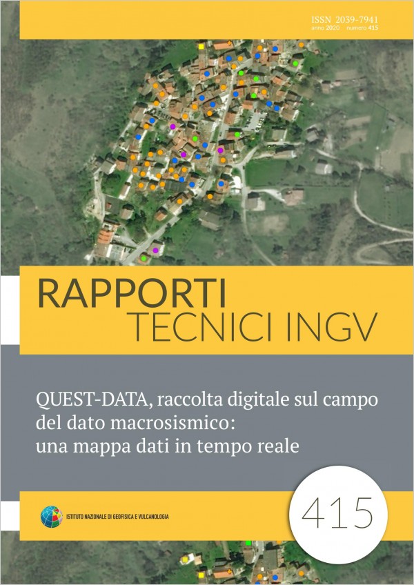
QUEST-DATA, raccolta digitale sul campo del dato macrosismico: una mappa dati in tempo reale
Vol. 415 (2020)
Soon after a seismic event, above the damage threshold, personnel of INGV is involved in emergency groups and is prepared, as soon as possible, to leave reaching the epicenter area. Each group has the task of collecting data, by making measurements and surveys, to study the earthquake from different points of view, and to support Civil Protection activities. In this context the field activities of the QUEST group (QUick Earthquake Survey Team) are included, with personnel that is specialized in macroseismic surveys, who has the task of reaching the areas affected by the earthquake to provide the survey on the effects on buildings, on the environment and people. The final macroseismic investigation aims to study the earthquake through direct observation and damage classification through the use of the EMS98 macroseismic scale [Grünthal, 1998]. Currently this investigation is carried out with the aid of paper questionnaire forms for collecting the data, and a series of maps, generally satellite images of the places to be investigated [Tertulliani et al., 2010]. Over time, attempts have been made to study increasingly rapid survey techniques in order to gather the actual data on the damage before the inevitable interventions of Firefighters or further damaging aftershocks that can modify the damage scenario. For this purpose, a tool for collecting macroseismic data is being developed, based on the use of tablets equipped with a graphical interface that allows the collection of information directly on maps of the locations to be investigated. In particular, the inclusion of timely information for each building, with the relative level of vulnerability and grade of damage, allows us to share information in real time between the various teams on the ground. This tool also allows the operator to work offline, and therefore to be able to gather information even in the absence or failure of the telephone signal and to send the data at a later time (as soon as it is available). In addition, the information is centralized at the operating centre that can manage and coordinate the displacement of the teams in the epicenter area. In this way new interesting scenarios are opened to the advantage of operational speed and knowledge of damage to the building, but also in terms of management of the personnel involved to optimize the survey activities.
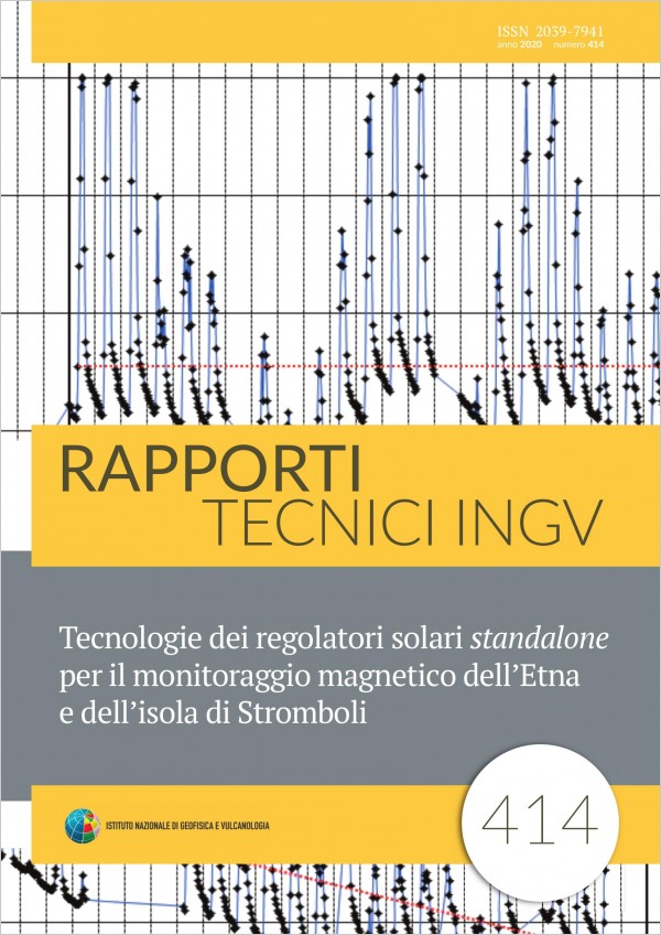
Tecnologie dei regolatori solari standalone per il monitoraggio magnetico dell’Etna e dell’isola di Stromboli
Vol. 414 (2020)
Like most monitoring stations, even those belonging to the Etna magnetic network use solar energy to work. The energy system is standalone and therefore formed by an array of solar panels and batteries managed by an electronic charger. At the beginning of 2003, due to the out of production of the regulator used up until then, the BGM10 TYPHOON C.E.P.U. (Efficient Powerful Stable Voltage), the entire network was affected by a forced upgrade that highlighted a weakness never found before. The solar regulator, which seemed similar to many others, turned out to be more unique than rare and its replacement created problems in the following years. Using many regulators and with different characteristics has highlighted the need to tackle the problem seriously. An in depth study has led to a solution that uses common components [Sicali et al, 2016] creating the basis for more effective and controlled maintenance, while at the same time becoming independent of what the market offers. It has also allowed us to classify a new source of noise, allowing it to be identified and eliminated whenever it occurs again. This form of noise was treated very well already by Fois, [2011] and by Benedetti [Benedetti, 2016] who provided a solution replacing the PWM (Pulse Width Modulation) regulator with a linear one. Completely open solutions surely have the advantage of being able to be modeled according to their own needs [Sicali et al., 2016], despite the fact that replacing a regular commercial with a built car is a company that requires a lot of effort. In fact there are applications that require particular functionalities such as load control [Sicali et al., 2013] and the performance of the system, depending on the recharge algorithms, could be compromised.
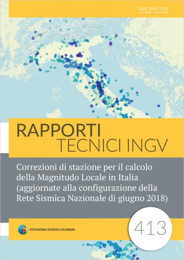
Correzioni di stazione per il calcolo della Magnitudo Locale in Italia (aggiornate alla configurazione della Rete Sismica Nazionale di giugno 2018)
Vol. 413 (2020)
Massimo Di Bona has published a function for the calculation of the local magnitude in Italy, together with correction coefficients for 197 seismic stations, using Italian earthquakes between September 2003 and March 2009 [Di Bona, 2016]. In this work, using the same function published by Di Bona, we calculate over 500 corrections for stations active in Italy from April 2009 to July 2018. We obtain the ML corrections for a total of 400 stations still active today.
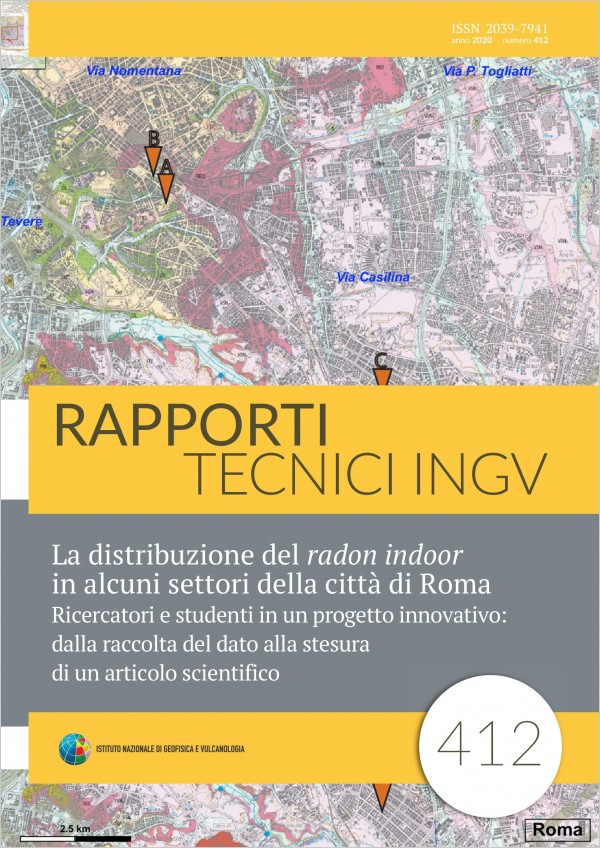
La distribuzione del radon indoor in alcuni settori della città di Roma. Ricercatori e studenti in un progetto innovativo: dalla raccolta del dato alla stesura di un articolo scientifico
Vol. 412 (2020)
Within the training courses of Alternanza ScuolaLavoro (a governative project for the introduction of work themes to the undergraduate students), a group of researchers from the Istituto Nazionale di Geofisica e Vulcanologia proposed and developed a project to a third class of the Liceo Scientifico Cavour in Rome. The idea was to introduce the students to the world of scientific research, allowing them to be faced in all their phases. The work was envisaged through the use of measuring instruments, data analysis, graph production, the construction of thematic maps and finally the writing in English of a scientific article (essential part of the researcher’s work) with the description of the research carried out and the results obtained. The research involved the distribution of radon indoor in some districts of Rome. The students had the opportunity to measure radon indoor through specific instruments in their houses and in their school, looking for possible spatial and temporal distribution between different data type and to isolate particularly anomalous cases. The aim was to investigate links between the measured values, the area’s geology and the housing typologies, to build thematic maps able to highlight the results achieved and finally to write a scientific article. This technical report has been introduced by the researchers and developed by the students.
Misure sismometriche di noise ambientale e di una esplosione sotterranea alla miniera di Sos Enattos (Nuoro): analisi preliminari
Vol. 411 (2019)
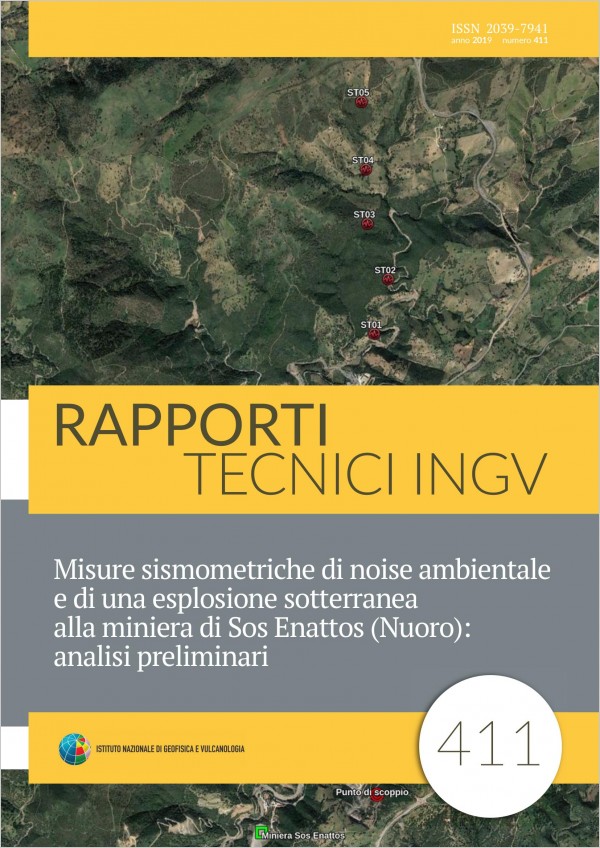
This paper describes the preliminary results of seismic survey performed in the area of SosEnattos mine (Lula, NU), by installing a linear array consisting of five shortterm mobile stations. The aim was to acquire both environmental seismic noise signals and signals from an active seismic source generated by the blast of explosive charges placed inside the mine. The spectral analyses of seismic noise highlight the presence of a dominant lowfrequency peak due to the marine microsism. A propagation velocity of P waves equal to 4500 m/s was estimated by analyzing the first arrivals of the seismic signal deriving from the explosion. Finally, using techniques of analysis of the local seismic response it was possible to obtain preliminary indications on the structure of the subsoil.
A procedure to import seismological data into the Ophidia big data analytics framework
Vol. 410 (2019)
The term Big Data identifies large data sets that cannot be managed with traditional processing software. Volume, Variety and Velocity are properties used to classify Big Data. Velocity, the most relevant property, refers to high speed of data acquisition and processing. Management of Big Data, and particularly Velocity, has become an open issue for scientific communities. The EC project INDIGODatacloud was conceived to tackle some of the Big Data challenges that scientific communities are facing. In the context of INDIGODatacloud we defined a case study in which one of the goals was the improvement of processing performance on seismological data. Starting with a practical case study, we identified, as possible software solution, Ophidia, a big data analytics framework. The first step to exploit the framework functionalities required the import of the seismological data in Ophidia. For this purpose, we designed and implemented a software module that enables the import of seismological data in SAC format. As a second step, we tested the capabilities of Ophidia through a performance test to evaluate the framework potential.
Il programma autoparco dell’INGV - Osservatorio Vesuviano: un esempio di sviluppo rapido di applicazioni a basso costo
Vol. 409 (2019)
Fleet management activity must be based on effectiveness and economy criteria. To this end, an application has been developed to optimize and making more functional and transparent the "Vesuvius Observatory" (section of the National Institute of Geophysics and Volcanology) car reservation system, to monitor it "real time", allowing to eliminate paper handling. The software was developed using the PHP language and using open source software such as Joomla!. The database used is Mysql, Oracle’s relational database, also released under the GNU General Public License. The use of this type of application allowed inhouse realization of a technological tool that did not involve any expensive purchasing of software and computer tools in general.
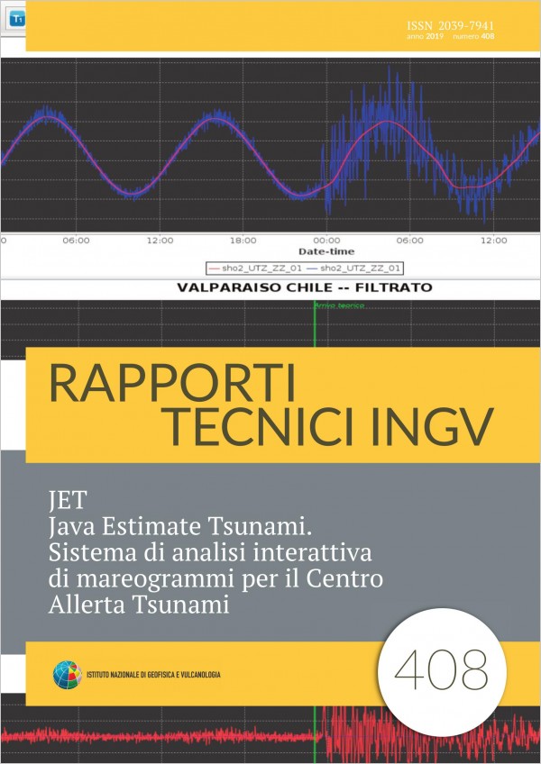
JET Java Estimate Tsunami. Sistema di analisi interattiva di mareogrammi per il Centro Allerta Tsunami
Vol. 408 (2019)
In this manual we present JET (Java Estimate Tsunami) the Decision Support System for managing earthquake location, tsunami alert messages, and tsunami waveforms analysis in use at the Centro Allerta Tsunami (CATINGV) of the Istituto Nazionale di Geofisica e Vulcanologia (INGV) in Rome, Italy. INGV has the responsibility for the operations of the Italian National Tsunami Warning Centre (It NTWC) in the framework of the NEAMTWS and as such is acting as CTSP through the CATINGV since October 2014. CATINGV has been put into service within the preexisting National Seismic Monitoring Centre at the INGV headquarters in Rome. JET has been developed by CATINGV to carry out the fundamental decision support operations of the the real time analysis of seismic signals, for the determination of the alert level, and of sea level gauges signals, for the confirmation/cancellation/ending of the tsunami alerts, and to send the messages to the NEAM subscribers, and to Italian Department of Civil Protection (DPC). DPC is responsible for disseminating warning messages to local authorities and population in Italy.