
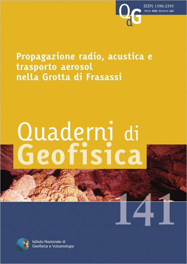
Propagazione radio, acustica e trasporto aerosol nella Grotta di Frasassi
Vol. 141 (2017)
The collaboration between the National Institute of Geophysics and Volcanology (INGV) and the Speleological Group CAI Fabriano (GSF) was established with the aim of clarifying from a physical point of view-modeling certain phenomena observed in karst cavities of the complex the Frasassi caves. The surveying of the sections explored by the cavers team, including a myriad of tunnels and caves show, mainly two tunnel systems: the Grotta Grande del Vento and the Galleria del Buco Cattivo separated by a apparently compact limestone of considerable thickness of about 120 m. This paper will present the experiments conducted between the two tunnels in order to predict the presence of additional cavities, or whether it is a compact thick, variously fractured or porous. The multi-disciplinary work deals with transport and diffusion of aerosol, radio and acoustic propagation models with the purpose to interpret and validate the experiments conducted by the GSF. The work will also cover the geological framework of the area, the speleogenesis of karst, caving evidence and experimental data to propose numerical-analytical models of aerosol diffusion, radio and acoustic propagation. The results obtained so far do not give a definite conclusion about the presence of other cavities but are a necessary methodology for other experiments and future research.
Terremoto a Campobasso del 16 gennaio 2016. L’evento di MW 4.3 e la sequenza sismica associata
Vol. 140 (2017)
At 18.55 UTC on January 16, 2016, an earthquake of magnitude ML 4.1 (MW 4.3) has been recorded by the National Seismic Network (in Italian: Rete Sismica Nazionale – RSN, http://doi.org/10.13127/SD/X0FXNH7QFY ) of the National Institute of Geophysics and Volcanology (in Italian: Istituto Nazionale di Geofisica e Vulcanologia - INGV). The earthquake affected the provinces of Campobasso and Isernia and also some areas of the neighboring provinces of Caserta, Benevento and Foggia. The event, located at about 6 km away from Campobasso and at depth ~ 10 km, had been preceded during the day by approximately ten events with maximum magnitude ML 2.9. The seismic sequence is located in an area of high seismic hazard and it occurred about 20 km southwest of the seismic sequence which began on December 29, 2013 with a ML 4.9 event (MW 5.0 [De Gori et al., 2014]). Due to bad weather during the following days the seismic station closest to the epicenters stop working and could not be restored; this worst the quality of the seismic monitoring system H24/7 at the headquarters in INGV of Rome.To overcome this problem, a 6-channels temporary seismic station has been quickly installed in collaboration with the Regional Civil Protection of the Molise. The activity has been prepared by the Coordination of mobile seismic networks INGV (Sismiko [Margheriti et al., 2014; Moretti et al., 2016]) and has been sufficient to ensure the efficiency of the seismic monitoring service as required in the current agreement between the INGV and the National Civil Protection Department (in Italian: Dipartimento Protezione Civile - DPC). The sequence has been then analyzed with different localization techniques, and the results are shown in the following for comparison.
Bollettino Sismico Italiano 2012
Vol. 139 (2017)
The Italian National Seismic Network (RSNI) in 2012 is described together with the seismicity occurred in Italy. In this year the RSNI has 413 seismic stations, belonging INGV and other local and regional networks, a part of which provides the signal in real time to the National Earthquake Center (CNT) in Rome. The Italian Seismic Bulletin (BSI) 2012 contains 18221 located earthquakes; a significant portion of this seismic activity belongs to the largest Emilian seismic sequence which mainly affected the provinces of Modena, Ferrara, Reggio Emilia, Bologna, Mantua and Rovigo, causing casualties, hundreds injured and serious damage to the artistic heritage, to rural and industrial construction, as well as to private homes (Fig. 1). On May 20 at 02:03 UTC an earthquake of ML 5.9 (5.8 MW) began the seismic sequence, preceded a few hours earlier by a 4.1 ML. On May 29, at 07:00 UTC, another strong earthquake (ML 5.8, 5.6 MW) struck the western sector of the area affected by the earthquake sequence. In 2012 the Emilian seismic sequence counted about 3100 earthquakes. In addition to the Emilia, we identified in 2012 other 27 seismic sequences. Among them, the sequence that affected the Pollino area is of particular interest; already started in 2009, continued throughout 2012: the strongest event occurred on October 25th, a magnitude 5.0 ML (5.2 MW) earthquake. The minimum magnitude of completeness of the BSI in 2012 is 1.4 MC. We have identified, in the seismicity of 2012, two new areas subject to anthropogenic activities, mostly quarry explosions. The BSI 2012 contains about 350 events of this type. We also analyze recordings produced by a collapse landslide, a phenomenon related to erosion widespread in our country, especially in the Alps.

Aggiornamento delle conoscenze sul terremoto del 28 luglio 1799 nel sub-Appennino maceratese
Vol. 138 (2016)
The earthquake of July 28, 1799, whose worse effects occurred in the hinterland of the province of Macerata, is one of the main events of the Umbria-Marches region. It is located in a seismogenic zone of transition between the distensive tectonic regime of the Apennines belt and the eastward compressive regime of the Adriatic coast, which makes it a key event for the understanding of this complex area. The distribution of the effects of the 1799 earthquake was reconstructed by several consecutive studies developed by different agencies with different research plans and variable levels of analysis. A careful reading of all these studies shows that the newer ones built up their intensity maps with values partly assessed from raw historical data and partly derived from previous studies (without first checking their correctness against the original data). This choice does not only lead to non-homogeneous results but it also entails the risk of adopting any mistakes made by previous studies and possibly even to distort the image of the earthquake. We (RE)analysed the event, (RE)reading the data provided by all the historical sources identified by previous studies, and (RE)assigned all intensity values according to a standard procedure from original historical data; for each of the assigned values, the historical data used to assign it and a summary of the reasons that dictated the intensity assignment are provided. As a result, the definition of the earthquake is improved; maximum intensity values are more severe than in previous studies but better aligned with the scenarios described by the sources. The presence of two separate areas of maximum damage (already highlighted by the most recent previous study) is confirmed, and this allows to assume that the earthquake of 28 July 1799 had a complex, probably multiple, source.
Pianificazione e gestione di un’emergenza sismica: esercitazione INGV del 26 novembre 2015
Vol. 137 (2016)
In the framework of INGV Earthquake Department organization, the Research Activity named “Sorveglianza sismica ed operatività post-terremoto” (Seismic survey and post-earthquake operativity” (T5) takes care of the development of tools and procedures for the real time evaluation of earthquake effects and the management of seismic emergency. One of main goals of T5 during 2015 was to formalize protocols from emergency teams mainly devoted to evaluation of damages and geologic effects and installation of temporary seismic stations, immediately after a relevant earthquake. Protocols of 5 teams have been formalized by an INGV President Decree on July, 2015. Another goal of T5 for 2015 was to write an INGV general protocol to face a seismic emergency. A draft version has been prepared and it includes an important news, i.e. the existence of an official Crisis Management Unit. To test all these protocols, a drill has been set up simulating a M6.4 earthquake in southern Latium, mainly aimed at verifying the feasibility of all the activities, and the information flows. In this report we describe its preparation, implementation and also the comments written by a group of observers. At the end, positive and critical observations are reported. We underline the relevance of such drills, suggesting that they should be carried out at least once a year.
Stima automatica della magnitudo minima rilevabile dalla rete sismica ReSIICO
Vol. 136 (2016)
The ability of a seismic network to detect signals of earthquakes depends on the geometry of the network, the instrumentation used and the noise present at each station. This ability is not constant, as the state of health of seismic stations and the radiation characteristics of the noise sources change in time and geometry and instrumentation of the network are not homogeneous in space. An automatic procedure to produce maps of the minimum magnitude detectable from the network (detection) was implemented, using the software PQLX to calculate the noise levels and an empirical relationship to estimate the signal amplitude of a seismic
event to the stations. After the description of the automatic procedure and of the different maps that are produced, the results are compared to the
seismicity actually recorded. The area of the Upper Tiber Valley was chosen for the density of stations and the high rate of seismicity.
Continuous monitoring of the detection is useful to check the performance of the network but also to explain some features of the catalog of earthquakes that results from the interpretation of the signals recorded by the network. In fact, changes of seismicity rate between day and night or during the presence of disturbances are explained through the maps of detection.
Analisi delle condizioni di sismicità nelle aree di discarica della Regione Sicilia prese in considerazione nel Progetto SIGLOD
Vol. 135 (2016)
this work has been carried out in the frame of the Project PON Smart Cities called SIGLOD and was aimed at the analysis
of the seismic features for three specific sites of the Sicilian region (Bellolampo, PA; Siculiana, AG and Cava dei Modicani,
RG). The study has been conducted using different kinds of data and methodologies, also including innovative ideas:
firstly, the main seismogenic structures existing in Sicily and in the surrounding areas have been identified; then, the available
information on the historical seismicity of the considered territory and on the cynematics of the recognized seismogenic structures
has been evaluated. This information has then been introduced as input to an algorithm of earthquake simulator, which allowed
the compilation of a synthetic seismic catalogue lasting 100,000 years for the whole territory of Sicily. This catalogue has been
statistically analysed in order to obtain the recurrence time and the occurence probability of large earthquakes in the considered
area. Lastly, an attenuation law has been applied to all the events reported in the synthetic catalogue for the estimation of the
exceedance probability of given values of peak acceleration (PGA) on the sites considered in the project.
Bollettino Sismico Italiano 2011
Vol. 134 (2016)
This work illustrates the state of the Italian National Seismic Network (RSNI) and the main characteristics of the seismicity in Italy during 2011. In that year the RSNI located 16,499 events recorded by 359 stations belonging to INGV, and to other local and regional networks connected in real time to the National Earthquake Center in Rome. The apparent minimum magnitude of completeness of the Bollettino Sismico Italiano (BSI) is ML 1.5. The event of maximum magnitude (ML 4.8) was located in Veneto, in the Po Valley. We have identified 46 relevant seismic sequences during 2011. The Montefeltro sequence began in late May and lasted several months, with two events of magnitude ML 4.0. The Pollino sequence is remarkable for its duration: it started in 2009, and repeatedly struck the area, reaching magnitude 5.2 MW on October 25th, 2012; this sequence shows at the beginning of 2011 an increase of seismicity that culminates with the major event of that year (3.6 ML). Analyzing the BSI 2011 we also identified a new area subject to anthropogenic events (quarry blasts), in addition to the 16 areas already identified in previous works. We also consider signals produced by landslides from collapses, widespread in our country along the Alpine and Apennine arcs.
Materiali per una storia sismica del territorio di Gubbio: terremoti noti e ignoti, riscoperti e rivalutati
Vol. 133 (2016)
Gubbio (Umbria) is the chief locality in a moderately seismic area and also a landmark in Italy’s network of tourist
destinations; this makes Gubbio a significant economic resource and the mitigation of seismic risk in the Gubbio area
a strategic objective. To achieve this objective it is required – inter alia – to have a comprehensive and reliable picture of
local historical seismicity; until now, however, no critical study of historical earthquakes of the Gubbio area had ever been made.
From 2013 to early 2015 this area has been affected by constant seismic activity, with mostly low energy events interspersed with
a few significant ones, though none comparable with the last major local earthquake, occurred in 1984 (Mw 5.6). As the sequence
went on, a few INGV researchers teamed up with local scholars with the intent of producing a systematic, up-to-date study of
Gubbio historical seismicity. The study, carried out on a voluntary basis and totally unfunded, has had excellent results: the total
number of macroseismic observations available for Gubbio has risen to 159 from 56 observations that were collected in the Italian
Macroseismic Database 2011 (DBMI11) [Locati et al., 2011]; evidence of damage has been collected for some earthquakes that
were previously believed not to have caused any damage; finally we discovered about twenty hitherto ‘unknown’, earthquakes,
some of which caused damage in Gubbio and/or the surrounding area.
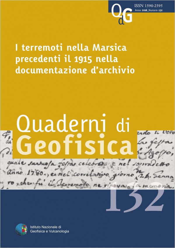
I terremoti nella Marsica precedenti il 1915 nella documentazione d’archivio
Vol. 132 (2016)
This work aims to provide an overview about seismicity before 1915 by finding traces of past earth-quakes among the
archival records (old documents and new ones not yet organized and systematized). The evidence here presented have been
collected mostly in the Historical Diocese Archive of Marsi (Avezzano) but also in the National Archives and in both
private collections and parish or notarial archives coming from different parts of the Region. Beyond the macroseismic data
related to the great earthquakes of 1456, 1703 and 1706 that had occurred in a drawn-out time, the handwritten evidence
highlight a series of local seismic activities under the damage threshold but constantly frequent throughout the history of the
region. Through the data acquired from seismology and related disciplines, the historical research contributes to definitely place
the sub-region Marsica within the most dangerous areas for seismic risk of Italy.
Sistema di elaborazione automatica dei segnali infrasonici al Monte Etna
Vol. 131 (2015)
In the last 10 years, the infrasonic monitoring has become one of the most effective tool to characterize the volcano activity. In 2006, the infrasonic permanent network, run by Istituto Nazionale di Geofisica e Vulcanologia, Osservatorio Etneo- Sezione di Catania (INGV-OE), was installed at Mt. Etna. Today, this network is made up of 10 stations. In order to process the data recorded by these stations, an automatic system, composed of 4 software, has been developed, allowing to detect, characterize in terms of amplitude and spectral content, and locate infrasonic events and tremor generated by the volcano. The processing results are stored in ASCII files, and successively the information written in them are imported in the INGV-OE database by software loader, specifically developed. The information provided by this automatic system are available in near real-time to the people on duty in the control room, where the data regarding infrasonic source locations and occurrence rate of infrasonic events are always visible. Moreover, such data are used to give further data on the volcano state of health for INGV- OE internal monitoring purposes or to provide additional information to the Civil Protection.
Contributo storiografico alla datazione della Sciara del Fuoco dello Stromboli
Vol. 130 (2015)
The volcanic and seismic hazard that the Aeolian archipelago is subject to urges detailed multidisciplinary studies on those potentially destructive events that probably occurred as volcanism developed along with local anthropogenic history over the last 7500 years. By examining the oldest human settlements in the Aeolian Islands, from which we may deduce the population density, as well as the behaviours and lifestyles of the inhabitants, the aim was to identify a link between the sudden and irregular cultural changes and the natural calamities recorded in the profuse Aeolian volcanological literature [Gillot and Keller, 1993; Kokelaar and Romagnoli, 1995; Rosi et al., 2000; Tinti et al., 2002; Speranza et al., 2008; Calvari et al.,2011; Francalanci et al., 2013]. Recent radiometric and paleomagnetic dating have established that significant phenomena affected Stromboli during its 5th life cycle between 13,000 and 4000 BP (Neostromboli). In particular, a major eruptive phase ended about 7500-7000 years ago, followed by a period of quiescence lasting roughly 3000 years when the volcano, having reached its maximum expansion of the north sector and undergoing structural instability, was affected by massive collapses, after that of Vàncori about 13,000 years ago. These were the main and most recent landslides leading to the formation of the Sciara del Fuoco [Tinti, 2002; Francalanci et al., 2014]. Concerning the major collapse of Neostromboli, the ensuing tsunami certainly had disastrous effects along the southeastern Tyrrhenian coasts, as deduced by Tinti et al. [2002] through numerical simulations. Though investigating the dynamics causing the collapses of the sector is beyond the scope of this paper, it is possible that different phenomena such as seismic events or coastal erosion, may have caused the landslides. This would relate the two major collapses of La Sciara with the two profound economic and demographic crises marking aeolian prehistory at the beginning of the 3rd and the 1st millennium BC respectively.
Use of Multiple in situ and remote sensing instruments and techniques at Solfatara field campaign for measurements of CO2, H2S and SO2 emissions: special demonstration on unmanned aerial systems
Vol. 129 (2015)
In this paper we present the field campaign held in October at the Solfatara of Pozzuoli, near Naples, concerning measurements of CO2, H2S and SO2. The campaign was carried out in collaboration with the University of Costa Rica and Jet Propulsion Laboratory of the California Institute of Technology (Pasadena, California) and has allowed the acquisition of a number of measures through scientific instrumentation as miniaturized multi-gas, thermal cameras and spectro-radiometer. First analysis in terms of brightness temperature was carried out through Landsat and ASTER satellite data. In addition to the instrumental test, one of the objectives has been to verify the possibility of mounting a light payload on a quadcopter and fly it on areas of high gas flow to allow the acquisition of data security. First results are reported in this work while it is foreseen a more accurate analysis of the data obtained.
campaign, some results using the spectro-radiometer ASD FieldSpec of optical laboratory of “Unità Funzionale Dati satellitari per l’osservazione della Terra” (UF8) are also reported. A comparison with remote sensor data acquired by Landsat 8 and ASTER will be done in the next months, while in this paper a brief description on the Landsat 8 data acquired on 27 October and ASTER data acquired 26 September are reported.
1. Objective of field campaign The Solfatara of Pozzuoli, near Naples, is part of the Campi Flegrei volcanic complex that contains a fumarolic field more or less extended, whose activity is mainly from the release of steam and gases with high sulphur component. The Solfatara of Pozzuoli is located within an area densely
Formazione, diffusione e distribuzione del percolato: modelli matematici integrati del progetto SIGLOD
Vol. 128 (2015)
This work, carried out under the project PON SIGLOD, deals with the development of mathematical models of formation, diffusion and distribution of leachate in large landfills, considered in this project. Recently simulation through mathematical models of some processes concerning both the formation and diffusion of pollutants found a significant benefit to all operators in this sector, because they are able to represent the scenarios and give essential information to “expert systems” that oversee the control and management of these facilities.
The models here implemented have provided results that will support the planning and future management of landfills activities. Their initial definition was rather long, since issues relating to physical and chemical phenomena have been addressed with their analytical formulations. These phenomena have been summarized and translated into numerical models object of this work. By these models, the quantities of the substances that are formed by the degradation of the organic fraction of the material have been foreseen to have a first estimate of the leachate quantity for the proper planning of the landfill management. The spread of leachate over time at various depths and spatial distribution, to assess and mitigate the impact in the environment, have been modeled. The analytical-numerical formulation has been implemented mainly in MATLAB and MATHCAD. In this work, the results of simulations of formation, diffusion and spatial distribution process of the leachate have been reported in some particular examined conditions.
The models here implemented have provided results that will support the planning and future management of landfills activities. Their initial definition was rather long, since issues relating to physical and chemical phenomena have been addressed with their analytical formulations. These phenomena have been summarized and translated into numerical models object of this work. By these models, the quantities of the substances that are formed by the degradation of the organic fraction of the material have been foreseen to have a first estimate of the leachate quantity for the proper planning of the landfill management. The spread of leachate over time at various depths and spatial distribution, to assess and mitigate the impact in the environment, have been modeled. The analytical-numerical formulation has been implemented mainly in MATLAB and MATHCAD. In this work, the results of simulations of formation, diffusion and spatial distribution process of the leachate have been reported in some particular examined conditions.
Attività sperimentali per l’implementazione del monitoraggio sismico di edifici pubblici nella Regione Marche
Vol. 127 (2015)
This paper describes a pilot project for the seismic monitoring of public buildings proposed by the Functional Centre of the Security Integrated Policies and Civil Protection Department - Marche Region (DPISPC) and the Ancona branch of National Institute of Geophysics and Volcanology (INGV).
The aim of the pilot project is to associate to vulnerability profile more information about vibrational characteristics of the building and subsoil, in addition to the seismic instrumental history that describe the seismic shaking at the base of the structure. To start the pilot project with the available resources, 11 sites in the Regione Marche were identified where there are already permanent accelerometers at the base of public buildings and temporary measurements of ambient seismic noise were carried out, both inside and outside the structures.
Frequencies and directions of the main spectral peaks of vibration of buildings were estimated, using spectral analysis techniques.
The directional analysis was useful for interpreting the irregular morphology of some spectral peaks resulting from the standard analysis obtained with the composition of the horizontal components of motion.
The collected information, combined with the geological and morphological classification of the sites, provide knowledge about seismic response of structures. Moreover, this approach will be compared to other case studies in which the seismic monitoring of individual structures is carried out with large instrumental and computational resources that allow precise and detailed results but difficult to largely apply on the territory.
La rete dei dilatometri in pozzi profondi dell’Etna
Vol. 126 (2015)
After a long preparatory phase on Etna a network of 4 borehole dilatometers has been installed. This activity took place in two successive phases (2010-2011 and 2013) supported by two research projects. The borehole dilatometers are installed in holes drilled at depths usually greater than 100 m, and they measure the volumetric strain of the surrounding rock potentially with nominal precision up to 10-12 in a wide frequency range (10-7 – 102 Hz). In this paper we describe the characteristics of the equipment used, the methods for the borehole installations, and the problematic related to the instrumental working. We describe the results of the instrumental calibrations obtained by different methods after the installations. We illustrate the results obtained by the changes of strain recorded in the short-term during the several lava fountains emitted from Etna during 2011-2013, and we also show signal changes recorded at all four stations during the recent lava fountain of 28 December 2014. Finally, we show the potential of the signal in the medium-term to detect significant changes related to different stages of volcanic activity.
Monitoraggio della sismicità locale nel Cilento nel periodo febbraio-ottobre 2014
Vol. 125 (2015)
Some temporary seismic stations were installed in Cilento from February to October 2014 for a monitoring of the local seismicity in the area of Roccadaspide and surrounding villages, where two earthquakes of magnitude Mw=3.6 and Mw=3.7 occurred on January 22, 2014. Following the warnings of rumbles and tremors from people living in the area, reported also by local press and television, a field survey was realized and the seismic monitoring begun. Acquired data showed a sequence of microearthquakes likely triggered by the two events occurred on January 22. We identified more than 750 very small earthquakes (M<2), of which more than 60 have been located. The 95% of the sources is located in an area of about 10 km2 with depth lower than 3 km. For about 15 earthquakes recorded by at least 5 stations we were able to compute also the focal mechanism. Results of our analysis suggest a predominant distensive dynamics in the epicentral area, although the full picture is rather complex, with significantly different mechanisms for sources very near to each other.
Misure GPS rapido statiche ed RTK per la realizzazione di un modello digitale del terreno ad alta risoluzione dell’isola di Lipari
Vol. 124 (2015)
In this study are shown and discussed results from two topographic campaigns based on GPS/RTK technique performed in the island of Lipari (Aeolian Islands) under the projects V3 Multi-disciplinary analysis of the relationships between tectonic structures and volcanic activity, funded by the Department of Civil Protection, and Response of morphoclimatic system dynamics to global changes and related geomorphologic hazard, funded by MIUR-PRIN 2011–2013. The purpose of this survey was to obtain the coordinates of a redundant number of Control Ground Points, estimated at centimeter accuracy, necessary for the realization of a very high resolution digital terrain model for this area, from aerial photogrammetric data. The obtained model has a resolution between 0.5 and 5 m and is currently one of the best available. This is essential for detailed geomorphological, volcanological, ground deformation and coastline changes for this still active volcanic island.
Materiali per un catalogo di terremoti etnei dal 1600 al 1831
Vol. 123 (2015)
Mount Etna, together with Vesuvius, are probably the two volcanoes with the longest and most detailed historical records in the world. About ten years ago, the most recent portion of the huge historical data set of Etna was used to compile a macroseismic catalogue of earthquakes occurring in this region from 1832 to 1998 [Catalogo Macrosismico dei Terremoti Etnei, Azzaro et al., 2000]. In the framework of the INGV Working Group on historical earthquake catalogues, the updated release of CMTE [Gruppo di lavoro CMTE, 2014] has become the main data source for the latest version of the Italian parametric catalogue CPTI11 [Rovida et al., 2011].
Historical research on Etna earthquakes was later extended further back in order to cover the previous two centuries. This is a strategic goal, since a relatively small number of earthquakes is listed in the existing repertories for the time-span 1600-1831: there are just 3 events in CFTI4Med [Guidoboni et al., 2007], and only 6 in the latest release of the parametric catalogue of Italian earthquakes CPTI11 [Rovida et al., 2011]; the previous PFG catalogue [Postpischl 1985], which also includes non- damaging -events and those with only epicentral parameters (no intensity data points), lists 26 earthquakes. Thus, it is difficult to believe that there had been so few earthquakes during this time-span - by contrast CMTE reports more than 150 events above the damage threshold in the following two centuries - all the more so as in the 1600-1831 period there were many significant eruptions which would have been accompanied, as usually occurs, by seismic activity. The likeliest explanation is that the available historical record had not been exploited to its full extent and, therefore, many earthquakes were overlooked.
To improve this overall scenario, historical research was carried out on the main Sicilian archives as well as regional, Italian and foreign libraries, looking for first-hand sources (diaries, chronicles, official records, travellers’ reports, newspapers) and retrieving
more than 200 original documents written between 1600 and 1850. These have been critically analyzed and interpreted to reconstruct the seismic activity, namely identifying the earthquakes and deriving the related intensity data. The result of this work is an inventory of 139 earthquakes occurring in the period from 1600 to 1831, 115 of which are unmentioned in previous studies. Depending on the quality of the collected information, it will be possible in a future step - compiling the catalogue - to calculate the earthquake parameters (epicentre, magnitude, epicentral intensities) for some events, while for the others only generic information on the location (affected areas) and type of macroseismic effects (weakly or strongly felt, damage) will be reported. This paper describes the methodological approach and results of the study and is enhanced by an appendix of short monographs, each of which includes the description of the earthquake effects (or seismic sequence), a list of localities with the associated macroseismic intensities, the transcription of texts and related references
L’alternanza scuola-lavoro all’INGV: 2010/2014, un’esperienza quinquennale nella divulgazione scientifica
Vol. 122 (2014)
The popular science has taken an important role in recent years within the activities of public research with the aim to attract a greater number of people to the knowledge of research activities and their social implications. The Istituto Nazionale di Geofisica e Vulcanologia (INGV) has developed many projects of popular science, organized in different shapes, suitable for the type of final users, such as: lectures, visits to the headquarters and laboratories, scientific info-point and more. At the INGV of Portovenere (La Spezia), in recent years, an interesting educational project has been developed in collaboration with a technical high-school. This project, developed within the school-work pathways (“2003, Moratti Law”), aims to guide students for future career choices. In this context, some stage experiences have been carried out to raise awareness of the role of a scientific researcher, using geophysical disciplines such as marine geomagnetism and gravimetry. To illustrate the role of a scientific researcher, it was decided to make the students an educational path that would stimulate them to carry out the scheduled activities in an autonomous, critical and constructive manner. Taught the scientific method and the basics of geophysical disciplines, they were left free to conduct the assigned research. In this way, not only explored the steps that make up a scientific research - which, bibliography, acquisition and data processing, presentation of results - but have acquired other important aspects that provide more complete information from the world of science: the awareness of the link between the fundamental physics concepts - previously acquired by the students in the school - and the implications in the applications for everyday use, the role of science in society, the importance of the interdisciplinary aspects and the science popularization. The five-years experience, with a group of four students attending the fourth class of the Scientific Technical high-school course of La Spezia city, pointed out that the students have been able to apply the theoretical knowledge to the practical work and to gain awareness about the realities of an unknown work to them like the scientific research.
Ray theory formulation and ray tracing method. Application in ionospheric propagation
Vol. 121 (2014)
This work will lead to ray theory and ray tracing formulation. To deal with this problem the theory of classical geometrical optics is presented, and applications to ionospheric propagation will be described. This provides useful theoretical basis for scientists involved in research on radio propagation in inhomogeneous anisotropic media, especially in a magneto-plasma. Application in high frequencies (HF) radio propagation, radio communication, over-thehorizon-radar (OTHR) coordinate registration and related homing techniques for direction finding of HF wave, all rely on ray tracing computational algorithm. In this theory the formulation of the canonical, or Hamiltonian, equations related to the ray, which allow calculating the wave direction of propagation in a continuous, inhomogeneous and anisotropic medium with minor gradient, will be dealt. At least six Hamilton’s equations will be written both in Cartesian and spherical coordinates in the simplest way. These will be achieved by introducing the refractive surface index equations and the ray surface equations in an appropriate free-dimensional space. By the combination of these equations even the Fermat’s principle will be derived to give more generality to the formulation of ray theory. It will be shown that the canonical equations are dependent on a constant quantity H and the Cartesian coordinates and components of wave vector along the ray path. These quantities respectively indicated as r i (t), p i (t) are dependent on the parameter t, that must increase monotonically along the path. Effectively, the procedure described above is the ray tracing formulation. In ray tracing computational techniques, the most convenient Hamiltonian describing the medium can be adopted, and the simplest way to choose properly H will be discussed. Finally, a system of equations, which can be numerically solved, is generated.
Terremoti con effetti macrosismici in Sicilia orientale nel periodo Gennaio 2009 - Dicembre 2013
Vol. 120 (2014)
Il presente lavoro è costituito dalla raccolta sistematica delle indagini macrosismiche eseguite in occasione dei terremoti più energetici verificatisi in Sicilia dal Gennaio 2009 al Dicembre 2013. Esso rappresenta l’estensione, agli anni più recenti, delle compilazioni effettuate per gli anni 1999-2008 [Azzaro et al., 2002, 2006; 2009] e, più in generale, è inserito nel contesto delle attività di monitoraggio dell’INGV, condotte in questi anni nell’ambito del TTC (Tema Trasversale Coordinato) 1.11 “Osservazioni e monitoraggio macrosismico del territorio nazionale”. Nel caso di forti terremoti, l’attività di rilievo macrosismico ha ricadute significative in diversi ambiti. Nell’immediatezza di un evento sismico, i dati raccolti servono infatti a definire il quadro degli effetti a supporto degli interventi di protezione civile, sia per la gestione dell’emergenza che per la predisposizione di eventuali atti legislativi. Successivamente, attraverso il confronto con gli effetti macrosismici di terremoti storici, aiutano a interpretare l’evento attuale nel contesto della sismicità a lungo termine di una data area. Infine, l’elaborazione di dati macrosismici anche nel caso di eventi di bassa magnitudo o che interessano aree limitate, è importante per l’implementazione di banche dati e cataloghi macrosismici sia a scala locale [CMTE, Azzaro et al., 2000], che per il territorio nazionale [DBMI11, Locati et al., 2011]. In tale ambito il presente lavoro costituisce una continuazione anche delle attività afferenti all’ex-TTC 5.1 “Banche dati e metodi macrosismici”.
Acquisizione del dato e parametrizzazione degli eventi I rilievi macrosismici effettuati nel periodo 2009-2013 sono relativi a tutti i terremoti oltre la soglia del danno che si sono verificati nel territorio regionale siciliano, cui si aggiungono vari eventi che sono stati avvertiti in modo significativo dalla popolazione. Gli epicentri dei terremoti investigati sono mostrati in Figura 1. Si tratta in larga parte di eventi di area etnea che hanno provocato effetti macrosismici di rilievo. Tra i terremoti regionali riportati, hanno provocato effetti macrosismici di rilievo i terremoti accaduti il 24 giugno 2011 e il 4 gennaio 2013 lungo la dorsale dei Monti Nebrodi, e quello del 15 agosto 2013 nel settore tirrenico peloritano. I rilievi sono stati eseguiti secondo le procedure operative di prassi adottate in questi casi dal gruppo QUEST [QUick
Acquisizione del dato e parametrizzazione degli eventi I rilievi macrosismici effettuati nel periodo 2009-2013 sono relativi a tutti i terremoti oltre la soglia del danno che si sono verificati nel territorio regionale siciliano, cui si aggiungono vari eventi che sono stati avvertiti in modo significativo dalla popolazione. Gli epicentri dei terremoti investigati sono mostrati in Figura 1. Si tratta in larga parte di eventi di area etnea che hanno provocato effetti macrosismici di rilievo. Tra i terremoti regionali riportati, hanno provocato effetti macrosismici di rilievo i terremoti accaduti il 24 giugno 2011 e il 4 gennaio 2013 lungo la dorsale dei Monti Nebrodi, e quello del 15 agosto 2013 nel settore tirrenico peloritano. I rilievi sono stati eseguiti secondo le procedure operative di prassi adottate in questi casi dal gruppo QUEST [QUick
Hyperspectral spaceborne, airborne and ground measurements campaign on Mt. Etna: multi data acquisitions in the frame of Prisma Mission (ASI-AGI Project n. I/016/11/0)
Vol. 119 (2014)
Hyperspectral spaceborne, airborne and ground measurements campaign on Mt. Etna: multi data acquisitions in the frame of Prisma Mission (ASI-AGI Project n. I/016/11/0) n the frame of the Italian Space Agency (ASI) Hyperspectral Mission PRISMA (Precursore IperSpettrale della Missione Applicativa), the Istituto Nazionale di Geofisica e Vulcanologia (INGV) is coordinating the scientific project ASI-AGI (Analisi Sistemi Iperspettrali per le Applicazioni Geofisiche Integrate) to develop specific algorithms and products for various geophysical applications. The data validation and calibration activities have been focused on three active volcanic areas located in Sicily: Mt. Etna, Paternò and Ciclopi islands. From June 23 until 27, 2012 INGV and the project partners have organized an airborne and ground campaign over the selected test sites covering different surface targets. The airborne data were acquired by using a SPECIM sensor working in the VNIR-SWIR range and jointed to an airborne laser scanner and a thermal camera. The ground campaign has allowed to collect several datasets using two portable spectroradiometer (Fieldspec), two portable Fourier Transform InfraRed spectrometer (FTIR), a ground laser scanner, a thermal camera and a TIR thermometer. Moreover, in order to acquire local atmospheric parameters a sun photometer and a meteorological station have been used as well as further meteorological information have been furnished by CETEMPS L’Aquila University. During the airborne and ground campaign the contemporaneous acquisitions of Hyperion and ASTER have allowed to extract a suitable data set that will be used to simulate PRISMA data and to develop and test the proposed algorithms for a large number of applications regarding for example land cover and agriculture, water quality monitoring, surface hydrology, urban areas monitoring, geology, security, desertification, territory monitoring to support to natural hazard management, atmosphere monitoring for its optical and spectral characterization, carbon cycle.
I terremoti a Sulmona: indagini di sismologia storica per la microzonazione sismica
Vol. 118 (2014)
He rich seismic history of Sulmona includes eleven earthquakes with Intensity Is≥6 MCS. Considering the different earthquakes with effects beyond the damage threshold, the comparison between the intensities attributed to Sulmona with those of the closer localities indicates that in many cases the town has suffered more severe damage. This suggests that the seismic history of Sulmona may have been conditioned by site effects, thus making more urgent the processing of a modern seismic microzonation. Within this light, an attempt has been made to reconstruct the damage distribution due to historical earthquakes in the old town centre. This practice was aimed at defining damage patterns to be compared with the results of the traditional geological and seismological investigations necessary to draw the “homogeneous microzones in the seismic perspective” and to define the possible site effects. In practical terms, we explored the possibility to identify trends in the repetition of the damage across the significant seismic history of the town. The trends may in turn suggest the occurrence of site effects at the scale of the town to be investigated with subsequent geological and seismological surveys. For this purpose, we have estimated the damage distribution due to the earthquakes occurred in 1706 (I 9-10 MCS at Sulmona), 1915 (I 8 MCS), 1933 (I 8 MCS), 1984 (I 6-7 MCS) and 2009 (I 5 MCS). The damage related to the oldest event cannot be defined in detail. However, historical information suggests that the entire town probably suffered strong effects. Therefore, in this case the presence of sectors in the old town centre more and less damaged cannot be hypothesised. As for the other mentioned earthquakes, the points of damage related to 1915 (181 points), 1933 (564), 1984 (141) and 2009 (91) have been defined. The obtained maps of the damage distribution do not indicate evident trends which may support the drawing of “homogeneous microzones in the seismic perspective”. However, sort of clusters of damage points have been observed close to the slopes bordering the terrace of the old town centre. This indication suggests that future geological and seismological surveys should be addressed to the characterisation of the site effects at the border of the old town. Moreover, this damage stratigraphy indicates that the vulnerability of the buildings has played a key role in the recent seismic history. In fact, 153 buildings, characterised by the repetition of the damage across the 1915, 1933, 1984 and 2009 earthquakes, have been identified. Most of the buildings have suffered damage due to two earthquakes among those mentioned above; more than twenty buildings have experienced damage due to three earthquakes; three buildings have suffered damage due to all mentioned earthquakes. This picture suggests a certain inaction and lack of care with respect to the post-earthquake restorations and for the maintenance of the historical buildings which are widespread throughout the entire old town centre of Sulmona.
Figura 1 Pianta del centro storico di Sulmona con I toponimi citati nel testo. In tratteggio, il limite approssimativo della Sulmo di età romana. Figure 1 Map of the old town centre of Sulmona with the place names mentioned in the text. The broken line defines the rough border of the Roman Sulmo.
Figura 1 Pianta del centro storico di Sulmona con I toponimi citati nel testo. In tratteggio, il limite approssimativo della Sulmo di età romana. Figure 1 Map of the old town centre of Sulmona with the place names mentioned in the text. The broken line defines the rough border of the Roman Sulmo.

Presentazione e analisi critica dei dati storici di base del terremoto dell’8 gennaio 1693 nel Pollino
Vol. 117 (2014)
La porzione meridionale del massiccio del Pollino è conosciuta nella letteratura sismologica come una sede di gap sismico [Valensise et al., 1994; Valensise e Guidoboni, 1995; Cinti et al., 1997; Michetti et al., 1997] nonostante la presenza di alcuni lineamenti strutturali ben conosciuti e considerati attivi come la faglia del Pollino e la faglia di Castrovillari. La concomitanza di faglie attive e di scarsa sismicità storica richiede un’analisi approfondita, soprattutto in considerazione della lunga sequenza sismica locale iniziata nel 2010 e culminata nell’evento del 26 ottobre 2012 (Mw 5.0). Secondo il catalogo sismico CPTI11 [Rovida et al., 2011] il massimo terremoto locale è quello dell’8 gennaio 1693 (Mw 5.7) oggetto del presente studio. Si tratta di un evento sconosciuto alla tradizione sismologica italiana, scoperto di recente [SGA,
1994; Guidoboni e Mariotti, 1997; Guidoboni et al., 2007] e ancor più recentemente inserito nel Database Macrosismico Italiano [DBMI11, Locati et al., 2011] e quindi in CPTI11 [Rovida et al., 2011]. Il principale motivo per cui l’evento è rimasto così a lungo sconosciuto è di natura cronologica: esso infatti precedette di poche ore il primo degli eventi principali della sequenza che devastò la Sicilia Orientale nel gennaio 1693, causando estese distruzioni e lasciando un’impronta molto duratura nelle fonti storiche e nell’immaginario collettivo. Questa coincidenza, amplificata dalle caratteristiche del sistema di circolazione delle informazioni del periodo, e cioè l’essere incentrato sulla meraviglia e sulla spettacolarizzazione della narrazione [Benigno, 2013] ha probabilmente, in una prima fase, contribuito a far confondere l’evento del Pollino con la sequenza siciliana, rendendolo poi invisibile agli autori di compilazioni sismologiche suc-
1994; Guidoboni e Mariotti, 1997; Guidoboni et al., 2007] e ancor più recentemente inserito nel Database Macrosismico Italiano [DBMI11, Locati et al., 2011] e quindi in CPTI11 [Rovida et al., 2011]. Il principale motivo per cui l’evento è rimasto così a lungo sconosciuto è di natura cronologica: esso infatti precedette di poche ore il primo degli eventi principali della sequenza che devastò la Sicilia Orientale nel gennaio 1693, causando estese distruzioni e lasciando un’impronta molto duratura nelle fonti storiche e nell’immaginario collettivo. Questa coincidenza, amplificata dalle caratteristiche del sistema di circolazione delle informazioni del periodo, e cioè l’essere incentrato sulla meraviglia e sulla spettacolarizzazione della narrazione [Benigno, 2013] ha probabilmente, in una prima fase, contribuito a far confondere l’evento del Pollino con la sequenza siciliana, rendendolo poi invisibile agli autori di compilazioni sismologiche suc-